Curated OER
Mapping the Aegean Seafloor
Earth science learners create a two-dimensional topographic map of the floor of the Aegean Sea. They use it to then create a three-dimensional model of the ocean floor features. This comprehensive resource delivers strong background...
Curated OER
Oceans Away
Young scholars explore oceans. In this science lesson plan, students locate oceans, seas and continents of the world, identify ocean-related occupations, and complete activities pertaining to food chains as well as pollution.
Curated OER
Capitals, Oceans, And Border States
Students investigate geography by completing games with classmates. In this United States of America lesson, students examine a map of North America and identify the borders of Mexico and Canada as well as the Pacific and Atlantic....
Curated OER
Marine Life, Oceans, Lakes and Rivers
Students examine the types of organisms found in oceans. In groups, they read articles about the research done at certain sites. They work together to research their own water ecosystems and report the findings to the class. To end...
Curated OER
Learning About the Equator, The Seven Continents and the Four Oceans
Young scholars use a globe or map to locate the equator, oceans and continents. Using the internet, they spend time surfing through predetermined websites on continents and oceans. They write facts on different parts of the globe on...
Curated OER
The Interconnectedness of Ancient Peoples Map Study
Seventh graders begin this lesson by viewing various maps of the Ancient World. As a class, they take notes on the changes of different areas in Europe and Asia as their teacher lectures to them. They answer questions about the...
Curated OER
Trade in the Indian Ocean: Should China End Zheng He's Treasure Voyages?
Students examine the amount of trade that occurs in the Indian Ocean. Using China as an example, they discuss the reasons why it ended its treasure voyages in the area and predict what would have happened if the voyages continued. They...
Curated OER
Lesson Plan #3 ~ Ocean Currents
Sixth graders experiment to understand the ocean's currents. In this ocean current instructional activity, 6th graders complete an experiment with two bottles of water and an index card to discover information about the ocean current. ...
Curated OER
Continents and Oceans on the Move
Students create an awareness of the vast percentage of water covering the earth. They relate similarities/differences between topographical maps and other maps of various time periods. Students examine how to use a topographical map.
Curated OER
Voyage to Kure Viewing Guide
Students complete a worksheet while viewing a video about the oceans. They locate the oceans on a map and identify positive and negative ways in which humans have impacted them. They discuss any questions at the end of the lesson.
Curated OER
Is the Hudson River Too Salty to Drink?
Students explore reasons for varied salinity in bodies of water. In this geographical inquiry activity, students use a variety of visual and written information including maps, data tables, and graphs, to form a hypothesis as to why the...
Curated OER
Hurricanes As Heat Engines
Students examine sea surface temperatures to see how hurricanes get heat from the oceans surface. In this hurricanes lesson students use the Internet to find data and make line plots.
NOAA
Into the Deep
Take young scientists into the depths of the world's ocean with the second instructional activity of this three-part earth science series. After first drawing pictures representing how they imagine the bottom of the ocean to appear,...
Curated OER
Coral Bleaching in the Caribbean
Students practice analyzing images, maps and graphs from Internet-based educational resources. They explore the correlation between sea surface temperature and coral bleaching. Students comprehend that coral reefs are collections of tiny...
NOAA
Sediments
Calcareous ooze ... what an interesting name! The 15th installment of a 23-part NOAA Enrichment in Marine sciences and Oceanography (NEMO) program focuses on sediments found on the ocean floor. After viewing the slideshow lecture,...
Curated OER
El Nino
Explore the properties of water and the affects of El Nino. Middle schoolers will learn about the devastation an El Nino can cause as well as the definition of El Nino. Additionally, they will discover the cause of El Nino along with the...
Curated OER
Mapping The Ocean Floor
Young scholars explore and analyze the bottom structure of underwater habitats. They describe and explain what can't see through the collection and correlation of accurate data. Learners assess that technology is utilized as a tool for...
Curated OER
Ocean Animals - A Kindergarten Research Project
Something’s fishy! Assign each of your pupils an individual sea creature and investigate the oceans. Young oceanographers utilize Kidspiration software to research a creature, illustrate an image, and create fact cards about their...
Curated OER
Oceanography
Fourth graders define new vocabulary associated with oceanography. They locate and label the four oceans. They also identify features of the ocean floor.
Curated OER
The Global Grapefruit - Representing a 3-Dimensional Globe on a 2-Dimensional Map
Students compare and contrast world maps and globes. They convert a 3-dimensional globe to a 2-dimensional map. They are introduced to the Mercator map projection. They observe map distortions of shape, area, distance, directions and angle.
Curated OER
Do You Need a Map?
Learners explain ways marine navigation is important in modern society. In this map study lesson students use a retrieval tool to obtain real-time information on weather forecasts.
Curated OER
Navigation Across the Seas
Students examine nautical navigation and discover the differences between nautical charts and other types of maps or charts. Students practice setting a course, taking a bearing, and dead reckoning. This gives students an example of...
Howard Hughes Medical Institute
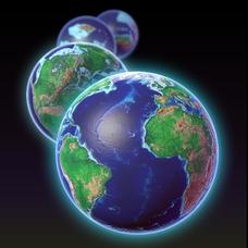
EarthViewer
Can you imagine Washington DC and London as close neighbors occupying the same continent? Learners will be fascinated as they step back in time and discover the evolution of the earth's continents and oceans from 4.5 billion years ago to...
Curated OER
Biomes: Coastlines and Seas
Students study the different types of coastlines and their territories. In this marine coasts lesson plan students identify life forms that are in the coastal regions.


