Curated OER
A Visit to Hogwarts
Young scholars collaborate in groups to read excerpts or entire selections from two Harry Potter books, use educational software to create concept maps detailing similarities and differences between first two Harry Potter books, and...
NASA
Biology Training Conclusion
Gravity is just one consideration when determining human habitability on a new planet. The lesson connects four different units and starts with connecting the various systems: planetary systems, human body systems, etc. After scholars...
Curated OER
Story Mapping
Fill-out a story map to help your scholars with pre-writing. They will use a story map template to pre-write. They also organize their ideas into steps which become the foundation for their first draft. Concrete objects are brought in to...
Curated OER
Forestry and Changing Feelings
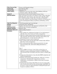
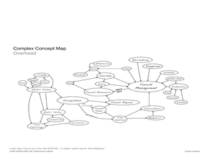
Students investigate how the forest affects their daily lives by creating a concept map. In this ecological lesson, students create a concept map linking the forest to the many things they use each day. Students take a field trip in...
Curated OER
Money Matters: The Importance of Global Cooperation
Students prepare for a visit to the International Monetary Fund (IMF). In this lesson students create a concept map of money. They discuss the goals of the IMF. Students research countries currently changing into market economies. After...
Baylor College
Mapping the Spread of HIV/AIDS
Where is HIV/AIDS most prevalent and what are the current trends regarding HIV? Have groups work together to map the world's HIV/AIDS rates, then create a class map with all the data. Lesson includes cross-disciplinary concepts including...
Lrymple Secondary College
Plate Boundary
Scholars examine diagrams and complete a concept map to discover key details about convergent, divergent, and transform plate boundaries.
Curated OER
Learning About Maps
Learners take a "field trip" with the teacher through the school then draw a diagram of what they saw. They bring the maps to the computer lab where they create electronic maps using the software program Neighborhood Map Machine.
Institute for Geophysics
Understanding Maps of Earth
Here is your go-to student resource on primary geography concepts, including facts about the surface of the earth and its hemispheres, latitude and longitude, globes, types of maps, and identifying continents and oceans.
Curated OER
Project Jukebox
Students analyze an interview with the Climate Change Project Jukebox in order to help them undertand how to use a concept map. In this writing and climate change instructional activity, pairs of students log onto the Internet site for...
Curated OER
First Amendment: Bill of Rights
Twelfth graders explore the First Amendment and the rights that are protected by the First Amendment. They discuss how the First Amendment is important to their daily lives. Students research the amendment and complete a concept map.
Curated OER
Using Graphic Organizers for Sensemaking
Learners create concept maps in order to assess the information that they have gathered during research. They study the concept map to determine if the research is complete.
Curated OER
Maps and Globes
First graders complete a unit on map skills and the globe. They label maps, create a styrofoam ball globe, create a map of their community, sing a continent song, and complete a map and globe assessment worksheet.
Curated OER
Mapping National and Geographic Identity
Students analyze geographic maps. In this map analysis lesson, students analyze the symbols in geographic maps and the impact of cultural, historical, and political concepts. Students compare and contrast maps in various mediums by...
Curated OER
Charts, Maps, and Graphs Lesson on the Holocaust
High schoolers practice interpreting data. In this Holocaust lesson, students research selected Internet sources and examine charts, maps, and graphs regarding the Jewish populations in and out of Europe. High schoolers respond to...
Curated OER
A Walk Around the School: Mapping Places Near and Far
After reading Pat Hutchins’ Rosie’s Walk, have your young cartographers create a map of Rosie’s walk. Then lead them on a walk around the school. When you return class members sequence the walk by making a list of how the class got from...
Curated OER
Esperanza Rising: Lesson 2
Sixth graders explore adversity. For this summarizing lesson students compare their culture to the Hispanic culture. Students reflect on a time they were met with adversity. Students summarize Chapter 1 of Esperanza Rising.
Curated OER
Exploring Maps: Navigation
Learners engage in a lesson that is concerned with the concept of navigation while research is conducted with the use of a variety of resources. The information is used to expand their perspective of the applications for navigation. The...
Curated OER
Using Social Studies in Five Shared Reading Lessons: Geography
After several short 15-minute mini-lessons, your learners will gain an understanding of the characteristics of a non-fiction text. Using the book Map It by Elspeth Leacock, your class will become acquainted with non-fiction terms such as...
Curated OER
Understanding "The Stans"
Students explore and locate "The Stans" in Central Asia to create, write and illustrate maps, graphs and charts to organize geographic information. They analyze the historical and physical characteristics of Central Asia via graphic...
Curated OER
Global Conflict: Kashmir
Students analyze different maps of the region. They create a timeline of the area in dispute, focusing on the creation of Pakistan, Indi and Kashmir and previous conflicts between Pakistan and India over Kashmir. Students construct a...
Curated OER
MAKING CONNECTIONS WITH MAPS
Students define choropleth map. They construct a choropleth map. They interpret a choropleth map. They present geographic information.
Curated OER
Put Your Face on the Map
Young scholars investigate topography and contour lines by examining a human face. In this mapping lesson, students create a plaster cast of a face and create a map of the contours of the face one centimeter at a time. Young scholars...
Curated OER
Paint My Counties: Map Coloring the Counties of Arizona
Fourth graders identify the counties of Arizona. In this social studies lesson plan, 4th graders color a county map of Arizona using the fewest number of colors possible. Students write a persuasive paragraph.
Other popular searches
- Cell Transport Concept Map
- Blank Concept Maps
- Genetic Concept Map
- Weather Concept Map
- Krebs Cycle Concept Map
- Science Concept Map
- Phylum Chordata Concept Map
- Concept Map Rubrics
- Inspiration Concept Map
- Dna Structure Concept Map
- Concept Map in Science
- Rock Concept Maps


