Delegation of the European Union to the United States
The Geography of Europe
What is the European Union? Where is it? Why is it? To begin a study of the EU, class members examine the physical geography of Europe and the size and population density of 28-member countries in comparison to non-member countries like...
Curated OER
Comparative Geography I
Learners use population density and other statistics to compare countries. They find the population density for the countries listed in the table. Students compare findings with a partner, and then share with the class.
Curated OER
The Effects of Limited Space on a Culture
Students predict the impact of population density on shelter, transportation, recreation, land use, and social skills and then research that impact on Japan. They write a response about the impact of population density on food...
Curated OER
Comparative Geography II
Students engage in a research question of finding the effect of population density upon the use of land in a physical area. They also find the effect of how this can effect the lifestyles of the people who live there.
Curated OER
East Asia: Population Facts and Figures
Students examine population information from East Asian countries. Using a specified website, pupils explore the population of China, Japan, North Korea and South Korea. Classmates examine the population density compared to the world's...
Curated OER
Living in an "Olympic" Country
Students research countries participating in the Olympic Games. They create a database which includes graphs for comparing population density, the number of athletes, per capita income, etc. for each country. This project is completed...
Curated OER
World Population
Learners examine the world population data using MyWorld GIS software and compare and contrast the population characteristics of countries around the world. Students summarize their findings in a report.
Curated OER
Historical Indian Treaties and Aboriginal Population
Sixth graders navigate an online atlas of Canada and compare the land area of of historical Aboriginal peoples in Manitoba to present-day figures.
Curated OER
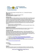
Learning and Population Information - Where I Live
Students study their county populations in a multimedia presentation format. In this populations lesson, students work in groups of 3 to research the county populations in their state. Students chart their results in an Excel document...
National Wildlife Federation
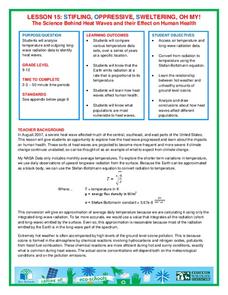
Stifling, Oppressive, Sweltering, Oh My!
Looking for a hot date? Pick any day in August, statistically the hottest month in the United States. The 15th lesson in the series of 21 instructs pupils to investigate the August 2007 heat wave through NASA data, daily temperature...
Curated OER
Postcards from California: A Unit on Geography, Social Studies, History and California's Resources
Fourth graders examine patterns that influence population density in the various regions of California. The unit's three lessons utilize graphic organizers for the interpretation and presentation of data.
Curated OER
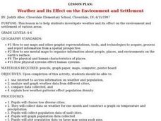
Weather and its Effect on the Environment and Settlement
Students, after choosing two diverse cities, collect data on weather for a month and construct a graph on temperature and precipitation. After collecting population data of said cities, and graphing it, they plot population on a large...
Curated OER
A Contouring We Go
Students examine the built environment and infrastructures of their community by constructing contour equipment, using the equipment, and comparing their results to current topographical maps of the same area
Curated OER
Australia and Argentina: A Study in Contrast
Students study world events and their effect on economic growth. They research and interpret graphs to determine explanations for economic growth. Students compare the World Wars and the Great Depression to the growth of Argentina and...
Curated OER
The Geography of the Philippines
Students examine the geographic features and population distribution of the Philippines. They analyze maps, take a quiz, define monsoon, and discuss how the people in the Philippines have adapted to their environment.
Curated OER
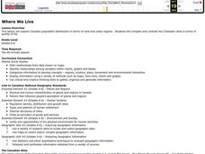
Where We Live
Students analyze Canada's population distribution. They access online information to gather demographic information about two Canadian cities. They compare and contrast the quality of life in the two cities and present their findings.
Curated OER
Social Studies: Canadian City Comparison
Learners research Canadian population distribution while comparing and contrasting the quality of life in two cities. They discuss issues and problems that cities and rural towns face. Students apply various methods, such as graphs and...
Curated OER
They're Tilling that Field Behind the Mall
Unfortunately, the article for which this resource was written is not available. You can, however, find another current document on agriculture and urban development for your class to read together, and then still follow the suggested...
Curated OER
Grades 6-8 Lesson Plan - Cities as Transportation Centers
Middle schoolers examine maps of the 1800's and 1900's. In this geography skills lesson, students collaborate to read core maps and identify transportation centers and travel networks.
Curated OER
Where Is Xinjinag?
Students geographically recognize the territory of Xinjiang Province by identifying the physical landscape and important cities. They see how human rights issues have affected the global, political, and economic arena in Xinjiang.
Curated OER
Critters in Your Own Backyard
Young scholars identify various animals and their habitats, as well as their specific traits In this animal habitat lesson, students list animals they've seen in their backyard. Young scholars select one animal and do research. Students...
Curated OER
Patterns of Settlement in Early Alabama
Fourth graders study the settlement of Alabama. They collect data from the U.S. census website and answer questions regarding settlement patterns in the counties of Alabama in 1820. They write a paagraph describing where they would have...
Curated OER
"Selling Seoul"
Learners research the economy of Korea and work in a small group in order to reach decisions about aspects of the information found. They conduct class discussion about how people live in Korea and what is considered an acceptable...


