Institute for Geophysics
Understanding Maps of Earth
Here is your go-to student resource on primary geography concepts, including facts about the surface of the earth and its hemispheres, latitude and longitude, globes, types of maps, and identifying continents and oceans.
Howard Hughes Medical Institute
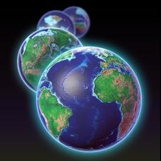
EarthViewer
Can you imagine Washington DC and London as close neighbors occupying the same continent? Learners will be fascinated as they step back in time and discover the evolution of the earth's continents and oceans from 4.5 billion years ago to...
Curated OER
Continents and Critters
Learners investigate and identify the continents of the world. They identify and locate the seven continents on a map, and label a coloring page of a world map. Students then conduct research on an assigned continent, and write and...
Devine Educational Consultancy Services
Geography Student Workbook, Australia
Your youngsters will be experts on the geography of Australia after working with these activities and worksheets, which review the continent's weather, major landforms, dimensions, history, and climate.
Curated OER
Around the World in 5 Days
Learners explore continents, draw map, discuss cultures, use research to learn geography, and investigate cultures.
Curated OER
Leapin' Landmarks: Locating 10 Man-made Landmarks Around the World
Third graders label continents, oceans, and major mountain ranges on maps and use the maps to write an informational report about landmarks. In this landmarks lesson plan, 3rd graders write about 1 major landmark.
Curated OER
Places in My World
Second graders explore where they are located on the globe. In this maps and globes lesson, 2nd graders use a map to show where they live and show the cardinal directions. Students identify characteristics of mountains, flat land,...
Curated OER
Giving Students a Little Latitude
Students use a world outline map to locate places using coordinates of latitude and longitude. They answer questions about places based on their knowledge of the map and on their research and make up more questions of this sort for each...
Curated OER
PLATE MOVEMENTS AND CLIMATE CHANGE
Students label three geological maps with continents provided to analyze the relationships between the movement of tectonic plates and the changes in the climate. In small groups, they discuss their findings and form hypotheses about the...
Curated OER
The Dynamic Earth
Students participate in assessments related to the layers of the Earth. They read chapters of text, answer questions, watch videos, and identify and label continents and oceans on a map. They design posters, create vocabulary cards,...
Curated OER
Important Rivers of the World
Third graders become familiar with names of the different parts of a river, define and locate drainage basins, locate six of the continents and explore the major rivers on each one, conduct research on a river of their choice.
Curated OER
Fantastic Flying Journey
Third graders listen to a teacher reading of the "Fantastic Flying Journey." students research each country/continent using the Internet and creating a travel journal.
Curated OER
Middle East Related
Eighth graders find a current event related to the Middle East. In this current event instructional activity students write a brief summary of a new story related to the Middle East. They give their opinion and tell how it affects their...
Curated OER
Where Am I, and How Do I Get Where I am Going?
Students describe geographical places through art, music, writing, and math. They compile information in booklets which may be published.
Curated OER
Yo-ho, Yo-ho a Viking's Life for Me
Students complete a unit of lessons on the Vikings. They analyze maps, read and discuss myths, summarize the main ideas from resource materials, watch videos, sing a song, draw a picture to illustrate Norse mythology, and define key...
Curated OER
Earth and Space Science: Exploring Earthquakes
Students explore earthquakes. In this earthquake activity, students research earthquakes and identify where they take place. Students use map skills to track down earthquake locations. There are internet sites suggested in this activity.
Curated OER
Traveling Through North America
Students identify places and landmarks in North America, specifically Canada and the United States, by using and constructing maps. Six lessons on one page; includes test.
Curated OER
Climate and Topography, What Is the Connection?
Fourth graders study Neumann's world continent map and explore topography and climate.
Curated OER
Landforms All Around
Students create a "Landform Dictionary". They develop an overlay map and participate in hands-on activities to identify the key characteristics of landforms. They discuss the plant and animal life of these areas. Handouts for the lessons...
Curated OER
Pets Around the World
Learners communicate via e-mail with other students to learn about pets, animals of interest , and geography from different parts of the world. Vocabulary focuses on rural, urban, and suburban areas.
Curated OER
Tracing Our Own Family Pilgrimages
The Pilgrims may have arrived in North America by way of the Mayflower, but chances are, your class members' ancestors came to the United States in another way. Guide them through an exploration of their own heritage, countries of...
Curated OER
Lights On ! Lights Off! Exploring Human Settlement Patterns
Third graders write informational paragraphs based on the settlement patterns of the United States. In this settlement lesson plan, 3rd graders read about population and how it affects where people settle next.
Curated OER
A Line Graph of the Ocean Floor
Students develop a spreadsheet and import the information into a line graph. In this spreadsheet and line graph lesson plan, students develop a spreadsheet of ocean depths. They import the information into a word processed document. They...
Alabama Learning Exchange
Forces that Change the Land
Students conduct Internet research find information about the following landforms: mountains, canyons, and valleys. They create travel brochures of their findings.


