Curated OER
Population Density
Students examine world population density and population distribution. They create pie charts showing population distribution and analyze population patterns in the United States and major regions of the world. They identify...
Delegation of the European Union to the United States
The Geography of Europe
What is the European Union? Where is it? Why is it? To begin a study of the EU, class members examine the physical geography of Europe and the size and population density of 28-member countries in comparison to non-member countries like...
Curated OER
A Look at the Population Density of the United States
Students acquire census information and create maps of the population density of the United States on different scales. They role play the roles of workers of a retail company and they use the population data to market to their customers.
Curated OER
Population Densities
Young scholars explore biological impact by completing a worksheet in class. In this animal population lesson, students utilize river rocks and jars to conduct a coqui frog population role play activity. Young scholars define a list of...
Curated OER
Where Should We Put a Store?
Students analyze population data. They convert population data into simple density maps to help make decisions about their world. They select the best location for a school store based on population density. They present their maps...
Curated OER
Population and Productivity: Two P's in a Pod
Students investigate the link between countries' population growth rates and levels of industrialization. They observe that, over time, as a country becomes more industrialized, its population growth rate decreases.
Curated OER
Why We Count
Learners visualize census data on a map and use a map key to read a population map. In this census lesson, students use a map of the Virgin Islands and corresponding worksheets to gain an understanding of population density.
Curated OER
Plotting Slave Population Density in Connecticut in the 1700's
Tenth graders explore slavery in the U.S. by researching the web. In this U.S. history instructional activity, 10th graders identify the geography of Connecticut and the overall involvement the state had in the slavery process. Students...
Curated OER
Comparative Geography II
Students engage in a research question of finding the effect of population density upon the use of land in a physical area. They also find the effect of how this can effect the lifestyles of the people who live there.
Curated OER
Social Studies: Population Distribution
Young scholars create a population distribution map of Goodland Island indicating where people live by marking the locations with dots. After reading a written description of the island, they write short paragraphs explaining and...
Curated OER
Historical Indian Treaties and Aboriginal Population
Sixth graders navigate an online atlas of Canada and compare the land area of of historical Aboriginal peoples in Manitoba to present-day figures.
Curated OER
Satellite Images- Night Time
Fourth graders study the geography and population distribution of various places on earth. They utilize actual satellite images of the night sky (lights showing heavily around area of dense population) to study and make observations...
Curated OER
Grades 6-8 Lesson Plan - Cities as Transportation Centers
Middle schoolers examine maps of the 1800's and 1900's. In this geography skills lesson, students collaborate to read core maps and identify transportation centers and travel networks.
Curated OER
Loco for Cocoa
Third graders research the history of cocoa. In this cocoa lesson, 3rd graders investigate how the cocoa bean has been traded from one country to another. Students create a timeline and map to track the history of the cocoa bean.
Curated OER
Postcards from California: A Unit on Geography, Social Studies, History and California's Resources
Fourth graders examine patterns that influence population density in the various regions of California. The unit's three lessons utilize graphic organizers for the interpretation and presentation of data.
Curated OER
Weather and its Effect on the Environment and Settlement
Students, after choosing two diverse cities, collect data on weather for a month and construct a graph on temperature and precipitation. After collecting population data of said cities, and graphing it, they plot population on a large...
Curated OER
A Contouring We Go
Students examine the built environment and infrastructures of their community by constructing contour equipment, using the equipment, and comparing their results to current topographical maps of the same area
Curated OER
Finding Your Way On the Farm
Third graders explore the food industry by viewing a presentation about farming. In this farming geography lesson, 3rd graders view globes and maps while identifying the prime geographical locations for fertile land. Students view a...
Curated OER
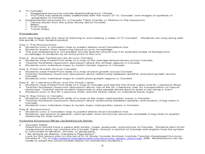
Where Do Canadians Live?
Students investigate Canadian people by researching the geography of the country. In this world geography instructional activity, students identify locations within Canada with large populations based on their access to waterways....
Curated OER
Reindeer Herders
Students examine the life of of nomadic herders in Siberia. They read and discuss an article and maps from National Geographic, identify threats to this way of life, and write a letter to the Russian government identifying ways to...
Curated OER
The Geography of the Philippines
Students examine the geographic features and population distribution of the Philippines. They analyze maps, take a quiz, define monsoon, and discuss how the people in the Philippines have adapted to their environment.
Curated OER
Where We Live
Students analyze Canada's population distribution. They access online information to gather demographic information about two Canadian cities. They compare and contrast the quality of life in the two cities and present their findings.
Curated OER
Geography of Japan
Students complete a worksheet that guides them through an overview of Japanese geography. Students research the topography, climate, population and size of Japan and consider how these factors work together to produce Japanese culture.
Curated OER
A Place Called Nepal
Young scholars investigate maps of Nepal and then create their own to disover how human activity is influenced by terrain and climate. Students participate in a trek across Nepal simulation to imagine the challenges people have to face...


