National Endowment for the Humanities
On This Day With Lewis and Clark
Walk in the footsteps of Lewis and Clark as they discover the wonders, beauty, and dangers of the American frontier. After gaining background knowledge about Thomas Jefferson and the Louisiana Purchase, young explorers use primary...
Curated OER
Put Your Face on the Map
Learners investigate topography and contour lines by examining a human face. In this mapping lesson, students create a plaster cast of a face and create a map of the contours of the face one centimeter at a time. Learners examine the...
Curated OER
Watershed Investigations
Students explore the components of a watershed and the factors that affect it. They read a topographical map and use geometry to determine the area of a watershed. Students estimate the volume of a body of water and perform runoff...
Curated OER
Map It!
Fourth graders demonstrate map making skills by using the computer to create maps of the geographic features, regions, and economy for their state.
Curated OER
Map It With Pixie
Fourth graders use the computer program 'Pixie' to create a topographic, detailed map for the state they live in. In this mapping skills lesson, 4th graders use Pixie to make a map of their state that includes topographic features, state...
Curated OER
MAPS AND TOPOGRAPHY
Students analyze the details of a topographic map and create one of their own by utilyzing a map of elevations.
Curated OER
Waldseemuller's Map: World 1507
Students investigate the 1507 word map. In this world geography lesson, students examine the details of each section of the map and then draw conclusions about how the people of 1507 understood the world. Students are evalated on...
Curated OER
The Landscape of a Novel
Students, after reading a novel, utilize geographic skills to map out the places described in the novel. They collect data, envision spatial features and then design a map to work off of to complete their assignment. Each student also...
Curated OER
A Shuttle's Eye View
Students explore the goals of the Shuttle Radar Topography Mission as a springboard to exploring the topographical features of their own state or region. They synthesize their understanding of landforms and topography by mapping their...
Curated OER
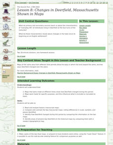
Lesson 8: Changes in Deerfield, Massachusetts Shown in Maps
Eighth graders study maps of the same area from different time periods which show the ways in which the land stayed the same, and the ways this New England village changed over the years.
Curated OER
Map It!
Fourth graders collect and explore different maps and their uses before using the program Pixie to create maps of geographic features, political features, and economic information for the state in which they live.
Curated OER
Interior of the Earth
Sixth graders identify and describe the composition and physical properties of the layers of the Earth. They also explain how scientists used the scientific process to know about the center of the Earth. Finally, 6th graders read a...
Curated OER
Geography And The Revolutionary War
Students gain a deeper understanding of both geography and the Revolutionary War. They practice using on line research in examining historical events and using political, physical, and topographic maps.
Curated OER
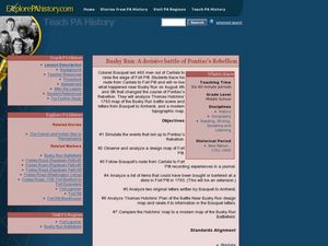
Bushy Run: A Decisive Battle of Pontiac's Rebellion
Middle schoolers study the battle at Bushy Run. In this Pontiac's Rebellion lesson, students examine an 1765 map of the Bushy Run battle as well as letters and a modern topographic map of the area in order to simulate the event and...
Curated OER
Trailblazers - Now and Then
Students, working in pairs, use maps to determine the most efficient routes between two cities. They research which route would have been used by early trailblazers. They present a first person account of one of the trailblazers place in...
Curated OER
A Thoreau Look at Our Environment
Sixth graders write journal entries o school site at least once during each season, including sketched and written observations of present environment. They can use sample topographical maps and student's own maps. Students can use...
Curated OER
Mapping Seamounts in the Gulf of Alaska
Students describe major topographic features on the Patton Seamount, and interpret two-dimensional topographic data. They create three-dimensional models of landforms from two-dimensional topographic data.
Curated OER
Mud Maps
Students discuss the location of stores, buildings, and homes in their community. Afterwards, they create a 'mud map' demonstrating the route from one point to another. In pairs, students read travel directions from a brochure, while...
Curated OER
The Battle of Brandywine
Students explore the Battle of Brandywine, how to analyze maps, and construct a model of a battlefield.
Curated OER
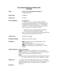
Chain Across the Hudson Lesson Plan A - Locating the Chain
Students read a letter from George Washington requesting them to identify on a map a location that would stop the advance of British warships. They choose a location and justify their choice.
Curated OER
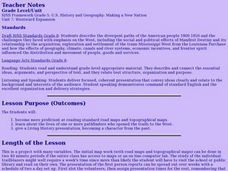
Making A New Nation
Eighth graders read standard road maps and topographical maps, and examine the lives of pathfinders who opened the trails to the West. They develop Living History presentations, role-playing a character from the past.
Curated OER
A Special Relationship: Connecticut and Its Settlers
Pupils study both geological and geographical features of Connecticut and the New Haven area. They focus on map works and rock formation.
Curated OER
Land Surveys
Students read and think about the relationship between maps and nature. They examine the origins of the Land Ordinance of 1785 and the large-scale topographical surveys that were commissioned a century later. They also read and analyze...


