Wind Wise Education
Where is it Windy?
How is the wind up there? The class builds a topography model using materials available in the classroom, then place wind flags in different locations on the landscape. Using a fan as a wind source, pupils collect data about how wind...
Curated OER
Topography: Know the topography of your neighborhood
Students read and identify features on a topography map. In this topography lesson plan, students learn how to read a topography map, and then go out and take pictures of their own and discuss the topography pictures they took.
Curated OER
Geological Forces and Topography
Learners discuss and research the Earth's geological processes. In this geology lesson, students study maps of Utah and the United States to learn about geological features. Learners then complete the research cards for each area of...
Curated OER
GEOGRAPHY: SPACE CENTERS
Young scholars examine the descriptive science dealing with the surface of Earth, its division into continents and countries, climate, natural resources, inhabitants and industries of the various divisions and analyze the political...
TED-Ed
A Digital Reimagining of Gettysburg
Why would Robert E. Lee order Pickett's Charge, an action that changed the course of the Civil War? Geographer and historian Anne Knowles uses digital technology to explain what she thinks is the missing piece in trying to understand...
Curated OER
Horse and Rider: The Pony Express in Utah
Fourth graders research the Pony Express. In this Pony Express lesson, 4th graders discover the reasons behind the development of this business and the technology that ended it.
Curated OER
Karst Topography
Learners observe a movie about karst topography over the Internet and note nonpoint source pollution. They discuss ways to manage pollution and their experiences with any polltion sources.
Columbus City Schools
Biome Basics with a Disastrous Twist
Bored with your current biome bag of tricks? This bundle is a bountiful bag of biome fun! Travel the globe with seventh graders and explore the biotic and abiotic factors that define our world's biomes. Then, introduce a little...
DiscoverE
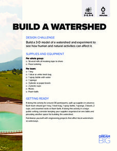
Build a Watershed
What's the best way to learn how watersheds work? Build one! Combining engineering, the water cycle, and ecology concerns, the activity is the perfect fit for an interdisciplinary unit. Teams construct a model watershed with simple...
Curated OER
The Sugar Cane Curtain/ Defining Political and Social Struggles Between Haiti and the Dominican Republic
Twelfth graders explore historical events that created conflict between Dominican Republic and Haiti, examine how need for cheap source of labor has led to exploitation of Haitian workers, and discuss how topography of island of...
NOAA
The Oceanographic Yo-yo
How does chemistry help deep-sea explorers? Part four of a five-part series of lessons from aboard the Okeanos Explorer introduces middle school scientists to technologies used in ocean exploration. Groups work together to analyze data...
NOAA
A Quest for Anomalies
Sometimes scientists learn more from unexpected findings than from routine analysis! Junior oceanographers dive deep to explore hydrothermal vent communities in the fourth lesson in a series of five. Scholars examine data and look for...
Curated OER
Geography, Map Skills & the Internet:
Students research various websites focusing on Italy while enhancing student utilization of computer, keyboards and the Internet. They discuss their findings on the geography, history, topography, and culture.
Curated OER
River Study
Students study physical features of a local stream. They study how to identify water features on topographic maps.
Curated OER
Mapmaking: Colorado Quarter Reverse
Students examine the Colorado quarter reverse and draw symbols of the state's land and water features on maps. Using copies of the Colorado reverse, they color the coin design. They list reasons for the state's motto of "Colorful Colorado"
Montana State University
Ice in Action
Make your own bite-size glacier! A resource teaches about the formation and melting of ice. Activities include videos, a hands-on activity where your pupils build glaciers, and a photographic analysis to teach individuals the chilling...
California Polytechnic State University
Australian Geography Unit
At the heart of this resource is a beautifully detailed PowerPoint presentation (provided in PDF form) on the overall physical geography of Australia, basic facts about the country, Aboriginal history, and Australia culture and lifestyle.
Oregon State
World Map of Plate Boundaries
Young geologists piece together the puzzle of plate tectonics in an earth science lesson. Given a physical map of the world, they search for land formations that indicate the location of different types of plate boundaries.
Science Matters
Seismic Activity and California Landforms
By the 19th lesson plan in the 20-part series, scholars realize volcanoes and earthquakes are related to plate boundaries. The lesson plan extends and applies the knowledge by having individuals create a bumper sticker for one specific...
PBS
Reading Adventure Pack: Oceans
Flotsam by David Wiesner and The Magic School Bus on the Ocean Floor by Joanna Cole, illustrated by Bruce Degen, begin a reading adventure pack focusing on oceans. With story listening and thoughtful discussion, scholars complete several...
Curated OER
Protecting Philippine Reefs
Students watch a slide show about the Philippine Reefs to explore the topic of fish populations. In this reef and fish population lesson, students watch a slide show about fish populations and how the Peace Corps works...
Curated OER
Animal Poetry
Fourth graders write poems that use local wildlife as their inspiration. After a class discussion which produces a list of wildlife that pupils have seen in their town, a review of three types of poetry ensues. They look at how...
Curated OER
Rainfall Mapping
Students explore rainfall and habitats. In this rainfall instructional activity, students explore the relationships among rainfall, vegetation, and animal habitats. Resources are provided.
Curated OER
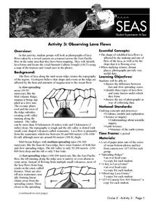
Observing Lava Flows
Students examine the difference between fast and slow spreading lava flows. They identify various types of lava flow and determine the factors that cause them to form. Viewing photographs of lava flows, students working in groups,...
Other popular searches
- Contour Maps
- Contour Maps and Elevation
- Contour Maps Topography
- Contour Lines Maps
- Contour Lines on Maps
- Contour Lines Map Reading
- Reading Contour Maps
- Contour Interval Map Scale
- Worksheets Contour Maps
- Geography Contour Maps
- Isolines and Contour Maps
- Music Contour Maps


