Virginia Repertory Theatre
The Town Mouse and the Country Mouse
Accompany the story, Town Mouse Country Mouse by Jan Brett with an assortment of activities designed to reinforce concepts covering story structure, comprehension, grammar, and social studies. Here, scholars identify the difference...
Curated OER
Shorten the Length
Learn how to summarize by identifying main ideas and supporting details. Readers cross out unimportant information as they read through a text. Is it a random detail? Cross it out! They then draw a concept map, placing the main idea in...
Curated OER
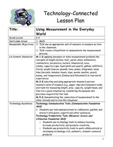
Using Measurement in the Everyday World
Students use an appropriate unit of measure to measure an item in the classroom. They create a PowerPoint to demonstrate the measurement process. Pupils are divided into pairs. Students use a concept map to discuss the terms for...
Curated OER
Charlotte's Web
Fourth graders focus on fluency by reading the book Charlotte's Web. In this reading strategies lesson, 4th graders partner read, do guided reading, and independent reading to increase fluency. Students use Venn Diagrams, discuss cause...
Curated OER
Quarters from the Coast
Students discuss Fifty State Quarters Program, compare and contrast location of land and water on map of United States, while also becoming aware of physical shape of nation and home state, and explore coastal areas in United States.
Edgate
Great Grids
Learners use grid boxes as a measurement tool and discover how grids are used for mapmaking and scaling down an area. They begin by attempting to draw a model shape drawn by the teacher by using the gridding process. At the conclusion of...
Sunburst Visual Media
Clouds
Support science instruction with a combination of engaging activities and skills-based worksheets that focus on clouds. Learners take part in grand discussions, write an acrostic poem, complete graphic organizers, solve word puzzles, and...
Curated OER
Observation and Inference
Assess your young scientists' understanding of the difference between observation and inference with this 20-question multiple choice quiz. It reviews a variety of physics and astronomy concepts, such as solar eclipses and sunspots, the...
Student Handouts
Christopher Columbus Workbook
Youngsters gain ample reading comprehension practice while studying the history of Christopher Columbus with this great workbook! It includes word puzzles and comprehension checks of multiple assessment styles, including multiple choice,...
New York State Education Department
Global History and Geography Examination: January 2017
Global history and geography class members demonstrate their knowledge of and ability to analyze primary sources such as graphics, maps, political cartoons, and texts from important documents with an assessment that includes multiple...
NOAA
Investigating Sea Level Using Real Data
The news reports on rising sea level, but how do scientists measure this rise? Scholars use NOAA data including maps, apps, and images to work through five levels of activities related to sea level. Each level in the series adds a new...
New York State Education Department
Global History and Geography Examination: January 2016
What do the Inca Civilization, Wittenburg Church, and India's economy in the Mughal Period have in common? The well-rounded standardized test challenges scholars to remember all of them. They use different graphics and maps to answer...
DocsTeach
From Dred Scott to the Civil Rights Act of 1875: Eighteen Years of Change
What do a photo of Abraham Lincoln, a map for the Battle of Antietam, and the Dred Scott decision all have in common? Learners consider the broader question as they examine documents related to civil rights during the Civil War and...
Curated OER
Map Making
First graders explore maps to realize the concept that maps are simply small representations of a much bigger picture. They discuss the importance of maps in everyday life, examine a map of the school, and then make a map of their...
Curated OER
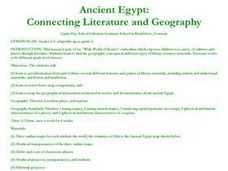
Ancient Egypt: Connecting Literature and Geography
Students brainstorm prior knowledge of Ancient Egypt, locate Egypt on map of Africa and on world map, watch King Tut film, discuss term biography, and map geographical information mentioned in stories and documentaries about Ancient Egypt.
Curated OER
Finding Your Way
Students work in small groups to practice basic map skills. They take turns giving directions and tracing a path from one location to different destinations on the map.
Curated OER
Do You Know Your Story Grammar?
Young scholars are introduced to the concept of story structure as a way to aid in reading comprehension. They identify the main parts of the story as they read. Students create a story map of the main plot points of their reading.
Curated OER
Latitude on World Maps - World Map Activity 2
Students explore the concept of latitude. In this geography lesson plan, students discover the global grid system and complete a map activity which require them to record the latitude of various cities in the world.
Curated OER
Globe Lesson 4 - Intermediate Directions
Students explore the concept of intermediate directions. In this geography skills lesson, students use map skills in order to identify intermediate directions as they complete a map activity.
Curated OER
Mapping with a Compass: A Simulated Survey
Students use compasses and grids to map the locations of artifacts found in a simulated dig site. In groups, they role-play as future archeologists excavating a school site. Groups begin at their assigned datum and site the artifacts...
Curated OER
Coordinate Grid: Mapping Archeological Sites
Fourth graders discover how to apply the Cartesian coordinate system by figuring out the length and width of their school playground. They determine that pacing is an important tool for the initial mapping of a site. Students conduct a...
Curated OER
The Map of Summarization
Students review the concept of silent reading. Through modeling and guided practice, they follow six given steps in summarizing a chapter from "Charlotte's Web." Then they follow the same steps in summarizing the next chapter on their own.
Curated OER
Ancient Rome: Map Work
Seventh graders explore the Roman Empire. In this ancient Rome lesson, 7th graders use digital and print maps to examine the geography of the Roman empires. Students are assigned regions of the empire to analyze and present their...
Curated OER
Map a World of Facts
Students mark ten places on a world map while they follow fun facts on the included printable sheet. They research using a variety of resources to determine the location of the ten places.
Other popular searches
- Cell Transport Concept Map
- Blank Concept Maps
- Genetic Concept Map
- Weather Concept Map
- Krebs Cycle Concept Map
- Science Concept Map
- Phylum Chordata Concept Map
- Concept Map Rubrics
- Inspiration Concept Map
- Dna Structure Concept Map
- Concept Map in Science
- Rock Concept Maps


