Biology Junction
Mammals
Mammals include more than 4,000 species and represent the most dominant land animals on Earth. Scholars learn about the large variety of mammals, including orders unfamiliar to most. The presentation highlights the characteristics and...
NASA
Cloudy vs. Clear - Graphs
Explore the link between solar energy and cloud cover using real data from NASA from China! Future climatologists analyze and interpret graphs of solar energy on clear and cloudy days using a literacy cube. Investigators draw conclusions...
US Environmental Protection Agency
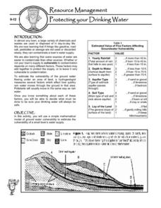
Protecting Your Drinking Water
Having a clean, reliable source of drinking water is essential for any community, but in many cases this is easier said than done. Engage young environmentalists in exploring the five factors affecting vulnerability of a groundwater...
Port Jefferson School District
Hurricane Katrina
Young scientists track Hurricane Katrina across the Atlantic Ocean as they learn about these destructive forces of nature. Provided with a table of data tracking the location and conditions of Katrina over a one week span, students plot...
Novelinks
The Hobbit: Concept/Vocabulary Analysis
Considering using Tolkien's The Hobbit for book circles or whole-class reading? Check out this packet that provides an overview of the novel, some interesting background materials, and links to additional resources.
Cornell University
Constructing and Visualizing Topographic Profiles
Militaries throughout history have used topography information to plan strategies, yet many pupils today don't understand it. Scholars use Legos and a contour gauge to understand how to construct and visualize topographic profiles. This...
Columbus City Schools
Totally Tides
Surf's up, big kahunas! How do surfers know when the big waves will appear? They use science! Over the course of five days, dive in to the inner workings of tidal waves and learn to predict sea levels with the moon as your guide.
Population Connection
The Human-Made Landscape
Agriculture, deforestation, and urbanization. How have human's changed the planet and how might we mitigate the effects of human activity on the planet? To answer these questions class members research the changes in human land use from...
Curated OER
Volcanoes: Second Grade Lesson Plans and Activities
Young geologists explore volcanoes with a series of engaging geology activities. First, they learn the difference between magma and lava before coloring and labeling the parts of a volcano. During the lab, individuals watch a...
Curated OER
Plate Tectonics: Second Grade Lesson Plans and Activities
Second graders explore convection currents and how they relate to the movement of tectonic plates. Then, young geologists reconstruct Pangaea with a worksheet and pinpoint plate boundaries on a map using locations of earthquakes and...
NOAA
Sediments
Calcareous ooze ... what an interesting name! The 15th installment of a 23-part NOAA Enrichment in Marine sciences and Oceanography (NEMO) program focuses on sediments found on the ocean floor. After viewing the slideshow lecture,...
Alabama Department of Archives and History
From Alabama Farmer to Civil War Soldier
As part of a study of the Civil War, class members conduct a WebQuest to create a timeline of battles fought by the 10th Alabama Infantry Regimen. They then use Google Earth to pinpoint these battles of the Civil War on a map of Alabama.
Orange County Water Atlas
Location, Location, Location…
Young geographers discover not only how to read and recognize coordinates on a map, but also gain a deeper understanding of latitude and longitude and how climate changes can vary significantly across latitudes.
Discovery Education
Satellite Telemetry
Satellites require rockets to launch, but it doesn't take a rocket scientist to understand them. Future engineers learn about how satellites send data to Earth and how to interpret satellite images. They see how radio waves play a role...
California Academy of Science
Discovering Rainforest Locations
How many rainforests are there, where are they, and do global factors effect their locations? These are great questions that have great answers. Children in grades four through eight use several different maps to determine why...
Curated OER
The Seven Continents Scavenger Hunt
Who doesn't enjoy an engaging scavenger hunt? Here, scholars listen to, and discuss, the informative text, Where is my Continent? by Robin Nelson. They then explore the seven continents and four major oceans using Google Earth.
Columbus City Schools
Diversity of Living Things
Here's a topic classes can really dig—the fossil record. Use the well-organized and thoughtful road map to take eighth graders back in time to unearth the answer. Learn how our climate has changed, and how organisms have changed along...
Australian Government
The Great Artesian Basin
Covering 23% of the continent and holding 64,900 cubic kilometers of water, the Great Artesian Basin is the primary source of water for much of inland Australia. Using detailed student worksheets, experiments, and case studies, young...
Safe Routes to School
Pollution & Evolution
Bring together a study of two major scientific topics with a lesson on the relationship between pollution and evolution. With the help of a PowerPoint presentation, hands-on activity. and class demonstration young scientists learn how...
EngageNY
Synthesizing Information from Texts about Natural Disasters: What Makes an Earthquake a Natural Disaster?
Are all disasters natural? Scholars reread Earthquakes! to determine what classifies these events as a natural disaster. They label earthquake facts as N for natural or D disaster to support their ideas. They then discuss academic...
NOAA
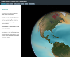
Ocean Acidification
Carbon dioxide is on the rise; does that also mean a rise in danger to humans and animals? Scholars learn what that means for the environment and more specifically the ocean. They examine data on the pH of different ocean areas and learn...
Carnegie Mellon University
Marcellus Shale: Who Pays?
After viewing short clips of unfortunate events, your class will consider two sides of a homeowner's court case, and then learn about the Marcellus shale deposit beneath the state of Pennsylvania and the hydraulic fracturing process. In...
Channel Islands Film
Island Rotation: Lesson Plan 1
How do scientists provide evidence to support the theories they put forth? What clues do they put together to create these theories? After watching West of the West's documentary Island Rotation class members engage in a series of...
Prairie Public Broadcasting
Egyptian Pyramids Virtual Field Trip!
A virtual field trip takes enthusiastic travelers to the pyramids of Giza. Using Google, scholars explore the grounds of the ancient pyramids found in Egypt then complete three worksheets: a photo analysis page, a reflection sheet, and a...
Other popular searches
- Earth Scene Concept Maps
- Earth Scone Concept Maps
- Earth Science Mapping
- Earth Sciecne Concept Maps
- Mapping Earths Surface
- Mapping Earthquakes


