Space Awareness
Let's Map the Earth
Before maps went mobile, people actually had to learn how to read maps. Pupils look at map elements in order to understand how to read them and locate specific locations. Finally, young cartographers discover how to make aerial maps.
Association of American Geographers
Project GeoSTART
Investigate the fascinating, yet terrifying phenomenon of hurricanes from the safety of your classroom using this earth science unit. Focusing on developing young scientists' spacial thinking skills, these lessons engage...
Keep it Simple Science
The Earth in Space
Skim the surface of the earth with this brief, compact, summary of outer space. The sun, stars, galaxies, planets, and phases of the moon can be found in this all-in-one resource. Seventh graders will enjoy these simple worksheets to do...
NOAA
Into the Deep
Take young scientists into the depths of the world's ocean with the second lesson of this three-part earth science series. After first drawing pictures representing how they imagine the bottom of the ocean to appear, young scholars...
Howard Hughes Medical Institute
Lesson 6: Biomes and Landscapes
Aside from the amazing animals in Gorongosa National Park, what else is there to discover? The sixth installment in an eight-part themed series contains an interactive map where scholars can learn more about the geographic features of...
Port Jefferson School District
Hurricane Katrina
Young scientists track Hurricane Katrina across the Atlantic Ocean as they learn about these destructive forces of nature. Provided with a table of data tracking the location and conditions of Katrina over a one week span, learners...
Space Awareness
How To Travel On Earth Without Getting Lost
Have you ever wanted to travel the world? Take a virtual trip with a geography lesson that uses longitude and latitude, the position of the sun, an astronomy app, and a classroom globe.
S2tem Centers SC
Seasons
Winter, spring, summer, and fall—take the learning of the seasons beyond the elementary level to the middle school classroom. Curious learners begin by watching videos about the seasons and the rotation of planet Earth. Then,...
Sunburst Visual Media
Clouds
Support science instruction with a combination of engaging activities and skills-based worksheets that focus on clouds. Learners take part in grand discussions, write an acrostic poem, complete graphic organizers, solve word...
K-State Research and Extensions
Water
How are maps like fish? They both have scales. The chapter includes six different activities at three different levels. Scholars complete activities using natural resources, learn how to read a map, see how to make a compass rosette,...
PBS
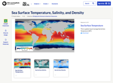
Sea Surface Temperature, Salinity, and Density
Earth's vast ocean is full of mysteries! Science scholars discover the big-picture properties that influence its characteristics at different latitudes using a lesson plan from PBS's Weather and Climate series. After completing a...
It's About Time
Renewable Energy Sources - Solar and Wind
There has been a huge solar energy spill! Let's go outside to play in it. This lesson includes multiple experiments showcasing solar and wind energies. Scholars build a solar heater and an anemometer before testing the results. The...
Mary Pope Osborne, Classroom Adventures Program
Mummies in the Morning Egyptian pyramids, hieroglyphics
Visit the Magic Treehouse and take your class on a trip through time with a reading of the children's book Mummies in the Morning. Using the story to spark an investigation into Egyptian culture, this literature unit engages...
Polar Trec
Create a Topographic Profile of Beacon Valley
Landforms in Beacon Valley, Antarctica, where there is no snow, bear a striking resemblance to landforms found on Mars. Scholars identify landforms found in Beacon Valley through analysis of topographic maps in the activity. They then...
Cornell University
Constructing and Visualizing Topographic Profiles
Militaries throughout history have used topography information to plan strategies, yet many pupils today don't understand it. Scholars use Legos and a contour gauge to understand how to construct and visualize topographic profiles. This...
University of Colorado
Strange New Planet
The first remote sensors were people in hot air balloons taking photographs of Earth to make maps. Expose middle school learners to space exploration with the use of remote sensing. Groups explore and make observations of a new...
Science 4 Inquiry
Edible Plate Tectonics
Many people think they can't observe plate tectonics, but thanks to GPS, we know that Australia moves at a rate of 2.7 inches per year, North America at 1 inches per year, and the Pacific plate at more than 3 inches per year! Scholars...
Science 4 Inquiry
An Investigative Look at Florida's Sinkholes
In May of 1981, the Winter Park Sinkhole in Florida first appeared and is now referred to as Lake Rose. Scholars learn about the causes of sinkholes through an inquiry project. Then, they analyze recent data and draw conclusions to...
Forest Foundation
Forest Watersheds
Where does the water we use come from? To understand the concept of a watershed, class members study the water cycle and then engage in an activity that simulates a watershed.
Science Matters
Energy and Winds
In the study of wind energy, scholars build a small windmill and observe how it transfers wind into mechanical energy. Learners will make connections to the previous lesson with concepts such as the creation of wind...
Polar Trec
What Can We Learn from Sediments?
Varve: a deposit of cyclical sediments that help scientists determine historical climates. Individuals analyze the topography of a region and then study varve datasets from the same area. Using this information, they determine the...
Channel Islands Film
Island Rotation: Lesson Plan 1
How do scientists provide evidence to support the theories they put forth? What clues do they put together to create these theories? After watching West of the West's documentary Island Rotation class members engage in a series of...
Columbus City Schools
Geological Effects of Plate Tectonics
Don't get your classes all shook up about plate movement, instead use a thorough unit that guides learners to an understanding of plate tectonics. The lessons incorporate a study of the types of plate boundaries and their effects on the...
Orange County Water Atlas
Location, Location, Location…
Young geographers discover not only how to read and recognize coordinates on a map, but also gain a deeper understanding of latitude and longitude and how climate changes can vary significantly across latitudes.


