Curated OER
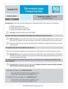
The Weather Page: Comparing Data
Students analyze data from maps. In this comparing data instructional activity, students use comparative and superlative statements to draw comparisons among the weather in different American cities based on USA Today weather maps.
Curated OER
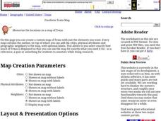
Freeform Texas Map
In this Texas map activity, students research, label and discuss the most important cities in Texas, its physical attributes and the states that surround Texas.
Curated OER
Freeform Pennsylvania Map
In this Pennsylvania map worksheet, students research, study and label twenty important cities, physical attributes and the neighbors that surround Pennsylvania on a Pennsylvania map.
Curated OER
Introduction to the United States Map
Students identify the United States of America and it's states on a map. In this mapping lesson, students examine a globe and find the United States as well as a few land marks (Florida and the Great Lakes). Students then look at a...
Curated OER
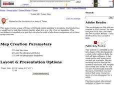
"Label Me" Texas Map
In this Texas map worksheet, students research, label and discuss the top ten major cities in Texas on a map, label the physical attributes and identify the surrounding states around Texas.
Curated OER
United States Map Quiz
In this online interactive geography quiz worksheet, learners respond to 50 identification questions about the shapes of countries shown. Students have 5 minutes to complete the quiz.
Curated OER
An Atlas of Health Care
Students use educational software to create an alphabetical directory of maps that indicates the precise location of the community's health care facilities.
Curated OER
Latitude and Longitude
In this latitude and longitude worksheet, learners find a set of 7 coordinates on a map. An answer key is included; a website reference for additional resources is given.
Curated OER
Earth at Night
Young scholars examine the Earth at night. In this geography instructional activity, students identify the continents at night using various Internet Web sites. This instructional activity may be adapted for use with middle school and...
Curated OER
Reading a Local and National Weather Map
Learners practice reading a national and local weather map. Using this information, they work together to make predictions about the weather for the next few days. They discuss the use of symbols and maps as a class and discuss how...
Curated OER
Mapping your watershed
Students investigate the importance of watersheds around the world. By visiting resource links, students can locate watersheds and their sources in the USA and Russia and analyze their effects on the surrounding topography. This lesson...
Curated OER
Any Town, USA
Young scholars launch an investigation of their home town by creating a mental map and examining the livability factors from their perspective. After completing their map, students write a brief description of their town
Curated OER
Mental Maps
Young scholars analyze and evaluate how they mentally organize information. They participate in a visualization exercise, create a sketch of a mental map of their neighborhood, state, country, and the world, and complete a Mental Map...
Curated OER
Mesopotamia
Students map Mesopotamia. In this Geography lesson plan, students are introduced to Ancient Mesopotamia. Students use an atlas to label the defining features and areas of Mesopotamia on a map.
Curated OER
USA Immigration by Country Quiz
For this online interactive geography quiz worksheet, students respond to 30 identification questions about countries U.S. citizens have immigrated from. Students have 5 minutes to complete the quiz.
Curated OER
USA State Tag / Mississippi River Shuffle
Learners reinforce the geographic location of the states of the U.S.A.
Curated OER
Names and Places
Students explore where jobs are done. In this careers and geography instructional activity, students locate places in Canada on a map and list jobs that are done in their area of Canada. Lesson includes extension and differentiation ideas.
Curated OER
Tracking Satellites Using Latitude and Longitude
Students, viewing an Internet site, plot the path of several satellites using latitude and longitude over the course of an hour. They learn the four basic types of satellites and their purpose.
Curated OER
SAMMY DISCOVERS SHAPES AT SCHOOL
Students study maps and use them for real world experiences.
Curated OER
Freeform Rhode Island Map
In this free form Rhode Island map worksheet, students study, locate and memorize key cities, physical attributes and surrounding states for a quiz. Students fill out the major cities on a blank map of Rhode Island.
GCSE Modern World History
Mao's China
Here is a great textbook chapter on China's establishment as a communist state in 1949 and the effects of World War II on the nation. The first page prompts learners to complete a timeline activity as they read the material, which...
ProCon
Israeli - Palestinian Conflict
Many people think the best solution to the Israeli-Palestinian conflict is a two-state solution. After reviewing the available resources, scholars determine whether they agree with that approach. They analyze graphs and charts about...
Curated OER
Vermont Map, Word Search, Scrambled Places and Crossword Puzzle
In this geography worksheet, learners learn the important physical features and major cities in the state of Vermont by completing any of the 5 worksheets. There is a free form map, a "label me" map, word search, scrambled places and...
Curated OER
The Science of Weather: Hurricanes
Students use this USA today activity to learn about hurricane season. In this hurricane lesson, students study the map of the earth and hurricane science. Students complete discuss questions. Students draw a map of the United States and...
Other popular searches
- Usa Maps
- Climate Maps Usa
- Usa Canada Maps
- Blank Usa Maps
- Maps of Usa Regions
- Choropleth Maps of Usa
- Northwest Usa Maps


