Ed Helper Clip Art
USA States
Looking for a map of the Unites States of America? Look no further than this printable map designed to accompany your geography instruction and to give map skills a boost.
Little 10 Robot
Geography Drive USA™
A trivia-style virtual road trip in which the player's car is moved from state to state as questions are correctly answered. Ideally, a player would learn about different states by reading the simple brochures available in the...
Richmond Community Schools
Map Skills
Young geographers will need to use a variety of map skills to complete the tasks required on this worksheet. Examples of activities include using references to label a map of Mexico, identify Canadian territories and European countries,...
Curated OER
Projects For USA Units
Young scholars study different regions of the United states through interdisciplinary activities. This lesson presents very creative, artistic ways for students to explore the variety of regions found in the United States.
Curated OER
Reading a Local and National Weather Map
Students investigate weather maps. In this weather lesson, students discover the meaning of different weather icons and symbols. Working independently, students use the local forecast to correctly label a state map.
Curated OER
Reading a Local and National Weather Map
Students examine weather maps. They examine icons and map symbols. Students explore vocabulary words related to weather. Students analyze and evaluate information provided on the weather map.
Curated OER
USA: Average Precipitation and Temperature Map
In this United States map instructional activity, students make note of the average precipitation and temperature in regions of the country.
Curated OER
Will There Be a White Christmas This Year?
Students examine historical weather data, and create map and color key that illustrates the likelihood of a white Christmas in different locations across the United States.
Curated OER
Exploring the USA and the World with Cartograms
Young scholars investigate cartograms in order to explore the different countries on Earth. In this world geography lesson, students use the Internet to analyze data on different cartograms. Young scholars compare data, such as...
Curated OER
Rapping Regions in America
Students determine what designates a place as a region. They apply their criteria for a region to the US map. They work in groups to write a rap about their region that describes its organization, type and structure.
Curated OER
Reading a Local and National Weather Map
Students practice reading a national and local weather map. Using this information, they work together to make predictions about the weather for the next few days. They discuss the use of symbols and maps as a class and discuss how...
National Wildlife Federation
Get Your Techno On
Desert regions are hotter for multiple reasons; the lack of vegetation causes the sun's heat to go straight into the surface and the lack of moisture means none of the heat is being transferred into evaporation. This concept, and other...
Curated OER
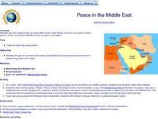
Peace in the Middle East
Students study a region. In this history instructional activity, students discover how different people and events have affected the Middle East in its efforts to be a peaceful area. They work in small groups on an assigned topic and...
Curated OER
Colonialism in Africa
Students examine Africa from a regional perspective. They appreciate the historic and geographic relationships that unite and divide the regions of Africa. Students create a comprehensive document outlining problems in the assigned...
Curated OER
Regions of the US: Gulf Stream, States and Their Capitals
Fifth graders identify one way of dividing the US into geographical regions and then consider alternate ways of doing the same. They locate each of the fifty states and their capitals on a map. They research the Gulf Stream region.
Curated OER
Edible Resource Maps
Third graders work in groups to create an edible resource map showing locations of at least five resources in the United States. Students research on the internet different regions and the resources that are found in those areas. They...
Curated OER
Where in the Usa is Radon?
Students determine the areas of New Jersey and the US that are likely to have high radon concentrations. Students draw a map of their own neighborhood that show soil associations in their neighborhood.
Curated OER
Made in the USA
Students map products made in the United States. They discuss regional interdependence and identify goods the U.S. produces and trades. They describe how economic links make Americans more alike, and locate major manufacturing centers in...
Curated OER
Muppet Treasure Island
Young scholars watch the movie "Muppet Treasure Island" and then taking on roles of characters in the movie answer navigational questions to try discover the location of a treasure hidden by the teacher.
Curated OER
Traveling the USA
Pupils simulate the role of travel agents addressing the needs of a foreign family visiting a state in the US. They prepare a presentation and informational sales pitch of a proposed travel itinerary.
Curated OER
Population and Air Pollution
Students conduct Internet research to compare the impact of increasing populations and how it affects air pollution in both, the USA and Russia. Students present their finding in a creative manner by developing brochures, bumper...
Curated OER
The First American Colonies
Fourth graders are introduced to the early colonial settlements of America by observing a map, filling in a map themselves and then researching information on their own.
Curated OER
Five Themes of Geography and Current Events
Basically, pupils look for a current world event from a reputable source and identify the five themes of geography within it. Throughout the school year, they keep a notebook of these current events. A grading guideline is outlined, and...
Curated OER
Geography of the United States
Students examine the population growth of the United States. In this Geography lesson, students construct a map of the fifty states. Students create a graph of the population of the USA.


