Curated OER
Lesson 4 Activity 1: Mapping the Third Dimension
Young scholars work in pairs to construct a simple stereoscope.
Curated OER
Explore Three-Dimensional Shapes
Students are assigned to shape groups and explore three-dimensional shapes. They review math skills and two-dimensional shapes.
Curated OER
The Global Grapefruit - Representing a 3-Dimensional Globe on a 2-Dimensional Map
Students compare and contrast world maps and globes. They convert a 3-dimensional globe to a 2-dimensional map. They are introduced to the Mercator map projection. They observe map distortions of shape, area, distance, directions and angle.
Curated OER
Edible Geometry
Students examine a chart that lists the main characteristics of polygons and 3 dimensional figures. They make examples of the polygons and figures using pretzels and gum drops showing how the gum drops are vertices and the pretzels are...
Curated OER
2: Isle of Shapes - Based on the Puerto Rico Quarter Reverse
Young scholars identify both two and three-dimensional shapes. In this geometric shapes lesson, students listen to a teacher led lesson about the island of Puerto Rico. They look at the symbols and shapes on "Puerto Rico Quarter Reverse"...
Curated OER
Making Maps
First graders create a map of their classroom that can be used to find a hidden treasure. They examine two- and three-dimensional objects and discover characteristics.
Mathematics Assessment Project
Representing 3-D Objects in 2-D
How does the shape of the surface of water in a container change as water leaks out? After tackling this question, learners take part in a similar activity with more complex figures.
Curated OER
Design an Island
Students explore islands. They create a two- or three-dimensional map of an island. They explain how the topography of an area influences the location of water sources, ecosystems, and human settlements. Lesson includes adaptations for...
Curated OER
Create A Map!
Students examine two- and three-dimensional shapes, and discuss map skills and attributes. They plan and create their own school campus maps using pre-cut building site shapes.
Annenberg Foundation
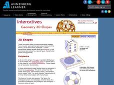
Geometry 3D Shapes: 3D Shapes
Explore vocabulary related to three-dimensional shapes. An instructional website describes the characteristics of different geometric solids. Learners can use an interactive component to view nets, faces, vertices, and edges of common...
Annenberg Foundation
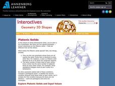
Geometry 3D Shapes: Platonic Solids
From polyhedrons to platonic solids, here is a lesson that will have your classes talking! As an introduction to platonic solids, scholars cut and fold nets to create the three-dimensional solids. They use an interactive component to...
Annenberg Foundation
Geometry 3D Shapes: Euler's Theorem
How do you get a theorem named after you? Euler knows what it takes! The third lesson of five asks pupils to use an interactive activity to compare the faces, vertices, and edges of seven different three-dimensional solids. They use...
Curated OER
Using Maps to Learn About Antarctic Topography
Young scholars explore maps and familiarize themselves with features of Antarctica. They utilize a topographical map to create a three-dimensional model of Antarctica. They identify and describe the different regions of Antarctic ice.
Curated OER
Worksheet 19 - Topographical Maps
In this map worksheet, students use information from given topical maps and locate the maxima and solve one dimensional wave equations. This two-page worksheet contains four problems.
Curated OER
Maps and Models
Students study maps of New Mexico examining settlement patterns over time and the location of water sources. They research the history of their community and discover how cultural groups interacted, adapted to their physical...
Concord Consortium
The Six Faces of Amzora
Here's a task that is out of this world! Given a description of a fictional cube-shaped planet, scholars answer a set of questions about the planet. They create a two-dimensional map and consider the distances between locations on the map.
Curated OER
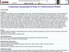
Comparing Topographical Maps to 3-Dimensional Models
Students apply knowledge of topographical maps and how computer programs are used to make 3-D models of areas that humans have never visited. They view a Mars Canyon movie, then map the canyon.
Curated OER
Introducing Topographic Maps: Guiding Students from Concrete Models to Graphic Representations
Students interpret topographic maps and infer human activity as it is influenced by the landscape.
Curated OER
Map-A-Buddy
Students investigate the concept of tracking and spatial movements of animals in relation to the environment in which they live. They participate in an interactive activity by tracking one another over a pre-defined region, record the...
Curated OER
Space and Shape in Geometry:
Students are asked to visualize three-dimensional figures and apply this visualization to problem solving.
Curated OER
Malta: The Landscape
Pupils work in small groups to create a topographic map of Malta. They must include labeled line drawings of bordering countries and bodies of water. Students use salt and flour clay to make Malta three dimensional, showing the nearest...
Curated OER
Round and Round
Learners interpret data from a three-dimensional array of current monitors to determine an overall pattern of water circulation. They hypothesize what effect an observed water circulation pattern might have on seamount fauna. A very...
Curated OER
Using Concept Maps to Design 3D Spheres
Young scholars create three dimensional shapes using concept maps. In this geometry lesson, students investigate the impact of mental schemas on humans. They collect data on this topic and plot their data on a coordinate plane.
Kentucky Educational Television
The Road to Proportional Reasoning
Just how big would it really be? Young mathematicians determine if different toys are proportional and if their scale is accurate. They solve problems relating scale along with volume and surface area using manipulatives. The last day of...
Other popular searches
- Three Dimensional Story Maps
- Three Dimensional Map
- Three Dimensional Physical Map
- Three Dimensional Map


