Curated OER
Mountains
An informative and well-designed presentation on mountains awaits your geographers. Excellent photographs from mountain ranges around the world are includedin this terrific PowerPoint. The last slide effectively sums up what pupils have...
Curated OER
Geography of South America
Young explorers study South American geography. They study maps and create a physical map of the Andes themselves! They also research the geography, environment, and the culture of the Andes and present a report to the class.
Curated OER
Lost Worlds
Students, while using the strategy of identifying the main idea and supporting details, explore the three nonfiction selections of the lost worlds of Machu Picchu high in the Andes Mountains, Great Zimbabwe, and Anasazi. In addition,...
Curated OER
World Map and Globe - Lesson 15 Mountains of the World
Students locate major world mountain ranges. In this geography activity, students identify major mountain ranges on 6 on of the 7 continents on a large world physical map.
American Museum of Natural History
Inca Investigation
A fascinating interactive resource lets young archaeologists dig through the history of Huanuco Pampa. The Inca city, located high in the Andes mountains of Peru, was once a thriving community. Craig Morris has spent years researching...
Curated OER
The Geography of Latin America
Perfect for a geography or world cultures lesson, the slides in this presentation cover the topography, demographics, and climate of Central America, South America, and the Caribbean. From the apex of the Andes Mountains, to the depths...
Curated OER
World Map and Globe - Lesson 15 (K-3)
Young scholars discover mountain ranges and their locations in the world. In this physical map lesson plan, students locate and identify major mountain ranges of the world on a large physical map.
Global Oneness Project
Highways and Change
What is the cost of change? Roberto Guerra's photo essay "La Carretera: Life and Change Along Peru's Interoceanic Highway" asks viewers to consider the impacts of the 1,600 mile-long highway through Peru and Brazil that connects Pacific...
Core Knowledge Foundation
Maya, Aztec, and Inca Civilizations
A 10-lesson unit explores the Maya, Aztec, and Inca civilizations. Over the course of two weeks, scholars read nonfiction excerpts, discuss their findings, and complete activities. An assessment equipped with multiple choice and matching...
Curated OER
Geological Features of Latin America
The rainforest, the Andes Mountains, and the Amazon River are all featured in this simplistic slide show. Intended to show the major geological features common to Latin America, this presentation provides only three geological areas and...
Curated OER
South America Puzzle
In this geography activity, students complete a crossword puzzle related to the countries, capitals, bodies of water, and populations of South America. They use the 23 clues given to solve the puzzle.
Curated OER
Music in Nature
Students research the Incan civilization. In this Incan civilization lesson, students study the geography of the Andes mountains and play an Andean siku. Students discuss how the sounds of nature influenced their musical piece.
Curated OER
Regions of South America
Students explore facts about South America in the four lessons of this unit. Booklets are created from the materials produced as the class delves into the topic.
Curated OER
Natural Wonders of the World
In this wonders of the world instructional activity, students complete a detailed fact chart about natural wonders of the world. Included are exceptional mountains, canyons, oceans and rivers.
Curated OER
Which Foods Come From Rainforests?
A very interesting and colorful presentation on the original sources of food is here for you. Learners discover where foods such as bananas, asparagus, potatoes, and oranges come from. They come from rainforests located all over the world!
Curated OER
Revolutions in Latin America (19c - Early 20c)
The history of the Latin American revolutions - and the philosophies behind them - is the focus of this comprehensive presentation. From the theories of the European Enlightenment, to the Revolutionary Wars of America and France, Latin...
Curated OER
South America Vocabulary
In this vocabulary activity worksheet, students read the statements about South America and complete them with 10 words from the word bank.
Curated OER
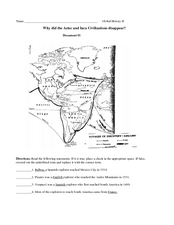
Why did the Aztec and Inca civilizations disappear?
Middle schoolers can analyze primary source documents to answer the question, "Why did the Aztec and Inca civilizations disappear?" They will read the provided excerpts then answer 11 different questions to uncover the ultimate answer.
Curated OER
Countries of South America
Students focus on the geography of the countries of South America. Using a map, they identify the European countries who claimed the South American countries and research the influences they had on South America. To end the lesson,...
Curated OER
Meso-America
Students will identify and locate Central and South America and their countries and features, as well as Meso-American civilizations. Students will compare civilizations and discuss voyages of relevant explorers.
Curated OER
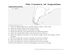
Map of Argentina
In this map of Argentina instructional activity, students label key areas, cities, bodies of water and surrounding countries, then color the map according to directions.
Curated OER
Inca Artifacts and Civilization Lesson Plans
By learning about Inca artifacts and this ancient civilization students can delve into history, geography, and much more.
Curated OER
Political Legends and Map Symbols
Students identify the legend and map symbols. In this map skills lesson, students use a world map to find various locations using a map key.
Curated OER
A Geography and Ecology Lesson for Grades 4-7
Pupils explore many of the unusual geographical features of the Amazon River region, and explain the importance of preserving the tropical rainforest.
Other popular searches
- Life in Andes Mountains
- Andes Mountains Model
- Andes Mountains and Culture
- Deadly Andes Mountains
- The Andes Mountains
- " Deadly Andes Mountains


