Curated OER
Central America Map Quiz
In this online interactive geography quiz activity, students examine the map that includes 22 Central American countries. Students identify the names of the countries in 3 minutes.
Curated OER
Central America Map wtih Country Borders
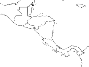
In this blank outline map worksheet, students explore the political boundaries of Central America and the nations there. This map may be used in a variety of classroom activities.
Curated OER
Mexico and Central America Map
In this blank outline map activity, students study the political boundaries of Mexico and Central America. Each of the counties is labeled and the capital cities are starred.
Curated OER
South America and Central America Capitals Map Quiz
In this online interactive geography quiz worksheet, students examine the map that includes all of Central and South America's countries. Students match each of the country names to the appropriate locations on the map.
Curated OER
South America and Central America Map Quiz
In this online interactive geography quiz learning exercise, students examine the map that includes all of Central and South America's countries. Students match each of the country names to the appropriate locations on the map.
Curated OER
Central America Outline Map
In this Central American political map worksheet, students make note of national boundaries and capitals in this region of the world. National capital city locations are noted with stars.
Curated OER
Central America Outline Map - Labelled
In this Central American political map instructional activity, students make note of national boundaries and capitals in this region of the world. National capital city locations are noted with stars.
Curated OER
Central America Outline Map
In this Central American political map instructional activity, students make note of national boundaries and capitals in this region of the world. National capital city locations are noted with stars.
Curated OER
Central America Region: Physical Map
In this Central America physical map instructional activity, students make note of the major landforms located in this region of the world.
Smithsonian Institution
Ceramica de los Ancestros
Scholars join a field expedition team to unearth a plethora of treasures from Central America. Artifacts listed in alphabetical order come with an informational blurb and a picture designed for participants to color. Activity pages...
Curated OER
Central America: Unlabeled Map
In this Central American political map worksheet, students examine the boundaries of the countries and capital cities located in this region of the world.
Curated OER
Central America Map
In this Central American political map learning exercise, learners make note of national boundaries and capitals in this region of the world.
Curated OER
Mexico and Central America Map
In this outline map worksheet, learners study the political boundaries of Mexico and the Central American countries. This map is labeled with the country names.
Curated OER
Central American Map
In this Central American political map worksheet, students examine the boundaries of this region of the world. The map may be used in a variety of classroom activities.
Curated OER
The Coming of Independence
Provide your learners with an opportunity to show what they know. Have them answer 10 questions on colonial America, 13 Colonies, colonial legislature, and popular sovereignty. There are 5 true/false and 5 multiple choice questions.
Curated OER
Latin America Map Quiz
In this Latin America map quiz worksheet, students label all of countries on Central and South American shown on the blank outline map.
Curated OER
Canada Map Quiz
In this online interactive geography quiz instructional activity, students examine the map that includes 13 Canadian provinces and territories. Students identify the names of the provinces and territories in 2 minutes, 30 seconds.
Baylor College
Pre-Assessment: The Brain
Break your class in to the general structure and function of the brain. Brainiacs discuss what they know about it and create personalized brain development timelines. They also take a true-false, pre-assessment quiz to get them thinking...
Curated OER
North American Biomes
In this Science worksheet, students color a biome map of North America. Students color the map by solving the clues listed on a separate sheet of paper.
Curated OER
Latin America: 1500-Present
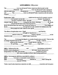
In this Latin American history study guide worksheet, students read a brief overview pertaining to the history of Latin America from 1500 to the present and fill in the blanks with the appropriate words. Students also respond to 23 short...
K12 Reader
The Apprentice System
Readers are asked to identify the central idea and two supporting details that develop this main idea in an article about the apprentice system popular in colonial America.
K12 Reader
Coyote: The Survivor of North America
Coyotes in Chicago? Yip. Middle schoolers demonstrate their ability to identify details that support the idea that coyotes are adaptable creatures.
Curated OER
Months, Seasons, and Dates
Beginning Spanish speakers will find this reference guide very helpful! Months and seasons are the central focus here. Pair this information with a practice activity.
Richmond Community Schools
Map Skills
Young geographers will need to use a variety of map skills to complete the tasks required on this worksheet. Examples of activities include using references to label a map of Mexico, identify Canadian territories and European countries,...
Other popular searches
- Central America History
- Central American History
- Geography of Central America
- Mexico and Central America
- Central America Map
- Central American Immigration
- Ss Central America
- Central America Geography
- Power Points Central America
- Central America Lesson Plans
- Central America Outline Map
- Central America Agriculture


