Curated OER
What State Are You In?
Students identify the major U.S. cities. In this U.S. geography lesson, students work in pairs and use game cards to name various cities in the United States.
Curated OER
States and Capitals, Mountains and Rivers
Students identify geographical locations in the midwestern United States. In this geography lesson, students identify 12 states and capitals and geographical features in the region by using U.S. maps. Students use blank maps to fill in...
Curated OER
Silouettes of New York City
Second graders create a New York City silhouette. In this visual arts lesson, 2nd graders view the picture book, Uptown, and identify the silhouettes. Students use construction paper, paint, and a flashlight to create artistic...
Curated OER
Mayor Puts City on Diet to Lose a Million Pounds
Students read a story called Mayor Puts City on Diet to Lose a Million Pounds and answer vocabulary and comprehension questions about it. In this current event Lose a Million Pounds lesson plan, students respond to literature by...
Curated OER
The State Seal Offline Lesson
Fourth graders discover the meaning of the different objects on the State Seal. They identify changes in the State Seal over time students hypothesize why elements have changed students suggest what elements should represent the State of...
Curated OER
States and Capitals Unit
Fifth graders explore the regions, states, and capitals that make up the United States. Through the five lessons in this unit students locate and name the fifty states and their capitals.
Curated OER
U.S.A. State Capitols
In this state capitol worksheet, students fill in the state capitol of given states. A reference web site is given for additional activities.
Curated OER
United States Map- State Capitals
Students explore the state capitals. In this geography instructional activity, students use a political map to identify the state capitals and place post-it notes on various capitals.
Curated OER
"Promote A City" Posters
Students choose a city, make a poster promoting that city and present the poster to the class highlighting positive aspects of the city.
Curated OER
Why Is The State Called Kansas?
Fourth graders research how cities are named. In this states names lesson plan, 4th graders discuss whom the state of Kansas was named after, work with a partner to write down what they've learned about Kansas, research the origins of...
Curated OER
Mapping the Most Common U.S. City Names
Pupils discuss the most common U.S. place names. They map the locations of U.S. cities with the most common names and use an atlas, or an online map tool such as MapQuest or Yahoo Maps.
Curated OER
World Cities and the Olympics
Students examine the various cities in which Olympics have been held. Using a map, they describe the reasons why those cities were chosen and choose their own city for the Olympics and state the reasons why. They examine information...
Curated OER
A Visit to Charm City
Learners explore U.S. geography by participating in a role-playing activity. For this Baltimore history lesson, students discuss the geography of Baltimore city and complete a worksheet which discusses the "charm" Baltimore is known for....
Curated OER
Urban Planning: Plan a City
Students analyze the concept of urbanization by planning the placement of some of the major urban/suburban features that make up most cities. They arrange the cultural features to benefit the people who live there, and maintain respect...
Curated OER
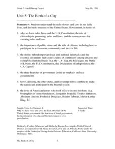
The Birth of a City
Third graders understand the role of rules and laws in our daily lives. They research the basic structure of the United States government. They participate in a simulated City Council meeting.
Curated OER
City Animals
Students, in groups, conduct research, including interviews of people in various animal related occupations, to identify and describe how animal populations of cities have changed over time, to outline the benefits and problems...
Curated OER
Study of New York City
Fourth graders read A Cricket in Times Square and examine the essence of living in New York City. They examine subway maps and other resources concerning NYC and then complete several writing activities about the city. They also create...
Curated OER
Introduction to the United States Map
Students identify a map of the United States. In this United States map lesson plan, students study a map of the United States and find various locations on the map. Students then locate and list the state that touches their state.
Curated OER
Naming the States of the U.S
Fifth graders study the 50 states on a map. In this social studies lesson, 5th graders identify the names of the states and location. Additionally, students work in small groups to name and locate as many states as they can on a blank map.
Curated OER
Participating in State and Local Government
Students analyze the structure, organization, and powers of State legislatures. They outline the overall shape of the office of the governor.
Students analyze the structure of local governments as creations of the State. They describe...
Curated OER
Archaeology- State Map
Students study state maps. In this map skills instructional activity, students identify the states' location and how to use a legend. Students complete photocopies of the state map.
Curated OER
Comparative Government: Japan & the United States
Students compare the governmental systems of Japan and the United States. As a class, they discuss the differences between the parliamentary system and the presidential system. Pupils read provided handouts about the duties of a a...
Curated OER
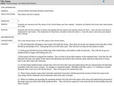
Fifty States
Fifth graders find each state and its capital city on a map before memorizing the information. They work in small groups after watching a modeled instructional activity by the teachers. They write a statement about their assigned states...
Other popular searches
- City States in Mesopotamia
- Greek City States
- Greek City States
- Ancient Greek City States
- Sumerian City States
- Sumerian City States
- Ancient Greece City States
- Ancient Greek City States
- Italian City States
- Ancient Greece City States
- Warring City States
- City States of Sumer


