Curated OER
Geography and Culture of China
Take out a map, a paper, a ruler, and those coveted colored pencils for a lesson plan on Chinese culture and geography. This is a multifaceted approach to basic geography skills that incorporate story telling, class discussion, primary...
Curated OER
Christopher Columbus: The Man, the Myth, the Legend
Learn more about maps by examining Christopher Columbus's voyage to the New World. Kindergartners will learn about basic map skills and how to identify the compass rose, oceans, and land masses. They will also discover the purpose of...
Curated OER
Understanding "The Stans"
Students explore and locate "The Stans" in Central Asia to create, write and illustrate maps, graphs and charts to organize geographic information. They analyze the historical and physical characteristics of Central Asia via graphic...
Curated OER
Producing a concept map for governance of countries in the EU
Students explore, examine and study the terminology associated with governance and discover the types of governance within each EU country. They produce a mind map that concentrates on UK government and monarchy and critique the...
Indian Land Tenure Foundation
Maps and Homelands
You are never too young to learn about maps. To better understand the concept of a homeland, students work together to construct a map of their local area out of paper puzzle pieces. They'll put the maps together and then add details by...
Curated OER
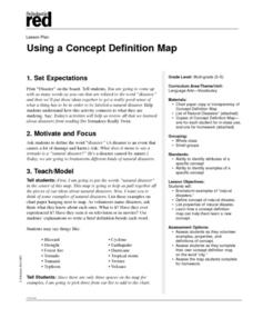
Using a Concept Definition Map
Students define "natural disaster" by offering examples and charting them to discover what a concept definition map is. Then students create their own maps using the word "city".
Curated OER
Mapping Colonial New England: Looking at the Landscape of New England
High schoolers understand the similarities and differences between English and Native American conceptions of the land and town settlement. They understand how the colony of Massachusetts developed and expanded. Students understand the...
Curated OER
Water - Our Future
How is it that water that falls as rain ends up coming out of the tap on our sinks? Learners trace water's journey and examine how along the way pollutants make their way into the water supply. They conduct experiments, use the Internet...
Edgate
Journal Maps
Inspire your class to look at their environments as if they were seeing them for the first time in order to gain a better understanding of the concept of perspective. After exploring their communities and keeping a journal of major...
Hastings Prince Edward Public Health
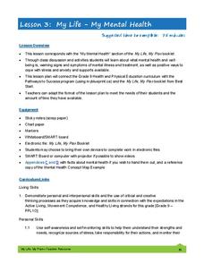
My Life—My Mental Health
Between peer pressure, an onslaught of hormones, and brand new responsibilities, the teenage years can be emotionally volatile. Equip young adults with coping mechanisms and a safe place to discuss their feelings with a guided...
Curated OER
Map-A-Buddy
Students investigate the concept of tracking and spatial movements of animals in relation to the environment in which they live. They participate in an interactive activity by tracking one another over a pre-defined region, record the...
Curated OER
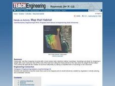
Map that Habitat
Students participate in an activity that replicates the creation of sea floor bathymetry by taking a simplified form of soundings in the classroom. They discuss sea floor mapping technologies, sonar, soundings, and remote sensing,...
Curated OER
Storyboards: The Director's Map to a Video Project
Class groups collaborate to produce the storyboard for their video project. After determining the sequence of scenes, the camera angles, and characters in each scene, each group member is assigned a number of scenes to illustrate. When...
Curated OER
Global Conflict: Kashmir
Students analyze different maps of the region. They create a timeline of the area in dispute, focusing on the creation of Pakistan, Indi and Kashmir and previous conflicts between Pakistan and India over Kashmir. Students construct a...
Curated OER
Learning About Maps
Students investigate the many uses and features of maps and globes and locate where they live on both. In this map lesson, student play a travel game and create their own maps to explore states, continents, countries, and islands.
Curated OER
Mapping Puerto Rico
Students use maps to discover where Puerto Rico is located. In groups, they use the internet to research the vegetation. They also compare and contrast the relationship between the United States and Puerto Rico's government.
Curated OER
United States Map - Lesson 9
Students explore the concept of cardinal directions. For this geography lesson, students identify the compass rose on a large U. S. map and then discuss the cardinal directions.
Curated OER
Second Graders on the Map
Second graders explore the various types of maps. They examine the differences between street maps and aerial photographs. Students identify various features on each map. They use cardinal directions and the compass rose. They write...
Curated OER
Ecology of the Savanna-Forest Boundaries in Central Brazil
Students explore photosynthesis. In this photosynthesis lesson, students label parts of photosynthesis and take notes. Students conduct experiments on leaves, make observations and record their findings.
Curated OER
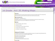
Making Maps
First graders create a map of their classroom that can be used to find a hidden treasure. They examine two- and three-dimensional objects and discover characteristics.
Curated OER
Read a Map ... It's a Snap!
Learners are introduced to map and globe skills. They use grids and are able to construct their own simple maps of familiar places. Students are able to define a map, globe, and symbol and use the direction words north, south, east,...
Curated OER
MAKING CONNECTIONS WITH MAPS
Students define choropleth map. They construct a choropleth map. They interpret a choropleth map. They present geographic information.
Curated OER
Galaxy Mapping
Young scholars research the constellations and discuss their findings. Then they construct their own maps of the galaxy using paper, black paint, aluminum foil, etc. They make a 3-D map of their chosen constellation.
Curated OER
French and Indian War: Make A Map
Fifth graders create a map of the battles that occurred during The French and Indian War. In this history lesson plan, 5th graders read about the war in their text books, then divide into groups to create a detailed map of a famous...
Other popular searches
- Cell Transport Concept Map
- Blank Concept Maps
- Genetic Concept Map
- Weather Concept Map
- Krebs Cycle Concept Map
- Science Concept Map
- Phylum Chordata Concept Map
- Concept Map Rubrics
- Inspiration Concept Map
- Dna Structure Concept Map
- Concept Map in Science
- Rock Concept Maps


