Curated OER
Names in the Field: A Simple GPS Field Exercise
Students explore basic methods of GPS data collection, uploading the data to a computer, and making simple maps of their data using GIS software. They create a map of the data using GIS software (or Excel)
Curated OER
Borah Peak Earthquake
students use the internet, an atlas map, and other sources to explore a map of Idaho. They locate the Lost River Range and Mt. Borah. Students read the atlas map to locate earthquake faults, find the magnitude, fault, and epicenter of...
Curated OER
Earthquake Analysis
Students analyze and plot the coordinates for several recent earthquakes on a world map. They learn not only about research and geology, but about map-making and data analysis. They think of other ways to analyze the data given.
Curated OER
BOUND TO BE NEW HAMPSHIRE
Students identify neighborhood, town, and state boundaries. They distinguish between natural and man-made boundaries. They identify major state geological features and explain how NH boundaries have changed over time.
Curated OER
The Story of Hot Springs, 1500-1900 AD
Students study the geology and hydrology of Arkansas hot springs and how they contributed to the development of the city of Hot Springs. They create advertisements for the city of Hot Springs and the therapeutic effects of the waters.
Curated OER
Earth's Surfaces
Students identify and define geology and earth surface vocaulary and their meanings to classify rocks and explore caves and their properties. Students find rocks and test them according to Moh's scale. They create a color coded earth...
Curated OER
A Thoreau Look at Our Environment
Sixth graders write journal entries o school site at least once during each season, including sketched and written observations of present environment. They can use sample topographical maps and student's own maps. Students can use...
Curated OER
Natural History of Costa Rica
Students use outline maps to become acquainted with Costa Rica. They see how it was formed and how its origin has created very diverse environments. Students then use atlases and compare their physical maps with maps of climate and the...
Curated OER
Musical Plates
Students receive current data on the movement of plates on the earth's crust. These plates shift and the magnitude of their shift over time can be tracked. They track this velocity vector on a global map and determine the speed of the...
Curated OER
Glacial Landscapes
Students examine the impact of glaciers on Great Britain. In this geological history lesson plan, students examine and measure a glacial valley and look at several types of glacial landscapes in Britain.
Curated OER
America Will Be
Students work together to research and create different types of maps of the United States to be used as part of a geography trivia game.Groups research North American annual rainfall, climate, mountain ranges major rivers and state...
Curated OER
Building A Topographic Model
Students visualize, in three dimensions, features represented by contour lines on a topographic map. They see that the different elevations shown on a two dimensional topographic map can be used to build a 3-D model.
Curated OER
Pangaea Puzzle
Students explore plate tectonics and the formations of the Earth's surface and why maps are distorted. In this Earth's surface lesson students complete a lab and answer questions.
Curated OER
Fossil Fuels (III), The Geology of Coal: Interpreting Geologic History
Young scholars hypothesize about why various samples of coal have different characteristics. Pupils use information that they found during Internet searches to ascertain the validity of their hypotheses and verify the "story" of coal. ...
Curated OER
Ecology of The Sonoran Desert Soil Crusts: Biology, Geology
This lesson is designed after research done on the ecology of soil lichen in the Tucson Basin area during the summers of 1997 and 1998. Its purpose is to guide students into adopting the problem solving thinking of ecologists. The lesson...
Curated OER
Volcano Contour Models Activity and Tracing the Highs and Lows in San Francisco
Pupils investigate how to draw topographic contours and read topographic maps.They examine the topography of San Francisco and contrast the elevation of different points within San Francisco.
Curated OER
Tracing Highs and Lows in San Francisco
On a topographic map, learners identify the scale bar, north arrow, and contour interval. They then locate a hill on the map and make note of the contour lines. Students then locate other places with similar contour line patterns....
Curated OER
Then and Now, A Watershed in San Francisco
Students compare recent and historic maps to explore landscape changes. Using photos provided, students identify prominent features on the maps. They discuss differences in landscape, human impact on watershed, and changes in natural...
Curated OER
Geological Development of Indiana and the Movement of Peoples Across the State
Fourth graders examine the geological development of the state of Indiana. Using the internet, they interact with the United States Geological Survey. They identify earthquake zones and energy resources in the state. They work...
Curated OER
Geological Development of Indiana and the Movement of Peoples Across the State
Students are introduced to the geological development of the state of Indiana. Using the internet, they visit the U.S. Geological Survey and locate the earthquake zones in the state. In groups, they locate and identify the energy...
Curated OER
Nebraska's Geology, Soils, Groundwater Regions, and Topographic Regions
Students examine the distribution of geology, soils, groundwater, topography, and geography in Nebraska. They identify various regions and characteristics on a map, and develop a plan to manage the soil and groundwater resources of the...
Curated OER
The Geologic Time Scale
Students research and explore the earth's past and make comparisons with the earth's present. They map out a timeline that explains how the earth and its organisms have changed over time. Studnets create a scale for their time line, they...
Curated OER
Discovering Fossils
Students dig for and discover fossils in a classroom setting. They dig on a tarp to find, map, assemble, and photograph their discoveries.
Howard Hughes Medical Institute
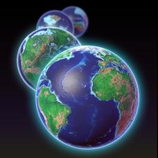
EarthViewer
Can you imagine Washington DC and London as close neighbors occupying the same continent? Learners will be fascinated as they step back in time and discover the evolution of the earth's continents and oceans from 4.5 billion...
Other popular searches
- Geologic Mapping Loveland
- Geologic Mapping of Loveland
- Geologic Mapping Love Land
- Creating a Geologic Map
- Geologic Mapping of Love Land


