Curated OER
Drawing Portraits Using a Grid
A well-developed art lesson plan is always great to have around. This lesson plan on portrait drawing includes a full procedure, modifications, background information on artist Chuck Close, recommended websites, and a few thoughts from...
Curated OER
Where is ? ? ? ?
Students explain and explain the concept of a grid system. They define absolute and relative location and develop an imaginary city on graph paper using a grid system.
Teach Engineering
The Grid
Upper graders form a "Presidential Task Force," and attempt to make recommendations concerning the future of the national power grid. After a teacher-led discussion which proves that our nation's energy consumption will soon outpace our...
EngageNY
Introduction to Simultaneous Equations
Create an understanding of solving problems that require more than one equation. The lesson introduces the concept of systems of linear equations by using a familiar situation of constant rate problems. Pupils compare the graphs of...
Curated OER
The Global Grid System-World Map Activity
Young scholars demonstrate how to use the global grid system. In this map skills lesson, students use a world map to locate various locations. Young scholars identify locations based on the global grid system. Students complete a...
Curated OER
Lesson 7: Smart Grids
Energy conservation is a hot topic these days; introduce your kids to the Smart Grid solution through a video clip and several interactive online tools. They discuss areas of household energy consumption, examining a pie chart...
Teach Engineering
What is GIS?
Is GIS the real manifestation of Harry Potter's Marauders Map? Introduce your class to the history of geographic information systems (GIS), the technology that allows for easy use of spatial information, with a resource that teaches...
Curated OER
Landscape Picture Map: Making a Map Grid
Students create a map grid system. In this map lesson plan, students discuss how mapmakers use a grid system to make giving directions easier. Students learn how the grid system works and create a grid system on their landscape pictures.
Ohio Literacy Resource Center
Solving Systems of Linear Equations Graphing
Do you need to graph lines to see the point? A thorough lesson plan provides comprehensive instruction focused on solving systems of equations by graphing. Resources include guided practice worksheet, skill practice worksheet, and an...
Curated OER
Scale Drawings of Birds
High schoolers create their own copies of Phoenix Birds using a grid system.
Curated OER
Wreck Detectives
Junior archaeologists examine types of artifacts from the Bronze Age on the internet. In collaborative groups, they create a story about a ship from this period and then construct a model of the ocean floor after their ship has sunk....
Curated OER
Where in the World
Students explore the global grid system. In this globe instructional activity, students identify latitude and longitude lines and how these can tell the coordinates of any place. They use the Internet to find the exact coordinates for...
Utah Education Network (UEN)
The Pasture and the Fence
Beginning geometers use tiles and grid paper to draw and calculate perimeter and area. Rectangles of different sizes are created and then measured to build understanding. The one-inch grid sheet referenced is attached.
Curated OER
Absolute Location Using GPS Technology
GPS is great for identifying your position, but is it finding your relative or absolute location? Ninth graders explore the difference between absolute and relative location, use the standard grid system coordinate system, and use GPS to...
Curated OER
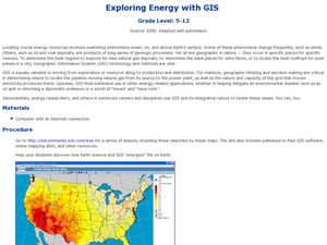
Exploring Energy with GIS
Learners examine GIS technology as it is used to locate energy sources. In this GIS activity, student access an assigned website to locate a series of lessons using the GIS software. They use the maps that are located on the primary...
Curated OER
Location, Location, Location: Using a Grid to Determine Context
Seventh graders are introduced to making inferences about artifacts. Using a grid system, they locate the artifacts and determine where they originated from. They use this information to make conclusions about the way people lived...
Curated OER
Put Me in My Place: Using Alphanumeric Grids to Locate Places
Students practice locating points on a large wall grid and create and label a neighborhood map. In this geography lesson, students spell and discuss places as the teacher places them on the map. They discuss the concept of an...
Curated OER
Finding Your Way on the Farm
Third graders make a grid map. For this directionality lesson, 3rd graders review how to use a grid to locate objects or places on a map. Students draw a grid map of the classroom and locate seating assignments. Students create a grid of...
Curated OER
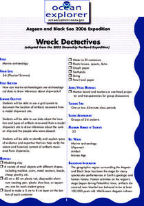
Wreck Detectives
Students investigate shipwrecks. For this marine archaeology lesson ,students collect data and make inferences about the causes of shipwrecks. Students work in groups to create their own model of a shipwreck using clay. Students then...
Curated OER
Plant Systems
Second graders learn about plant systems and how plants grow and function. In this plant lesson plan, 2nd graders collect data based on roots, leaves, terrariums, plant uses, and locations of certain kinds of plants. They fill out...
Curated OER
Locating Places - Making a Map Grid
Students learn how to use a letter and number map grid. In this map grid lesson, students look at a landscape map and describe how to locate the airport. They compare the descriptions of different students to determine how they are the...
Curated OER
Solving System of Linear Equations
Students solve systems of equations. For this algebra lesson, students identify the number of solutions to a system of equation. They solve using linear combination and graphing.
Curated OER
Important Decisions Don't Just Happen! Using Data to Plan Your Services
Young scholars interpret statistics. In this data lesson, students examine and organize given data. They present the data in a grid format. Using the census data, young scholars determine the best location for a local business.
Curated OER
Locating Places
Students demonstrate how to use the map grid system. In this map skills instructional activity, students are given coordinates to locate several locations on a world map. Students use the map grid system to identify these locations.
Other popular searches
- Global Grid System
- Grid System Drawing
- Mapping Grid System
- Grid System Art
- Drawing With a Grid System
- Texas Grid System
- Grid System Worksheets
- Map Features Grid Systems
- Map Features "Grid Systems
- Map Features "Grid Systems"
- Alphanumeric Grid Systems


