Edgate
Journal Maps
Inspire your class to look at their environments as if they were seeing them for the first time in order to gain a better understanding of the concept of perspective. After exploring their communities and keeping a journal of major...
Curated OER
Persuasion Map
The Persuasion Map, a one-page graphic organizer from Houghton Mifflin, not only makes visual the logical organization structure of persuasive writing, but also provides young writers a chance to organize and record facts they will use...
Curated OER
Map Reading in the 21st Century
Students interact with MapPoint tools to view maps of the past and the present in multiple ways. They participate in mini-lessons aimed at locating certain points of interest or famous routes taken in history.
Curated OER
Learning About Maps
Pupils investigate the many uses and features of maps and globes and locate where they live on both. In this map lesson, student play a travel game and create their own maps to explore states, continents, countries, and islands.
Curated OER
The Roman Empire-Map Activity
For this Roman Empire worksheet, students complete a map activity in which they label and color civilizations, countries and physical features as instructed. There are no maps included.
Curated OER
California Outline Map
In this California outline map worksheet, students examine political boundaries of the state and the placement its capital city as well as its major cities. This map is not labeled.
Curated OER
Making Maps
In this map making activity, students learn about the science of making maps, which is cartography. They then answer the 11 questions on the activity. The answers are on the last page.
Curated OER
Westward Expansion : Mapping
Fifth graders travel along exploring the expeditions of John F. Fremont. For this Westward expansion lesson, 5th graders gain understanding of the events that shaped the west through the use of maps. Students use mapping skills to...
Curated OER
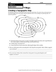
Creating a Topographic Map
In this topographic map activity, students add contour lines to a topographic map using instructions provided. Once topographic map is finished, students complete 2 follow-up short answer questions.
Curated OER
Mapping Gymnosperms and Angiosperms
In this plant learning exercise, students create a map of a familiar area such as their yard, a nearby park, or the school grounds showing the major plants. On their map they identify the plants in three ways following the example...
Curated OER
Using a Concept Definition Map
Students define "natural disaster" by offering examples and charting them to discover what a concept definition map is. Then students create their own maps using the word "city".
Curated OER
Put Your Face on the Map
Learners investigate topography and contour lines by examining a human face. In this mapping lesson, students create a plaster cast of a face and create a map of the contours of the face one centimeter at a time. Learners examine the...
Curated OER
Maps Can Help Us
First graders explore the geography of Montana by analyzing geographic maps of the area. In this Native American reservation lesson, 1st graders discuss the similarities and differences between reservations in the state of Montana....
Curated OER
The Tone Map
High schoolers listen carefully to a portion of the Poetry Out Loud CD. They focus on the tones the poet uses in his recitation of a poem. Then they map a poem of their own so that a classmate can read it using the tonal qualities...
Curated OER
Cause And Effect Map
For this Language Arts worksheet, students create a cause and effect map. Students describe three causes, one event or situation, and three effects.
Curated OER
Story map
In this story map worksheet, students fill in a story map that contains the elements of conflict in a story. Students answer the questions of who, what, and why.
Curated OER
Map Reading
In this reading maps practice worksheet, students respond to 16 questions that require them to determine the directions north,, south, east, and, west.
Curated OER
Examining Character Traits through Character Mapping
Some of what we know about a character is directly stated. Some of what we know is inferred by events in the story. Character maps help primary learners recognize the difference. After modeling with a story your class has read, pupils...
Rainforest Alliance
Knowing the Essential Elements of a Habitat
To gain insight into the many different types of habitats, individuals must first get to know their own. Here, scholars explore their school environment, draw a map, compare and contrast their surroundings to larger ones. They then write...
Curated OER
Understanding Protagonists and Antagonists
How can you tell if a character is a villain? What about a hero? Work on literary analysis with an engaging language arts worksheet. After completing an activity about the four types of conflict, learners fill out a character map about a...
Teaching Oasis
Gingerbread Baby Lesson Plan Guide
Reinforce reading comprehension and story mapping skills with the help from a story, Gingerbread Baby by Jen Brett. Individuals discover new vocabulary, make predictions, retell main events, respond to reading using a graphic organizer,...
Newspaper Association of America
Community Connections with Geography and the Newspaper
Understanding geography and government begins at the local level. Using maps and the parts of a newspaper, a unit plan introduces the concept of community. It starts with the creation of classroom and school maps, and then moves through...
Curated OER
Rhode Island Map
In this recognizing the shape of the state of Rhode Island worksheet, students fill in the state capital, major cities, and other attractions or follow their teacher made directions. Students write at least 7 answers.
NASA
Mapping the Watery Hills and Dales
How does GPS know where everything is located? Pupils read about satellites that are mapping the ocean and the question on how satellites know where they are. Readers discover the workings of the Global Positioning System and create...
Other popular searches
- United States Maps
- Weather Maps
- Topographic Maps
- Story Maps
- Maps and Charts
- Types of Maps
- Maps and Globes
- Middle East Maps
- Maps and Flags
- Historical Maps
- Maps of Europe
- Create Character Maps


