Newspaper Association of America
Community Connections with Geography and the Newspaper
Understanding geography and government begins at the local level. Using maps and the parts of a newspaper, a unit plan introduces the concept of community. It starts with the creation of classroom and school maps, and then moves through...
Curated OER
Flower Power
This fascinating series of four lessons use the paintings of artist Robert Harris to illustrate different types of ecosystems, and the harm that comes to them from human policy. A global view of environmental policies are studied, which...
Curated OER
Map Puzzles
Students make puzzles from world maps, dramatizing how much of the globe is covered by ocean.
Curated OER
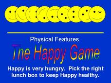
The Happy Game: Physical Features
Students love to test their knowledge, use this game to see what your students know about landforms and other basic geographic terminology.
Curated OER
Landforms of Illinois
Fifth and sixth graders are introduced to the primary landforms of Illinois and discover how they were created. Landform cards are made for each pupil. They use the twenty-questions format until they have identified each one. Then,...
Curated OER
Climate Shifts
Eight slides of information related to shifts in the climate make up this presentation. The vocabulary and concepts displayed are geared toward high school meteorology learners. Content is not cohesive from slide to slide, but the...
Star Wars in the Classroom
Star Wars Geography Unit
What kind of animals live on an ice planet like Hoth? How would the habitat on Tatooine allow different organisms to thrive? Connect social studies, science, and Star Wars in one engaging activity that focuses on the ecosystems of the...
Curated OER
Geography Lesson Plans Using Google Earth
Geography lesson plans using Google Earth, or other interactive websites can make this topic current and interesting for students.
Curated OER
Natural History of Costa Rica
Students use outline maps to become acquainted with Costa Rica. They see how it was formed and how its origin has created very diverse environments. Students then use atlases and compare their physical maps with maps of climate and the...
Association of American Geographers
Project GeoSTART
Investigate the fascinating, yet terrifying phenomenon of hurricanes from the safety of your classroom using this earth science unit. Focusing on developing young scientists' spacial thinking skills, these lessons engage learners in...
Oregon State
World Map of Plate Boundaries
Young geologists piece together the puzzle of plate tectonics in an earth science lesson. Given a physical map of the world, they search for land formations that indicate the location of different types of plate boundaries.
Howard Hughes Medical Institute
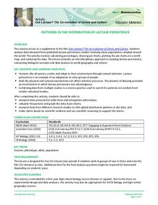
Patterns in the Distribution of Lactase Persistence
We all drink milk as babies, so why can't we all drink it as adults? Examine the trend in lactase production on the world-wide scale as science scholars analyze and interpret data. Groups create pie charts from the data, place them on a...
K-State Research and Extensions
Water
How are maps like fish? They both have scales. The chapter includes six different activities at three different levels. Scholars complete activities using natural resources, learn how to read a map, see how to make a compass rosette,...
Curated OER
Waters of the Earth - Friends or Enemies
High Schoolers observe the paintings and drawings of Robert Harris, and do a study of the ocean that delves into human and physical geography. Learners make prints, listen to music, create a database, and perform research on a specific...
NOAA
A Watery World
With about 70% of the earth's surface covered in oceans, it's fair to say that we live in a very wet world. Young scientists gain a better appreciation of this fact as they use maps to identify the world's ocean basins in the first...
Curated OER
Coasts and Reefs: Shallow Marine Processes
A more thorough presentation on coastal systems would be difficult to find! Detailed diagrams illuminate the offshore, shoreface, foreshore, and backshore zones of beach. The sources and movement of sediments along the coastline are...
Curated OER
What in Our World Affects the Way People Live
Sixth graders study various maps that show geographical features and population. They compare the maps and make inferences about how various geographical features influence the population and human activities of an area.
Curated OER
The Open Ocean, What is it and How Does it Change?
Students investigate the ocean environment. In this ocean lesson, students discover the physical properties of the ocean. Over two days, students work in small groups investigating ocean maps and creating water currents.
NOAA
Into the Deep
Take young scientists into the depths of the world's ocean with the second lesson of this three-part earth science series. After first drawing pictures representing how they imagine the bottom of the ocean to appear, students investigate...
Curated OER
It's not just pretty - it's a survival method!
First graders write explanations for why certain animals can only live in certain environments. In this animal survival lesson plan, 1st graders take pictures of animals and place them into the right environment after a lesson on the...
Curated OER
GEOGRAPHY: SPACE CENTERS
Students examine the descriptive science dealing with the surface of Earth, its division into continents and countries, climate, natural resources, inhabitants and industries of the various divisions and analyze the political geography...
Curated OER
The Big Circle
Students explore geography by participating in a mapping activity. In this concentric ring lesson plan, students utilize a poster board, string and markers to identify their current location within the entire world. Students write about...
Curated OER
MAISA and the REMC Association of Michigan
Students complete online research to study geography's impact on weather. In this geography and weather lesson plan, students research weather in their city for ten days using an online website. Students bookmark the site, enter data...
Curated OER
Curricular Correlations
Here is a terrific way to teach your oceanographers about the effects that the ocean have on the weather and climate found throughout the world. In it, pupils engage in a science experiment designed to emulate how the ocean affects...
Other popular searches
- Europe Physical Geography
- Canada Physical Geography
- Physical Geography of Africa
- Physical Geography of Europe
- Human and Physical Geography
- Physical Geography of Japan
- Physical Maps of Europe
- American Physical Geography
- Africa Physical Geography
- Earth's Physical Geography
- African Physical Geography
- Physical Geography of Canada


