Curated OER
State or Region Project
Invite your youngsters to learn about a state or region through their choice of a creative project. The resource lists 15 project options that range from a 3-D map of the area, to a puppet show about the region. Pupils can also propose...
Sharp School
US Geography Landmark Commercial
Experience famous geographical landmarks around the United States right from the comfort of your very own classroom. Learners research national landmarks, such as the Grand Canyon, Yellowstone National Park, and Niagara Falls, and then...
Scholastic
Owl Moon Teaching Plan
Capture the engagement of young readers with this collection of activities based on Jane Yolen's book, Owl Moon. Following a shared reading of this children's story, the class explores the geography of the American Northeast,...
Curated OER
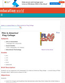
This Is America! Flag Collage
In a visual essay of their thoughts about "What America Means to Me," kids of any age can create a collage about their country. Originally intended to be created physically, learners could share their projects online by using an...
DocsTeach
Lewis and Clark's Expedition to the Complex West
Lewis and Clark's famous expedition is a prime example of the United States' westward expansion. Aspiring historians examine maps from Lewis and Clark's journey, as well as discuss their interactions with Native American tribes. The...
Sharp School
Travel Brochure Project
Designing a travel brochure is a classic project that will help your class members develop a variety of skills, such as researching informational texts, designing creative visual products, and communicating what you have learned.
DocsTeach
Red Record of Lynching Map Analysis
Long before the civil rights movement, leaders were working to secure equal rights. An informative activity explains the 1922 anti-lynching campaign with a map. Scholars analyze the map, complete a worksheet, and participate in group...
K-State Research and Extensions
Water
How are maps like fish? They both have scales. The chapter includes six different activities at three different levels. Scholars complete activities using natural resources, learn how to read a map, see how to make a compass rosette,...
Mesa Public Schools
Country Project
Give your young learners the chance to discover more about countries in their world community with a research project. Class members write reports on an assigned country and include such major features as geography, important historical...
Teach Engineering
What's Wrong with the Coordinates at the North Pole?
Here is an activity that merges technology with life skills as individuals use Google Earth to explore the differences between coordinate systems and map projections. The self-guided worksheet is the fourth segment in a nine-part unit....
Teach Engineering
Where Are the Plastics Near Me? (Mapping the Data)
The last activity in a nine-part series has teams create a Google Earth map using the data they collected during a field trip. Using the map, groups analyze the results and make adjustments to the map to reflect their analysis. A short...
DocsTeach
Around the World with First Lady Pat Nixon
Travel the world with the First Lady! Academics study images from Pat Nixon's travels as First Lady to discover her role in Richard Nixon's presidency. Historians match images to world locations, complete a worksheet, and...
Prince William Network
The Incredible Journey
Divide your school gym into breeding grounds and non-breeding grounds so that your zoologists can play a game simulating the seasonal migration of shorebirds. Players pick one of the included game cards and follow its directions, which...
National Gardening Association
Migration Mishaps
Elementary ecologists pretend to be migratory hummingbirds. They fly between wintering and nesting grounds, trying to reach a habitat haven. In a musical-chair fashion, some birds will miss out, and are removed from the game. To further...
PEGAMES.org
Confusing Compass
This is a very simple PE game that can be performed indoors or outdoors, and will help your learners develop a sense of direction! If playing this game outdoors, identify north, south, east, and west, and consider varying the type of...
The New York Times
Decision Point: Understanding the U.S.’s Dilemma Over North Korea
Simulate the Situation Room and analyze the US's relationship with North Korea. The plan starts off with a quick review and an examination of a online timeline that updates as the situation continues. Next, the class reads an article and...
Curated OER
Latitude/Longitude Activity
Youngsters work in groups to solve clues involving latitude and longitude coordinates in order to decipher mystery animals in this fun learning experience!
Jeopardy Labs
Third Grade Social Studies Review
In this interactive JeopardyLab game, with the assistance of a teacher, students can play against each other or in teams to review the content of Third Grade Social Studies. Allow the first team to choose a topic and a point value for a...
Newspaper Association of America
Cereal Bowl Science and Other Investigations with the Newspaper
What do cereal, fog, and space shuttles have to do with newspapers? A collection of science investigations encourage critical thinking using connections to the various parts of the newspaper. Activities range from building origami seed...
Curated OER
Modern Europe Research Project: How Changes in Late 20th Century Europe Helped To Shape Our Global Society Today
Students research a topic relevant to the late 20th century. They create a project while following the conditions explained in the rubric.
Other
Western Washington University: Provinces Not States
A good activity designed to get students thinking about differences between states and provinces. While designed for US students, Canadian students may also find them of use.
Read Works
Read Works: Three Symbols of the United States
[Free Registration/Login Required] Three main symbols of the United States are provided in this informational text: The Liberty Bell, the American flag, and The White House. " Early readers can use the visual cues to help them comprehend...
Nature Conservancy
Nature Conservancy: California, Protecting the Golden State
Explore the rich habitats and natural beauty of the California landscape in this interactive video.
Other
Letter People Geography
Mr. X of the Letter People has disappeared in one of the 50 U.S. States. You must use your U.S. geography skills to help track him down.
Other popular searches
- State Political Maps
- State of Georgia Maps
- State Outline Maps
- State and Local Maps
- State Outlines Maps


