Curated OER
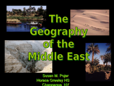
The Geography of the Middle East
Topographic, political, and satellite maps establish the world of the Middle East for your class- a land about which they have heard quite a lot, but might not really understand. This presentation would be a good introduction into a unit...
Devine Educational Consultancy Services
Geography Student Workbook, Australia
Your youngsters will be experts on the geography of Australia after working with these activities and worksheets, which review the continent's weather, major landforms, dimensions, history, and climate.
Curated OER
The Geography & Peoples of Europe
Extremely throrough and informative, this presentation details many aspects of European geography and demographics, including natural resources, climate, topography, and population distribution. This slideshow would be an excellent...
World Maps Online
Introduction to the World Map
Learners identify the differences between maps and globes. For this map skills instructional activity, students are shown a globe and a map and recognize the differences. Learners use post-it notes to locate several locations on the...
Curated OER
The Geography of Africa
Hop a flight to Africa in this presentation, which includes brilliant and appealing photographs of the continent as well as maps and graphs about its geography, topography, and climate. Those who are researching Africa for a project or...
Curated OER
Atlantic Ocean Map Quiz
In this online interactive geography quiz worksheet, students respond to 7 identification questions regarding the Atlantic Ocean.
Curated OER
Physical Geography of Africa
Fifth graders investigate the topography of Africa. In this physical geography lesson, 5th graders research the six regions of Africa and complete a physical map. Students locate various landforms in Africa. Students use their...
Curated OER
Florida: U.S. Geography for Kids
In this Florida geography worksheet, students locate and label the important features of Florida and create icons for the economy and culture of Florida.
Curated OER
World Map
For this world map worksheet, learners practice their geography skills as they label the 7 continents and 5 oceans. A word bank in included.
Curated OER
Geography
Introduce your second graders to geography with this 13-slide PowerPoint. Students discover the names of the 7 different continents, as well as review the four oceans on the Earth. This presentation contains fabulous graphics on each slide.
Curated OER
Geography Game - Educated Guess
Students participate in a geography game that involves teams creating clues about a secret location. They select a location, develop the clues, and take turns solving the clues written by the other teams.
Curated OER
Geography And The Revolutionary War
Students gain a deeper understanding of both geography and the Revolutionary War. They practice using on line research in examining historical events and using political, physical, and topographic maps.
Curated OER
European Explorer IMovie
Film is a wonderful way to communicate any concept or idea. Fifth graders will use IMovie and GarageBand software to create a IMovie about one of eight European explorers. They will chose an explorer, research his travels and life, then...
Curated OER
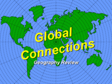
Global Connections Geography Review
In this beginning world geography PowerPoint, students answer basic questions about continents and oceans, as well as land and water that surround or can be found in the United States. Correct responses earn a mark on the interactive...
Curated OER
Geography of South America
Students explore South America. In this geography skills instructional activity, students watch a video about the geographical features of the continent. Students complete worksheets on the topic.
Curated OER
Maps and Globes: Where in the World are We?
Students explore maps and globes. In this introduction to map and globe concepts lesson, students identify features of physical maps, political maps, and globes. Students locate land and water, and recite a poem about the names of the...
Curated OER
Capitals, Oceans, And Border States
Students investigate geography by completing games with classmates. In this United States of America activity, students examine a map of North America and identify the borders of Mexico and Canada as well as the Pacific and Atlantic....
Curated OER
NATO Geography & Language
The class receives background information on NATO, an atlas, and a blank world map. They color the original 1949 countries in red, the 1952 additions in green, and the 1990 additions in blue. This exercise would be a good starting point...
Curated OER
World Geography Quiz
In this world geography learning exercise, students answer several questions based on world geography and landmarks. Students answer 10 multiple choice questions.
New York State Education Department
US History and Government Examination: August 2010
Geography has played a complex role in America history. The Atlantic Ocean has served as a buffer to protect the United States from European Wars, but its proximity to Cuba, however, left it vulnerable to nuclear war during the Cuban...
Institute for Geophysics
Understanding Maps of Earth
Here is your go-to student resource on primary geography concepts, including facts about the surface of the earth and its hemispheres, latitude and longitude, globes, types of maps, and identifying continents and oceans.
Curated OER
Geography of the United States
Students examine the population growth of the United States. In this Geography lesson, students construct a map of the fifty states. Students create a graph of the population of the USA.
Curated OER
From Sea to Shining Sea
Students study the geography of the United States of America. Students write letters, create travel brochures, make maps, graph population numbers, read fiction and nonfiction selections, complete KWL charts, and watch films.
Curated OER
Introduction to the World Globe
Students examine a globe and the world map to see what constitutes the differences. In this world map introductory lesson, students discuss what they see when they view the globe. Students then, look at a world map and compare the...


