New York State Education Department
US History and Government Examination: August 2010
Geography has played a complex role in America history. The Atlantic Ocean has served as a buffer to protect the United States from European Wars, but its proximity to Cuba, however, left it vulnerable to nuclear war during the Cuban...
Curated OER
Atlantic Canada Report
Ninth graders create a report that will show an in-depth knowledge of the various geographical and climatic features of Atlantic Canada. They produce various items, on paper and using the computer, to demonstrate knowledge of outcomes,...
Curated OER
The Ocean Floor
Fifth graders discuss the process of sedimentation and the continental drift theory. They locate major structures on the ocean floor and they identify life forms at each level of the ocean.
Curated OER
The Country of Chile - Map Work
In this map worksheet, students label a map of Chile by following 11 directions given at the bottom of the page. They label landforms and water bodies associated with the country.
Curated OER
Modelling Ocean Currents
Students construct a replica of the Atlantic ocean given certain parameters. In this earth science lesson, students draw their own map of ocean currents. They answer questions related to the activity.
Curated OER
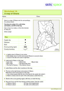
A Map of Ghana
In this Map of Ghana worksheet, students are given a blank map and key. They are told to label major features and color according to directions.
Curated OER
Mapping Spain
For this map labeling worksheet, students follow directions to label 10 items on a map of Spain. They label the capital city of Madrid, the Pyrenees Mountains, surrounding water bodies and countries. They trace the flow of the Duero River.
Syracuse University
Erie Canal
While canals are not the way to travel today, in the first half of the nineteenth century, they were sometimes the best way to move goods and people. Scholars examine primary sources, including maps and pictures, to investigate the role...
Curated OER
Oceanic Heat Budget Activities
Students map and research imaginary islands located in different parts of the world. They describe the weather and climate of their island and show how local currents, water temperatures and waves may influence the weather patterns.
Curated OER
Follow Your Dreams: Career Goals
It is so important for impending high school graduates to start thinking about their potential careers. Here, they discuss the persistence of Blondie Hasler and his impressive transatlantic trip. They follow various routes on a map and...
Curated OER
Reading a Map
Third graders become familiar with the vocabulary and skills related to mapping. In this guided reading lesson, 3rd graders find proper nouns on from the map. Students read Goldilocks. Students make a map of their room.
Curated OER
The Distance Between Us and Them: Sea Floor Spreading in the Atlantic Ocean
Students examine how geologists determine rates of sea floor spreading between two tectonic plates. They apply mathematical concepts such as the calculation and use of velocities and conversion from one set of units to another.
NOAA
Climate, Corals and Change
Global warming isn't just an issue on land; deep ocean waters are also showing troubling signs. Young scientists learn more about deep water corals and the many recent discoveries researchers have made. Then they examine data related to...
Curated OER
Continents and Oceans
In this geography activity, students read a paragraph and learn about the seven continents and five oceans of the world. Students study a map of the world and answer 12 short answer questions. This is an online interactive activity.
Curated OER
Introduction to the Globe
Students investigate how to use a globe. In this map skills lesson, students define what a globe is and locate the various continents on the globe. Students are also asked to locate the four oceans on the globe.
Curated OER
Reading the World, Then and Now
Students distinguish geographic features using Ptolemy's map of the world.
Curated OER
Globe Skills Lesson 4 The Colonial Period
Students practice their map skills. In this Colonial geography lesson, students complete an activity that requires them to locate English colonial locations using latitude and longitude coordinates.
Curated OER
Summertime Travel
Third graders write about a summer event they participated in. In this paragraph writing lesson plan, the teacher models how to write about a place they have visited. Students then write their own paragraphs. Students will point out on...
Curated OER
Middle Ages Traveler
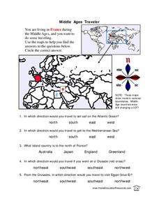
In this map worksheet, young scholars are given three maps of France to use to answer multiple choice questions. Students complete an activity from the perspective of a Middle Ages traveler.
Curated OER
State to State Scavenger Hunt
In this states worksheet, students utilize the Internet to access one specific website to locate the answers to five fill in the blank statements about the states found on a United States map.
Curated OER
The Seven Continents Scavenger Hunt
Who doesn't enjoy an engaging scavenger hunt? Here, scholars listen to, and discuss, the informative text, Where is my Continent? by Robin Nelson. They then explore the seven continents and four major oceans using Google Earth.
Curated OER
Mapping the United States
For this map of the United States worksheet, learners label mountains, surrounding countries, oceans, and more. Students complete 12 tasks.
Curated OER
Canada Map Quiz
For this online interactive geography quiz worksheet, students respond to 12 multiple choice questions regarding Canadian countries.


