Curated OER
Mapping the Civil War
Students identify the locations of pivotal American Civil War battles. In this map skills activity, students label Fort Sumter, Antietam, Vicksburg, Gettysburg, and the Battle for Atlanta on an outline map. The map is not included.
Curated OER
Where in the World...?
Students use longitude and latitude to locate various cities, regions, landforms, and bodies of water around the globe. They use The New York Times Learning Network's crossword puzzle 'Longitude and Latitude' to sharpen their atlas skills.
Curated OER
Selecting A Destination
Middle schoolers utilize atlases, maps, and Internet resources to select destinations and places to stop along the way on a day trip. They examine and write about the reasons they want to visit the particular places they chose.
Curated OER
Basic Geography of Canada
Students identify different geographical locations in Canada by using an Atlas. In this geography of Canada lesson plan, students locate features such as rivers, lakes, cities, provinces, and more.
Curated OER
How Can We Organize Study of a Given Place?
Seventh graders embark in discovery of basic facts about an assigned continent and are asked to organize their information into categories. The Five Themes model is taught and students reshuffle their information appropriately.
Curated OER
3rd Grade Social Studies Core Skills (Reference Books)
In this reference materials worksheet, students complete the 20 multiple choice questions pertaining to the correct book needed to find the answer in each situation. Included are dictionary, atlas, encyclopedias, newspapers and maps.
Curated OER
Geography of Africa
Young scholars examine the geography of Africa and understand its diverse ethnicity. In this African geography lesson, students create a mental map of Africa. Young scholars label the maps and list the languages of Africa. Students...
Curated OER
Literacy as a Force in the World
Learners research and compare economic factors and data mining in Nepal. Students look at data to determine how the Nepalese quality of life compares to other countries and predict whether the literacy rate indicates or influences the...
Curated OER
U.S. Geography: The West
Students explore the national parks of the American West. In this geography skills lesson plan, students watch "U.S. Geography: The West," and examine print and Internet sources about the national parks found there. Students feature...
Curated OER
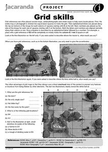
Grid Skills
In this geography worksheet, students use grid references on a map to locate places in the pictures given. They also identify another advantage of using a grid map, which they have an overhead view of the content to prevent any features...
Curated OER
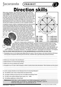
Direction Skills
In this geography worksheet, students read an excerpt on what directions tell someone. They respond to 6 short answer questions related to the neighborhood illustration found on the second page of the worksheet.
Curated OER
The Rivers and Lakes of Alberta
Students are introduced to the online Atlas of Canada and they identify the lakes and major rivers of Alberta.
Curated OER
Discovering Dinosaurs: Planning your Summer Vacation
Students use the online Atlas of Canada to gather information about places in Canada.
Curated OER
Discovering the Northwest Territories Through the Five Themes of Geography
Students use the Atlas of Canada to find basic geographical information about the Northwest Territories.
Curated OER
What a Relief Map
Students create a map using cookie dough. In this geography lesson plan, students research the physical features of a country, draw a diagram and design and create a map out of cookie dough.
Curated OER
Mapping the Census
Students learn why the census makes a difference. In this U.S. Census lesson plan, students learn the key elements of cartography, examine the difference between data and their representation, and create a map using census data.
Curated OER
Using Old Maps as Tools to Explore Our World
Students explore historical maps. In this primary source analysis lesson, students uncover the meanings in selected historical maps as they use them to enhance lessons on historical events. Samples for classroom use are provided in this...
Curated OER
Play Doh Map of Your State
Students create a state map using Playdoh. In this hands-on state geography lesson, students work in groups to form a three-dimensional map of their state using Playdoh made at home following a (given) recipe. Students use four colors...
Curated OER
Transportation and Mapping
Students view murals that depict various modes of transportation. They discuss the importance of maps to navigation and create a map. They compare and contrast transportation of the past with modes of transportation used today.
Curated OER
Johnny Appleseed Walkabout
Second graders calculate mileage for a journey. In this place value and measurement lesson, 2nd graders read Johnny Appleseed, work in groups to locate his birthplace on a map, locate the other states he stopped in, and measure the...
Curated OER
Using the Library for More than Research Papers
Use the repository of resources that modern libraries hold to your advantage during National Library Week.
Curated OER
Reference Materials
After a class discussion where kids share how they find answers to their questions, learners explore the world of reference materials such as, an atlas, an almanac, and an encyclopedia. The Internet is also discussed as a way to access...
Curated OER
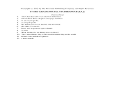
Social Studies Review Third Grade
In this review of various skills worksheet, students answer multiple choice questions about Georgia history, references, fiction and nonfiction, and U.S. history. Students answer 12 questions.
Curated OER
A world of oil
Students practice in analyzing spatial data in maps and graphic presentations while studying the distribution of fossil fuel resources. They study, analyze, and map the distribution of fossil fuels on blank maps. Students discuss gas...
Other popular searches
- Research Skills Atlas
- Atlas Skills Elementary
- Atlas Skills Worksheets
- Atlas Skills 2
- Atlas Skills Page Two
- Atlas Skills Canada
- Beginning Atlas Skills
- Free Atlas Skills Elementary
- Atlas Skills Worksheeets


