Curriculum Corner
Earth Day Book
This Earth Day, celebrate our beautiful planet with an activity book that challenges scholars to show off their map skills, complete a crossword puzzle, write acrostic poems, alphabetize, and reflect on their personal Earth-friendly habits.
Curated OER
Exploring an Atlas
Learners explore global geography by participating in an atlas activity. In this countries of the world lesson, students collaborate in small groups and analyze an atlas while researching continents, countries and demographics. Learners...
Spark Notes
Atlas Shrugged by Ayn Rand: Study Guide - Mini Essays
For this online interactive literature worksheet, learners respond to 9 short answer and essay questions about Anne Rand's Atlas Shrugged. Students may check some of their answers online.
Curated OER
Desertification
Students investigate the process of desertification in the Sahel region of Africa. They discuss photos from a National Geographic magazine, analyze the physical/political map of the Sahara, identify the causes and effects of...
Curated OER
Clouds & Condensation
Students use the digital atlas of Idaho to study different weather patterns. They use the Climatology section of the Digital Atlas of Idaho to explore concepts such as relative humidity, dew point, condensation, and cloud formation.
Curated OER
Where in the World...?
Students use longitude and latitude to locate various cities, regions, landforms, and bodies of water around the globe. They use The New York Times Learning Network's crossword puzzle 'Longitude and Latitude' to sharpen their atlas skills.
Curated OER
Choosing Plymouth - Pilgrim Study Unit
Pupils identify the principal physical features the Pilgrims considered when choosing the location of Plymouth. They create a postcard to send to a friend in Europe as if they were a Pilgrim; illustrating one aspect of the settling in...
Curated OER
Literacy as a Force in the World
Learners research and compare economic factors and data mining in Nepal. Students look at data to determine how the Nepalese quality of life compares to other countries and predict whether the literacy rate indicates or influences the...
Curated OER
Where Am I? Navigating Around the Globe
Third graders review spatial sense learned in grades one and two. They measure distances using map scales. They use atlases, and on-line sources to find geographical information.
Curated OER
Where We Live
Students analyze Canada's population distribution. They access online information to gather demographic information about two Canadian cities. They compare and contrast the quality of life in the two cities and present their findings.
Curated OER
Social Studies Review Third Grade
In this review of various skills worksheet, students answer multiple choice questions about Georgia history, references, fiction and nonfiction, and U.S. history. Students answer 12 questions.
Curated OER
Me on the Map Lesson 2
Students analyze and interpret maps, globes and geographic information systems to define and identify cities, counties, states, countries and continents to create a booklet called me on the map. They also determine and calculate the...
University of Minnesota
Sheep Brain Dissection
Bored with frog and earthworm dissections? Had your fill of fetal pigs? Anatomy young scholars will be intrigued by the sheep's brain, and you will be prepared with guiding questions, extension activities, and pictures as they dissect...
Curated OER
Geographical Features of the West
Students practice using latitude and longitude appropriately. In this geography skills lesson, students participate in a classroom activity where they identify latitude and longitude.
Curated OER
MEDIEVAL SUB-SAHARAN AFRICA
Seventh graders examine the area of medieval Sub-Saharan Africa through eyes of travelers in the company of one of history's greatest travelers, Ibn Battuta. The project has been structured to include all the State standards for this unit.
Curated OER
What is a Dictionary?
Second graders explore the purpose of a dictionary. In this library media lesson plan, 2nd graders explore My First Dictionary and identify guidewords, entry words, and captions. Students list ways they can use the dictionary.
Curated OER
Plotting A Hurricane Using latitude and Longitude
Students explore map and plotting skills by tracing the movement s of hurricanes through the Earth's systems. a hurricane map is developed from daily media reports.
Curated OER
Geography and Culture
Students explore African geography, study the overall continent of Africa and its individual countries, discuss demographics, and participate in research and class activities.
Curated OER
Creating a Dichotomous Key for Amphibians
Learners are introduced to the purpose of dichotomous keys and create one together as a class. In groups, they use a digital atlas to examine the different types of amphibians in Idaho. Using this information, they make their own...
Curated OER
Canada...A Visual Journey
Students work together to analyze the six natural regions of Canada. Using this information, they create a visual representation of each region on a large wall map and present it to the class. They must identify five key points of each...
Curated OER
Treasure of the Tar
Students, using an atlas, locate the region known as the "Tar Sands" in the Central Plains of Canada. They hypothesize about the future economic potential of this natural resource. They create a poster about the Tar Sands industry in...
Curated OER
Canada's Landform Regions
Students identify and describe the processes that created the landform regions in Canada. They map the regions and research one region to discover more about it. They present their findings to the class.
Curated OER
Canada's Landform Regions
High schoolers use a atlas to identify and describe Canada's Landform region. Using the information they collect, they create a thematic map of the region and describe all of the physiographic regions and the processes that formed them....
Curated OER
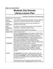
Dictionary Work - Entry Words
Second graders examine the use of entry words in the dictionary. In this dictionary use lesson plan, learners look at guide words in a children's dictionary as the teacher/librarian describes the characteristics of each entry. They...


