Curated OER
A More Perfect Union: The Story of Our Constitution
Sit back, relax, and transport to 1787! This lesson on the Constitution begins with guided imagery of the Constitutional Convention. The class reads A More Perfect Union: The Story of Our Constitution in an...
California Academy of Science
California's Climate
The United States is a large country with many different climates. Graph and analyze temperature and rainfall data for Sacramento and Washington DC as you teach your class about the characteristics of Mediterranean climates. Discuss the...
Curated OER
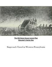
Old Stone House Lesson Plan
From stagecoach to railroad tracks, your class will discover how advancements in travel in the United States during the nineteenth century played an integral role in the industrialization and development of American society. The main...
University of California
Anti-Communism at Home
Have you ever been accused of something without cause? The sixth installment of an eight-part series asks scholars to create a museum exhibit on the anti-communist activities in the United States at the start of the Cold War. To make...
Curated OER
Understanding Weather Maps and the Importance of StormT
High schoolers explain how storm tracking is important to understanding sources of acid rain pollution. The read and explain a weather map. They set up plastic or glass collection container for rain in an open area away from buildings...
Curated OER
Where In the World Are You?
Fourth graders fill in blank copies of the United States Map and then the World Map.
Curated OER
European Union Map Quest
Sixth graders identify countries of the European Union. They locate countries of Europe on a map and pair with a student to complete a blank map of Europe. They label each country and complete worksheets for the European Union. They...
Curated OER
Map Keys
Third graders examine maps and map keys. In this locating map features lesson, 3rd graders use crayons, markers and colored pencils to label maps. Students work in partners to read map keys and locate given places and things.
Curated OER
Africa: Political Map
Students create a political map for Africa. In this country identification lesson, students locate Africa on a globe and discuss some of its major countries and bodies of water. Students complete a political map of Africa and...
Curated OER
Orienteering - Introductory Lesson
Gain knowledge of directions and degrees while learning how to read a compass. NEWS - north, east, west, south, and everything in between. It's crucial to be accurate in reading a compass and understanding degrees and direction when...
Curated OER
Four Learning Styles
Students play a game where they insert the states of the United States onto a map, and discuss the four learning styles as they play. In this learning styles lesson plan, students discuss how each learning style would play and think...
Curated OER
Treasure Hunt!
Learners follow directions on a worksheet to follow directions on a map of the United States and Territories of the United States. In this directions worksheet, students use a compass rose and learn the directions.
Curated OER
Using Google Squared to Compare and Contrast Canada and the US
Sixth graders compare and contrast Canada and the United States. In this geography skills lesson, 6th graders use Google Squared to research information so that they may compare the geography of Canada and the United States.
Curated OER
Mapping China
Students identify cities in China on a map. In this map skills instructional activity, students locate the continent of Asia and the country of China. Students use a blank map to label China and bordering countries.
Curated OER
Indiana Travel Guide
Fourth graders share their information about their home state. In this research lesson, 4th graders use graphic organizers to make a travel guide about the state of Indiana. This lesson could be modified for use with any state, it also...
Curated OER
Regions of South Carolina
Third graders explore the 5 regions of South Carolina. In this regions lesson, 3rd graders locate the regions on a map and compare and contrast the areas. Students have sentence strips that have facts about the regions on them, students...
Curated OER
NATO Geography & Language
The class receives background information on NATO, an atlas, and a blank world map. They color the original 1949 countries in red, the 1952 additions in green, and the 1990 additions in blue. This exercise would be a good starting point...
Curated OER
Culture Regions of the U.S.
Students identify the location of different cultural groups within the United States (agricultural, retirement, urban, etc.) They map these areas and analyze the correlation between the landscape of a given region and the type of...
Curated OER
Deserts
Young scholars do various activities to explain where the United States' desert region lies in relationship to the state in which they live, become familiar with plants and animals in the Sonoran desert, and make a story map of...
Curated OER
Underground Railroad
Students navigate the Scholastic Underground Railroad site and listen to journey of the Underground railroad. In this Underground Railroad lesson, students use maps and compare and contrast the differences between the North and...
Curated OER
Weather Watchers
Students are introduced to an Underground Weather Stations. In groups, they use the internet to research the weather in different parts of the United States locating each city. To end the lesson, they summarize the information they...
Curated OER
United States Climates
Students identify regional climates by using weather maps. They, in groups, locate and mark their city on the small map, then go to the larger map to locate and mark their city when they are called upon by teacher.
Curated OER
Reading a Map
Third graders become familiar with the vocabulary and skills related to mapping. In this guided reading lesson, 3rd graders find proper nouns on from the map. Students read Goldilocks. Students make a map...
Curated OER
Majority Rules
Students color code a map of the United States and label the amount of Electoral votes each state has. In this Electoral College lesson plan, students conduct a vote of their own.


