Curated OER
Mapping the Middle East
Students examine how the countries of the Middle East were created. They explore the influence of various political and geographic factors in their creation. They list the things they should consider in deciding how to draw new borders...
Curated OER
A New Federation
Students describe the relationships between state and federal parliaments in Australia. They identify responsibilities shared between federal and state and territory governments. Students explore an alternative federal structure by...
Curated OER
Book: Spain
Students, after reading Chapter One in the book, "Spain," design and re-create the political boundaries as well as the physical features of nation of Spain. They utilize play-doh or salt dough to illustrate and create their three...
Curated OER
California Geography
Fourth graders explore geography of four distinct regions of California: mountains, coast, central valley, and desert. They locate California on map, identify state's boundaries and borders, and explore agriculture, a major economic...
Curated OER
Surveying the Land
Students explore the different kinds of maps and the purpose of each. In this Geography lesson, students work in small groups to create a map which includes the use of a map key.
Curated OER
How are Boundaries Created?
Students examine two new concepts: orientalism and objectification. They view two film clips/videos on Seven Years in Tibet with Brad Pitt to incorporate the new concepts. In addition, students read Orientalism and write key questions...
Curated OER
The Landscape
Students recognize and recreate the political boundaries and physical features of the nation of Slovakia. They create topographic maps of Slovakia. The maps should include labeled line drawings of bordering countries. Slovakia should be...
Curated OER
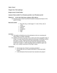
The Landscape of Poland
Students recognize and re-create the political boundaries and physical features of the nation of Poland. They create three dimensional topographic maps of Poland. In addition, they compose two journal entries written in two different...
Curated OER
Greece: The Landscape
Young scholars work in small groups to create a topographic map of Greece. They must include labeled line drawings of bordering countries and bodies of water. Students use salt and flour clay to make Greece three dimensional, showing the...
Curated OER
Africa Map
In this blank Africa map worksheet, students investigate the continent of Africa and it's political boundaries. No country borders are denoted.
Curated OER
Walking that Line
Students attempt to describe and use longitude and latitude. They will identify different countries, their neighbors, and borders around the world. Included in the lesson the students identify natural features that control the borders of...
Curated OER
States with Attitude, Latitude and Longitude Dude
Sixth graders identify states whose boundaries are formed by lines of latitude and longitude or natural borders such as rivers. They trace a map of the U.S., and fill in borders, rivers and lines of latitude and longitude.
Curated OER
Papier Mache Globe
Students use newspapers and balloons to create a paper mache globe. They define areas of land and sea with geen and blue tempera paint, then define borders with markers.
Curated OER
Track Your Trip
Fourth graders are shown how to read a map and identify key cities, landmarks, rivers, state boundaries, and train routes. They solve basic mathematical problems. Students reivew the componets of a map legend. They are asked to find...
Curated OER
The Impact of Islamic Culture on the Arts of the Renaissance
Eighth graders examine the linguistic and cultural impact of the Arabic language and Islamic culture on the Spanish language. They analyze and label maps, listen to and differentiate between Spanish and Arabic music, and compare and...
Curated OER
Using the Patterns and Symbols of Mali Mud Cloth to Convey Identity
Students participate in relating the role of the arts in defining identity. They examine the community in West African society and how members of that community define their role. They view how artifacts, music and performance can...
Exploratorium
Tired Weight
Take your class out to visit your automobile and use the tires to compute the weight of the vehicle. This is done by measuring the surface of the tire meeting the ground and the air pressure. This is a fun lesson in the relationship...
Curated OER
Lincoln's Spot Resolutions
Students take a closer look at historical relations between the United States and Mexico. In this Texas annexation lesson, students examine primary documents authored by Zachary Taylor, James Polk, and Abraham Lincoln to consider why the...
Curated OER
Geography/Current Events Project
Using the Balkan region as an example, fourth graders review the five themes of geography as a class. They identify the physical and human characteristics of a region before labeling the countries and landforms on a map. They then...
Curated OER
Lesson: Looking Closer: The Artwork of Shinique Smith
A critical discussion regarding the nature of Shinique Smith's second-hand clothing art is the foundation for the lesson. Critical thinkers fully analyze the meaning behind her work, taking close consideration of where the clothing came...
Curated OER
Manifest Destiny
Complete with maps, photographs, and historical documents, this presentation would be a great resource throughout a unit about mid-19th century America. Manifest Destiny, Texas Independence, the Oregon Trail, and the Mexican War are...
Curated OER
American Foreign Policy: 1920 - 1941
Take your class through the period between World War I and World War II. Covering various treaties and pacts between America and its neighbors - namely, Japan, Germany, and the Soviet Union- these slides could inspire some political...
US National Archives
Documented Rights Educational Lesson Plan
How have groups struggled to have their unalienable rights recognized in the United States? Acting as a research team for the Human Rights Council of the United Nations, your young historians will break into groups to research...
World Health Organization
Sun Protection
Primary graders become sun scientists and conduct experiments to learn about the beneficial and harmful effects of the sun and UV radiation. They also investigate their personal sunburn danger zones and learn about how to protect...


