Indian Land Tenure Foundation
Indian Trust Lands
An important aspect of studying Native American history is understanding the nature of trust lands. Budding historians will learn that as Native Americans were removed from their home lands, trust lands were provided in the form of...
Curated OER
Latin America Map Quiz
For this Latin America map quiz worksheet, students label all of countries on Central and South American shown on the blank outline map.
Curated OER
American Journeys: Right Place, Right Time
Sixth graders measure distances on a map using string and a ruler. They complete mathematical word problems about measurement.
Curated OER
Map Studies
Middle schoolers analyze maps of Europe, and research and discuss current wars in Europe, and compare them to World War I and World War II.
Curated OER
MAPPING THE BLACK ATLANTIC
Pupils examine the geographic characteristics of Western and Central Africa, the impact of geography on settlement patterns, cultural traits, and trade. They compare political, social, economic, and religious systems of...
Curated OER
Biome Map
In this biomes worksheet, learners color the map of North America according to the biome clues. Students then answer questions about the North American biomes.
Curated OER
Welcome to the Americas
Students research and map the North and South American continents. In this geography lesson on the Americas, students can locate North, Central and South American countries and states. Students choose a location to research and prepare a...
Curated OER
Mexico: One Land, Many Cultures
Students, through a variety of activities, discover the geography and culture of Mexico. They make maps, read folktales, write a journal, create pinatas and other artistic pieces, and review the history of Mexico.
Curated OER
Conflict in the Frontier town of Deerfield
Students use primary sources to investigate, explore and represent varying perspectives on the 1704 Deerfield Raid. They consider the reasons Deerfield was at the center of English, French and Native American conflicts in the early 18th...
PBS
What's In a Name?
What is in a name? Eager historians trace the geographical history of places in the United States with Spanish names. Using a worksheet activity, clues, and web research developed in conjunction with the PBS "Latinos in America" series,...
Mathematics Assessment Project
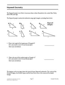
Hopewell Geometry
Right triangles from 2,000 years ago? Learners investigate different right triangles found in the earthworks of the Hopewell people, a Native American culture that populated the United States from 200BC to AD 500. Learners apply concepts...
Curated OER
Mayan Farming Practices
The introduction of this lesson requires reading a from The Maya by Jaqueline Dembar Greene. Learners sketch a Mayan during the reading. Teaching strategies include direct instruction, grouping the students for discussions, reasearch,...
Curated OER
World Map and Globe - Lesson 15 Mountains of the World
Learners locate major world mountain ranges. In this geography lesson, students identify major mountain ranges on 6 on of the 7 continents on a large world physical map.
Curated OER
Meso-America
Students will identify and locate Central and South America and their countries and features, as well as Meso-American civilizations. Students will compare civilizations and discuss voyages of relevant explorers.
Penguin Books
Teacher's Guide: Where the Crawdads Sing by Delia Owens
An 11-page teacher's guide that focuses on Delia Owens' bestseller Where the Crawdads Sing is packed with discussion questions and activities. Text-dependent questions, activities, and writing prompts are also included....
Curated OER
English Perspectives
To further their understanding of the basis of the conflicts between the Pocumtucks and the English settlers, class members research the religious beliefs and attitudes of the Puritan farmers that settled in Deerfield, Ma.
Orlando Shakes
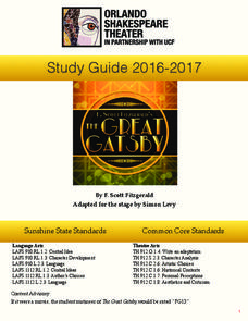
The Great Gatsby: Study Guide
Uncover the exciting world of the Roaring Twenties with The Great Gatsby study guide. Individuals become critics as they write a review of the production. Scholars also read historical information and analyze the differences between the...
Curated OER
Planning a Railroad Online Lesson
Students design a train route using a topographical map. In this historical and spatial thinking lesson plan, students must plan a route through the Sierra Nevada mountains that a train could physically travel. Links to printable student...
Curated OER
Latin American Film
Students critique, discuss, and identify characters in a film about Latin America. For this Latin America lesson plan, students watch the film and discuss the film and everyday life.
Curated OER
Bank Loans Money to Start Businesses
After locating Latin American countries on a world map, children read about how microbanks are loaning money to help start small businesses. Involving both current events and economics, the teacher introduces the article with a map...
Curated OER
Salt of the Earth: A Caddo Industry in Arkansas
Middle schoolers explore the history of the Caddo Salt Industry found in Arkansas. Along with learning about how salt deposits formed in Arkansas, learners study the process of salt production and how valuable salt is as a natural...
Curated OER
Wappo Indians of Napa County
Third graders describe the American Indian nation in their local region long ago and in the recent past in terms of national identities, religious beliefs, customs, and various folklore traditions. They synthesize their findings into a...
Curated OER
World Map and Globe - Lesson 15 (K-3)
Students discover mountain ranges and their locations in the world. In this physical map lesson, students locate and identify major mountain ranges of the world on a large physical map.
Curated OER
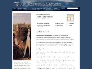
Trade Trials Treaties
Fourth graders explore the trade relationships that existed in the late 1700's Colonial America. In this American history lesson, 4th graders examine English and Cherokee trade treaties by reviewing primary and secondary sources....
