Curated OER
Knowing Where You Are
Fifth graders research place names of one section of their state and create a chart to show their findings.
Curated OER
Passport to the Eastern Hemisphere
Seventh graders create a time line of significant dates in the history of their nation. This requires students to examine the entire history of a country and make informed judgments based on their historical knowledge.
Curated OER
Lewis and Clark: The Language of Discovery
Students replicate some of the trailblazing methods of Lewis and Clark on a fifteen-minute "writing journey" through the school or neighborhood.
Curated OER
Memo from the Governor
Fourth graders inquire about the history of Florida's capital after receiving a mock memo from the governor.
Curated OER
Selling Warfare - Propaganda Posters
Learners examine the use and purpose of propaganda posters during World War I. They work in groups to create a propaganda poster supporting a nation's war effort.
Curated OER
The Arctic and Taiga Ecozone of Canada
Students discover the differences in the Arctic and Taiga regions of Canada. They identify physical and human characteristics of both region. They also practice using an atlas.
Curated OER
Sea Surface Temperature Trends of the Gulf Stream
Students use authentic satellite data to produce plots and graphs of sea surface temperature as they explore the seasonal changes of the Gulf Stream.
Curated OER
Michigan Fun Facts
Fourth graders work with a partner to plan, rese,a rch design and publish a
slide show that depicts the most important or interesting facts they
have learned about Michigan. They are given the choice of working in
one of the seven...
Curated OER
So -- What's Happening Here? On this Old Christmas Tree Farm
Students take a field trip to an old Christmas tree farm near their school. In groups, they gather data at the site and analyze the data in an attempt to discover what happened to the area. They identify human activities that led to the...
Curated OER
Michigan United Conservationists Club (M.U.C.C). v. Michigan Secretary of State: An Issue of Referendum
Students observe the procedures of the Michigan Supreme Court. They identify the processes and procedures being used. They debate a case that was presented to the Court and analyze the oral arguments of the case.
Curated OER
Comparing Ethnic Groups
Eleventh graders explore the relationship between the United States and the Native Americans from after the Civil War to the early 1900's. They evaluate the actions of the United States towards Native Americans and compare the actions to...
Curated OER
The European Union
Students explore what the European Union is by looking at the historical steps that have revitalized European nations as an economic competitor in global trade. They design three illustrated and comprehensive time line murals to show the...
Curated OER
The Arctic and Taiga Ecozone of Canada
Young scholars examine the various sub-regions of the Arctic and Taiga zones in Canada. Using the online Canadian Atlas, they locate and describe the characteristics of each zone. They organize their information into a chart and share...
Curated OER
Digital Picture Books
Second graders create digital picture books reflecting their experiences during the school year on field trips and various classroom activities. Using digital pictures taken during the year, they write captions for each picture and...
Curated OER
Community Bus Tour
Second graders take a bus tour to discover different businesses, schools, and other buildings located in the community. They then learn about the different types of technology that is used in the community.
Curated OER
Exploration of Civil War Webquest
Students use the internet to research what life was like for Confederate and Union soldiers in a specific battle of interest to them. In groups, they complete a webquest on the battle in which one represents a Confederate soldier and the...
Curated OER
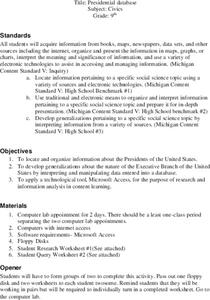
Presidential Database
Ninth graders research the Presidents of the United States. They develop generalizations about the nature of the Executive Branch using the researched information. Students complete a Query worksheet about the Presidents.
Curated OER
The Great Depression WebQuest
Tenth graders explore the events of the Great Depression. They analyze the events and select those most important to contemporary people and the future of the nation. Students create a PowerPoint presentation over the Great Depression.
Curated OER
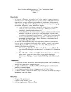
Creation and Interpretation of Voter Participation Graph
Ninth graders research information about voter participation in the United States based on age. They develop generalizations about voting patterns in the U.S and use Microsoft Excel to analyze the information.
Curated OER
Brochures
Students discuss how the climate in their area affects they way they live their life. In groups, they identify the climate zones throughout the world and research one country of interest to them. To end the lesson plan, they make a...
Curated OER
Routing Explorers
Students read excerpts from an explorer's journal and then become investigators and navigators themselves. Students answer questions about the difficulties and time it took for the explorers to travel from Washington to New Orleans and...
Curated OER
Let's Get To the Core!
Students practice analyzing ice core samples to discover climate changes. Using the samples, they identify and graph the gas amounts. They use these numbers to determine their effect on global warming. In pairs, they complete a...
Curated OER
Using My Nasa Data To Determine Volcanic Activity
Learners use NASA satellite data of optical depth as a tool to determine volcanic activity on Reunion Island during 2000-2001. They access the data and utilize Excel to create a graph that has optical depth as a function of time for the...
Other popular searches
- Maps and Charts
- Analyze Maps and Charts
- Reading Maps and Charts
- Ireland Maps and Charts
- Tables, Maps and Charts
- Maps Graphs and Charts
- Maps, Charts, Globes
- Interpreting Charts and Maps
- Tables Maps and Charts
- Graphs, Charts and Maps
- Graphs\, Charts and Maps
- Word Maps and Charts


