Curated OER
Exploring Hawaiian Mountain Zones
Fourth graders watch a video that describes the climate and vegetation zones of Hawaii. They describe the different physical conditions that create vegetation zones from the sea to the mountains. In groups, they create an illustrated...
Curated OER
Top to Bottom
Marine science classes read about the 2005 North Atlantic Stepping Stones Expedition and review climate change. They use maps to locate the seamount chains. In collaborative groups, they research how climate change may be altering the...
Curated OER
Weather's Outer Limits
Students make educated guesses and explain their reasoning and compile, graph, and map weather data. They then study environmental weather extremes on earth and discover that many variables determine climate.
Curated OER
On The Causes of The Dust Bowl
Here's a new twist on the causes and focus of the 1930s Dust Bowl. Looking to be a part of an intense climate study, the presentation offers maps and explanations for the causes of the Dust Bowl. Global warming, drought, and climate...
Curated OER
The Pacific and El Niño
El Nino, and the climate changes that go along with it, are the focus of this Earth Science lesson. Learners pay particular attention to the wind patterns that are established on Earth, and look at weather maps to see how El Nino can...
Curated OER
Weather Pals
Students study maps of the United States to locate weather pals from a list of schools. They communicate with Weather Pal schools through the use of closed circuit TV. Using weather data collected in their area, they exchange the...
Curated OER
The Crash Scene
Fifth graders explore geography by participating in a mapping activity. In this engineering instructional activity, 5th graders identify the differences between latitude and longitude and practice locating precise points on a globe or...
Montana State University
What's the Weather?
How many jackets do you need to stay warm and climb Mount Everest? An informatie resource covers the topic of Mount Everest, the resource helps young scientists discover the difference between climate and weather. Activities include...
Chicago Botanic Garden
Faces of Climate Change
Sometimes, the best solution to a problem can be found by walking in someone else's shoes. Here, scholars use character cards to take on the roles of people around the world. They determine how their character's life affects our...
Curated OER
World Geography - Climate Notes
A challenging activity helps young geographers explore the temperatures around the world! They study how the Earth's land temperatures are affected by their proximity to an ocean, as well their latitude and their altitude. A very...
PBS
Sea Surface Temperature, Salinity, and Density
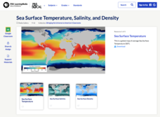
Earth's vast ocean is full of mysteries! Science scholars discover the big-picture properties that influence its characteristics at different latitudes using a lesson from PBS's Weather and Climate series. After completing a background...
National Wildlife Federation
Where In the World Is the Arctic?
Exactly how far away is the Arctic? Learners use maps to orient themselves to their locations on the globe. They then make calculations to describe how their location relates to the location of the Arctic regions.
Curated OER
Climatic Zones
Third graders recognize and locate Frigid, Temperate, and Torrid climatic zones on the word map or globe. They explain that plants, animals, and human societies display adaptations to the climates they live in .
Curated OER
Cartographer on Assignment: Creating a Physical Map of Africa
Students use geographic information to make an outline map of Africa, then demonstrate their understanding of the physical landscape of Africa by using a variety of materials to create a physical map of Africa
Curated OER
Introduction to Maps
Young scholars investigate a variety of maps to explain what each one is used for.
Howard Hughes Medical Institute
BiomeViewer
Which holds more influence, the environment over humans or humans over the environment? Young scientists explore an online interactive that addresses this discussion. They observe changes in the natural world over time and see which...
Curated OER
Sixth Grade Social Studies Quiz
In this social studies worksheet, 6th graders complete multiple choice questions about economics, climate, maps, and more. Students complete 15 questions.
Curated OER
HUMAN/ENVIRONMENT INTERACTIONS: CLIMATE
Young scholars explore the various global climates and apply cultural adaptations of the peoples in various zones due to climate.
Curated OER
Mapping South America
Students explore South America. For this South American lesson, students use their geography skills to create population, terrain, biomes/vegetation, and major exports maps. Students present their finished maps to their classmates and...
Curated OER
Wind Circulation, Surface Currents and Climate
High schoolers describe connections between wind patterns, surface currents, and ocean climate zones. In small groups, they color the ocean climate zones in four different shades of blue. Students then answer questions like what four...
Curated OER
Hopeful Eyes on Southern Skies
The Times covered a drought in 2011, which affected producers, consumers, and sellers. The class gets informed about climate and the economics of agriculture as the read this article and answer each of the 11 comprehension questions. A...
Curated OER
Changing Planet: Sea Levels Rising
Begin by showing a six-minute video, Changing Planet: Rising Sea Level as an anticipatory set. Pupils draw a topographic map of a potato continent. Finally, they will visit NOAA's sea levels online map and NASA's carbon dioxide...
Curated OER
Climate Patterns across the United States
Students articulate differences between climate and weather using examples in a written statement. Using climate data from across the country, they describe climate patterns for various parts of the United States on a map. Students...
Curated OER
World Climate Growing Zones
Students create a map showing where crops would be grown around the world. In this crops lesson plan, students show how the world climate would produce different parts of the world at different times. Students fill out worksheets.
Other popular searches
- Map the Climate Regions
- Climate Map Reading
- Temperate Climate Maps
- World Climate Map
- Reading Climate Maps
- Us Climate Maps
- Climate Maps of Africa
- Reproducible Climate Maps
- Southwest Asia Climate Maps
- Climate Maps Usa
- Regions Climate Maps
- United States Climate Maps


