Curated OER
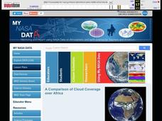
A Comparison of Cloud Coverage Over Africa
Students use a NASA satellite data to contrast amounts of cloud coverage over different climate regions in Africa. They explore how Earth's major air circulations affect global weather patterns, and relate to local weather patterns.
Curated OER
Cartographer on Assignment: Creating a Physical Map of Africa
Learners use geographic information to make an outline map of Africa, then demonstrate their understanding of the physical landscape of Africa by using a variety of materials to create a physical map of Africa
Boston University
Scramble for Africa
In this fantastic simulation, your young historians take on the roles of imperialistic European countries in the nineteenth century and then "scramble" to carve up the continent of Africa! This is a very hands-on activity that will help...
California Academy of Science
California's Climate
The United States is a large country with many different climates. Graph and analyze temperature and rainfall data for Sacramento and Washington DC as you teach your class about the characteristics of Mediterranean climates. Discuss the...
Curated OER
Africa: Introduction, Geography and Mapping
Students study the geography of Africa through the use of maps. They locate, distinguish, and describe the relationships among varying regional and global patterns of geographic phenomena such as landforms, climate, and natural resources.
Curated OER
The Geography of Africa
Hop a flight to Africa in this presentation, which includes brilliant and appealing photographs of the continent as well as maps and graphs about its geography, topography, and climate. Those who are researching Africa for a project or...
Curated OER
A Comparison of Cloud Coverage over Africa
Learners identify different climate regions and local weather patterns. In this cloud coverage lesson students use NASA satellite data and import it into Excel.
Curated OER
Trekking to Timbuktu: The Geography of Mali -Teacher Version
Students investigate the geography of Mali. They locate Mali on a satellite map, explore various websites, describe the landscape and climate, label a map, and write an essay about the Niger Riger.
Curated OER
Physical Geography of Africa
Fifth graders investigate the topography of Africa. In this physical geography lesson, 5th graders research the six regions of Africa and complete a physical map. Students locate various landforms in Africa. Students...
Curated OER
What Do We Know About Africa?
First graders explore Africa, its geography and climate. After completing a KWL chart, 1st graders locate Africa on a globe and discuss how its location on the earth affects its climate. Using the Internet and a given fact sheet,...
Curated OER
It's Getting Hot out Here! Should I be concerned? (Climate Change)
Students explore the effects of global warming. They examine the differences between weather and climate. After viewing a video, students summarize information on climate change and drought.
Curated OER
African Country Report
Sixth graders describe the relationship between the people of Africa and their environment. They examine the climate, economy and inhabitants of this land. Using maps graphic organizers and writing a report, 6th graders demonstrate how...
Curated OER
Adinkra Cloth
Students locate Ghana on a map of Africa and discover features of Ghana culture. They synthesize the importance of Adinkra symbols and cloth to the people of West Africa and design an Adinkra cloth.
Curated OER
Friends of the Desert
Young scholars examine the climate map of Africa with emphasis on the desert regions. They work together in groups to play the role of different delegations preparing for a conference. They present their information to the class.
Peace Corps
Weather and Water in Ghana
Students investigate the climate of their region. Students research statistics and conduct interviews. Students take a virtual tour of Ghana and discuss its climate. Students consider water conservation and the role it plays in both...
Curated OER
Africa: Animals of the African Savannahs
Students explore animals of the savannah. In this science lesson, students discuss the characteristics of animals that live on the savannah. Students create an animal that would be able to live on the savannah.
Curated OER
The Geography of the United States
Full of bright maps and interesting information, this presentation details U.S. Geography. Slides include basic facts about size, regions, topography, and demographics, as well as fascinating trivia about the United States, including...
Curated OER
Cyberspace Safari
Middle schoolers go on an information gathering hunt on the Internet to study West African empires. They work in teams; meteorologists, bankers, writers, and archaeologists. They collect data on all sorts of topics related to West...
Curated OER
The Gift of the Nile: Egypt and its River
Students begin with a piece of a puzzle that shows an artifact from ancient Egypt. They find others who have pieces that go with their puzzle piece. Students work in these groups to construct a relief map of the Nile River Valley.
Curated OER
Cacao Tree Geography
Young scholars use a map to learn about where chocolate comes from. In this lesson on the cacao tree, students locate various regions where the cacao tree grows. They will discuss why the cacao tree grows more favorably in particular...
Howard Hughes Medical Institute
Measuring Biodiversity in Gorongosa
Take your biology class' understanding of biodiversity to a whole new level! Ecology scholars use data to calculate three different diversity indices based on the organisms in the Gorongosa National Park. The four-part activity uses an...
Curated OER
Africa
Second graders explore Africa. They label the popular places in Africa on a map. Students label the different cities and monuments that are popular in Africa. They discuss the similarities and differences between cities in Africa and...
Curated OER
Learning About Africa
Students examine one of the locations in Africa listed in the lesson focusing on location, climate, products, activities, and other information they use for their short story. They then write an outline of their story and organize their...
Curated OER
Africa's Climatic Regions
Pupils are introduced to the different climates and vegetation of Africa, and compare them to similar climatic regions found in the United States.


