Curated OER
Number The Stars Geography
In this social studies worksheet, middle schoolers look for the location of Denmark and then color the continents of Europe and North America.
Curated OER
Asia Crossword
For this geography worksheet, students complete a crossword puzzle on the continent of Asia. They answer 21 questions related to the type of government systems found, capital cities, deepest lake, and lowest population density.
Curated OER
The Globe and World Map
Students explore how to use maps for travel. In this map skills lesson, students read the text, With Love from Gran and discuss the places the character traveled. Students list the names of each city and country on chart paper.
Curated OER
BIGGER AND BIGGER: (We Live in a family, a neighborhood, a city, and the United States)
Students discover that they are part of bigger and bigger groups. They begin with families and work up to belonging to North America as they initiate a study of the whole country.
Curated OER
Studying the African Immigration Lesson Plan
Students read a narrative, conduct an interview and write an autobiographical piece highlighting their findings about an immigrant's experience leaving their country.
Curated OER
There Is No Place Like Home! U. S. Immigration in the 1800's.
Students explore immigration in the late 1800's. They identify and describe the settlement patterns of European immigrants to the U.S. Students work in groups to research immigration from specified countries.
Curated OER
Exploring South America
Pupils research South American to prepare a PowerPoint presentation about its culture, traditions, and societies. In this South American research lesson, students research South American based on their export products to create a...
Curated OER
Adventures in Africa
Students research Africa and prepare an advertisement about travelling to the continent. In this African travel lesson, students research a country in Africa and write an advertisement that encourages travel to the country. Students...
Curated OER
What is the connection between rice and estimation?
Sixth graders investigate estimating. In this estimating instructional activity, 6th graders estimate how much rice is eaten around the world. Students estimate the percentages of rice eaten by other countries. Students compare rice...
Curated OER
Let's Play Geography Twister
Students practice geography skills by playing a game based on Twister. Students manipulate their position on a map by placing their arms and legs on the appropriate state or country called out by the teacher.
Curated OER
Africa Test Study Guide
In this Africa study guide learning exercise, students respond to 27 short answer questions about the geography and history of the continent.
Curated OER
First Nations Contributions
Eleventh graders recognize the contributions made my Indigenous people around the world. In this research skills lesson, 11th graders research native peoples of several countries and create presentations that feature the contributions of...
Curated OER
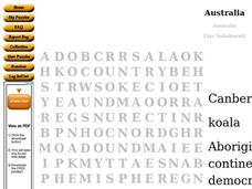
Australia Word Search
In this social studies worksheet, students find the words that are used to describe the continent of Australia and the answers are found by clicking the button at the bottom of the page.
Curated OER
Gauri and Prithvi: Nuclear South Asia
High schoolers examine South Asian relations. In this international affairs lesson, students explore the relationship between India and Pakistan as they participate in role play activities and conduct research regarding the relations...
Curated OER
Splish Splash: Daily Use of Water
Students assess their daily use of water and write stories about how water is used in their lives and communities. Students read about water usage in Ghana and Kenya and compare and contrast water usage and resources between the countries.
Curated OER
Location, Location, Location!
Twelfth graders locate cities, states and countries on maps. They use the cardinal directions to locate places on maps. They describe where they were born by giving clues without naming the exact state. They trade papers and try to guess...
Curated OER
Ramadan (Islamic Holiday)
Young scholars recognize that different groups of people have celebrations unique to them. They identify countries on a map where Islam is a dominant religion. They demonstrate their understanding of fasting and abstinence.
Curated OER
Australia: Introductory Lesson
Students explore Australia. In this global studies lesson, students listen to audio clips and watch video clips that introduce them to the the nation-continent. Students discuss what they already know about Australia and what they would...
Curated OER
World Map Labels
In this geography skills worksheet, students identify the countries and bodies of water labelled on the maps of the world, Africa, Asia, Canada, Europe, the Caribbean, the Middle East, North America, Australia, and South America.
Curated OER
China: How to Put Some "Tang" in Your Medieval Dynasties
Fourth graders label the countries that border China and the physical features of Asia. They discuss the physical features of Asia and label them on the other map.
Curated OER
The Western Migration Lesson Plan
Students examine the western migration in the United States in the early 19th century and identify the factors that caused the migration as well as how government adapted to meet the needs of an expanding country.
Curated OER
The Roots of the Afro-American Culture: The Artistic Approach
Students study the geographical structure of the continent of Africa. They discuss how and why there are so many tribes and kingdoms of Africa and dsicuss customs and traditions to determine how they come about in any ethnic group.
Curated OER
Africa Crossword Puzzle Worksheet
In this Africa crossword puzzle worksheet, students examine the 12 clues in order to fill in the blanks in the puzzle with the words and names from this continent.
Curated OER
Geography of South America
Students explore South America. In this geography skills lesson, students watch a video about the geographical features of the continent. Students complete worksheets on the topic.


