Curated OER
Naming Roads
Young scholars investigate the aspects of a historic map of roads and trails in the Southeastern United States. They explore reasons for giving roads certain names and decide on names for other roads themselves.
Curated OER
Life on the Border
Students discuss different types of boundaries. They research the United States/Mexico border and answer questions about their findings. They create collages, posters, or multimedia presentations showcasing various areas of concern...
Curated OER
Tobacco: Exploring Tobacco Culture
Eighth graders are introduced to the tobacco planting process. Using primary sources, they identify the steps necessary to grow the popular crop. They create a flow map to organize the process graphically. They discuss the...
Curated OER
My Diary From Here To There: Understanding Mexican Culture Through Research and Diary Entries
Third graders explore the adventures of an immigrant as she comes to the United States. They discuss the difficulties the immigrants had and they research the Mexican culture and society. Students create a diary of their own.
Curated OER
4: In With the Imports
Students research imports of American Samoa and Hawaii and create a map showing the major imports for both. In this economics lesson, students identify where American Samoa and Hawaii are on a map, discover what the imports for the...
Curated OER
We the People
Students create a map illustrating the three branches of goverment. They identify the branches of government and the shared or exclusive powers of each. Students use mapping as a prewriting stategy. They discuss our national...
Curated OER
Colonial America and Roots of Government
Students identify 50 States and the major geographic features, regions, and political representation of each. In connection, they investigate the causes and effects of European colonization on North America. They identify the formation...
Curated OER
Freedom of the Press Around the World
Students research press freedoms in various countries such as Iran and North Korea. They create a freedom of the press report card for the countries examined.
Curated OER
Push/Pull Factors and Welsh Emigration
Students view and discuss short sections of movies that relate to immigration. Working in groups, students create a map that shows directions of internal migration in their assigned geographical area. Students review ads/booklets created...
Curated OER
Working on the Railroad
Students plan a trip on the railroad. In this railroad creation and implementation lesson, students listen to the song "Working on the Railroad", make a map of where the track was laid and discuss the geographical challenges. ...
Curated OER
World War I
Eighth graders examine the condition of the world from 1880 until the start of World War I. After watching a PowerPoint presentation, they discuss the causes and effects of the war and complete a study guide with a partner. To end the...
Curated OER
Flipping Over Our Weather Reports
Young scholars create their own weather report. In this weather lesson, students work in groups to predict the weather for three days and create their own video. They have a director, camera-person, still cameraman, and two...
Curated OER
Africa Falls Prey to H.I.V.
Students use maps, statistics, and written texts to recognize the H.I.V. explosion in Africa.
Curated OER
Cultures and Cuisines WebQuest
High schoolers create and present a powerpoint presentation. In this cultures and cuisines research lesson, students select a country, interview someone from that country and visit a restaurant from that country. High...
Curated OER
Lewis and Clark and Native Americans, Part II
Students research the Native Americans living in the regions explored by Lewis and Clark. They identify the modern-day names of sites claimed by the Lakota Indians, and create a poster of the original Native American names.
Curated OER
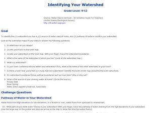
Identifying Your Watershed
Learners identify the watershed where they live and how it is related to their own water consumption. In this watershed instructional activity students locate their watershed on their town map. The learners find the source of their water...
Curated OER
River to the Sea
Students investigate the function of wathersheds and weather while they follow Lewis and Clark on their jouney west. They also create a map using acurate measurements and build a model watershed.
Curated OER
Mining Riches
Students research and map how various mining ventures have changed local geographies and populations. First they read the article provided--Examining the Environmental and Social Impact of the Mining Industry.
Curated OER
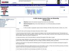
Diversity
Students work in groups to research and prepare an oral report about a region. In this regions lesson plan, students find out about the geography, population, state capitals, and landmarks. Students assign attributes to the...
Curated OER
Fire Safety
Students investigate fire safety. In this safety lesson, students identify the fire exits in the school building and draw a floor plan of their house to create an emergency escape route.
Curated OER
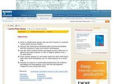
Earthquakes And Fault Lines
Students discuss major causes of earthquakes and identify famous fault lines, access and map information about ten largest earthquakes in world from 1989 to 1998, and theorize about location of these earthquakes as they relate to Earth's...
Curated OER
Biomes: The Threat of the Sea
Students create posters to raise awareness about Global Warming as an immediate threat. In this environmental lesson, students respond to the video Biomes: The Threat of the Sea by researching global warming and making posters to...
Curated OER
Early Settlements
Students embark on a journey through colonial times. In this early settlement lesson, students come to understand what life was like for the settlers in the early colonies. Students research and create projects illustrating their...
Curated OER
Plotting Earthquakes
Learners explore earthquakes. Using the National Earthquake Information Center website, students plot daily earthquakes on a map. They observe the magnitude of each earthquake. Learners identify the pattern of earthquake locations and...


