Curated OER
Create a Planet
Learners craft planets from clay. In this geography skills lesson, students create model planets that mimic the geographic features found on Earth as well as the other planets. Learners conduct research about characteristics of the...
Curated OER
North America Puzzle
In this geography worksheet, students complete a crossword puzzle in reference to North America. They identify capitals of some countries, the specific landforms of different areas, and languages spoken. There are 21 clues to solving the...
Curated OER
Geographic Landscapes and Interstate Freeway Development
Students investigate the topography of the United States through a discovery lesson. They create a hypothetical route for a highway across the United States. Students also conduct research major landforms and define geographic terms.
Curated OER
Saskatchewan's Population Distribution
Pupils explore landforms, vegetation, climate and population distribution in Saskatchewan. After discussing an atlas of Saskatchewan, students create their own relief map and climagraphs of Saskathewan. Using specified websistes,...
Curated OER
Metropolitan Areas in the USA
Fifth graders explore why people live in certain regions of the United States. They investigate information on specific metropolitan areas such as temperature, population, natural resources, precipitation and landforms. In groups, 5th...
Curated OER
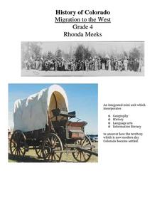
History of Colorado-Migration to the West
Fourth graders identify reasons for people moving to the Colorado Territory and examine how moving in the 1800's is different than moving today. They also practice reading maps and gathering information from maps, as well as, describe...
Curated OER
Where's the Barbecue?
Middle schoolers identify the major landforms, regions and rivers on a map of South Carolina. They compare the locations of the major Native American groups in the state as well. They chart where barbecue restaurants are located and...
Curated OER
African Safari
Sixth graders gain an appreciation for the different cultures that inhabit the Earth by focusing on the people of Africa
Curated OER
The Landscape Through Geographer's Eyes
Students examine different types of landscapes through a geographer's eye. Using a city block or a suburb, they organize their thoughts and take notes to survey a site. They discuss what they have seen and write about how looking at...
Curated OER
IDP Introduction
Fourth graders examine the three regions of North Carolina through class discussion of favorite places in the state and a review game based on the game of twister. The different colors on the twister sheet represent the different...
Curated OER
Hottest, Coldest, Highest, Deepest: Science, 4th Grade
Fourth graders investigate weather patterns in their home state of Utah. After creating KWL charts, they research weather and geographical data to locate the state's extremes. As an extension, 4th graders write and illustrate books about...
Curated OER
Mississippi Gulf Coast Islands
Fourth graders complete a variety of exercises as they study the creation, history, and geography of the Mississippi coastal islands. They discover the natuaral forces that act on the islands and how these forces affect the habitats and...
Indian Land Tenure Foundation
Relationships to Places
Young historians take a look at how the Indian tribes of California promoted a mindful relationship between people and the land. They begin to understand how the Indians were champions of conservation, and at preserving the natural...
Curated OER
Mission System of Texas
Students create a storybook about Texas missions including the history of why they were built. They research and create pictures depicting how and why the missions were built. They write and illustrate the primary groups of people found...
Curated OER
Greeks Around the World: A Case Study on Greek Diaspora
Students gain an understanding of the concept of Diaspora relating to Greeks. They use guided discovery to apply the geographic inquiry model to an examination of the reasons for Greek Diaspora.
Curated OER
Geo-Magazine
Divide your geography class into groups and have each research an assigned region. The result of this project is a regional magazine that addresses the five themes of geography. Many valuable resource links are embedded into the page...
K12 Reader
Natural Resources
What natural resources are available in your area? Your learners can consider this question after reading a brief passage about natural and renewable resources. After reading, class members respond to five questions related to the reading.
NASA
Geographical Influences
"If global warming is real, why is it so cold?" Distinguishing the difference between weather and climate is important when it comes to understanding our planet. In these activities, young scientists look at the climate patterns in a...
Curated OER
Edible Maps
First graders, in groups, identify major geographical features of Texas. They form a topographical map of Texas using edible dough, candy, etc. They present and then eat their maps.
Curated OER
Map Skills
Do you need to practice map skills? Children with a range of abilities will complete a KWL chart about maps, practice important map vocabulary and then read a few pages from their textbook. They will use their vocabulary words and...
Curated OER
The Silk Road, An Ancient Internet
Students examine how goods and ideas moved along an ancient trade route between China and Europe. They make charts of items, ideas, etc. that were transported along the Silk Route.
Curated OER
Through the Looking Glass: Recognizing Developing and Industrialized Countries
Students examine the regions of the world, and identify the basic characteristics of industrialized and developing countries. They conduct Internet research on the economic and population characteristics of industrialized and developing...
Curated OER
Geography With Dr. Seuss
Students read the book, The King's Stilts by Dr. Seuss and discuss the geographical information given in the book. Then they discuss and locate on a map the physical features that make up the continent of Africa. They create an original...
Curated OER
Tracing Highs and Lows in San Francisco
On a topographic map, students identify the scale bar, north arrow, and contour interval. They then locate a hill on the map and make note of the contour lines. Students then locate other places with similar contour line patterns....


