Curated OER
How Far Is It?
Learners use a map key to estimate the distance from Salt Lake City, Utah, to ten other cities. Then they use an online distance calculator to see how close their estimates come!
Curated OER
You Are Here
Students map local places and learn to use scale and distance. In this mapping lesson, students map their school and a favorite place. Students recreate their maps showing distance and scale sizes. Students locate their location on a...
Curated OER
Calculating Distance On Maps
Fourth graders determine the mileage from the local community to various scenic attractions in the Four-Corners-Region. They receive direct instruction and carry out activities in cooperative group settings.
Curated OER
Around the Town
In the world of GPS, make sure your kids can still read maps and determine distances between locations. You will need neighborhood street maps, ideally of your class' home turf. Ask kids questions about different locations in relation to...
Curated OER
Scaling it Down: Caves Have Maps, Too
Measurement and map skills are the focus of this lesson, where students crawl through a "cave" made out of boxes, desks and chairs, observing the dimensions. Your young geographers measure various aspects of the cave and practice math...
Curated OER
Massive Migrations
Here is an exciting exploration of a fascinating topic for your emerging ecologists: bird migration! They begin by visiting the US Fish & Wildlife Service website to discover which Arctic birds come to their areas. They are assigned...
Curated OER
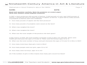
Mathematics Word Problems About the 1800s
In this history and math worksheet, students solve 20 problems pertaining to life in America in the 1800s. Students read four paragraphs and solve the five problems using that information. Basic math operations are used.
Civil War Trust
Map the Civil War
Mapmaking was a very important element in successfully planning attacks on enemies during the Civil War. Guide pupils through the process of pacing to find the average length of their steps, measure the distance between one object to the...
Curated OER
Johnny Appleseed Walkabout
Second graders calculate mileage for a journey. For this place value and measurement lesson, 2nd graders read Johnny Appleseed, work in groups to locate his birthplace on a map, locate the other states he stopped in, and measure the...
Curated OER
Exploring the Hudson in 1609
While this lesson focuses on a study of the Hudson River, it could be used as a template for a discussion of map skills, converting measurements, and plotting a route. The lesson includes vocabulary and other resources to make it a...
Curated OER
The Crash Scene
Fifth graders explore geography by participating in a mapping activity. In this engineering instructional activity, 5th graders identify the differences between latitude and longitude and practice locating precise points on a globe or...
Curated OER
Plot Your Course
Learners determine distance and direction on a nautical chart. In this nautical lesson, students identify obstacles and characteristics of common aid to navigation on a nautical chart.
Curated OER
Signal Corps
Students examine the role of signal corps during the Civil War and explore the technique of 'wigwag.' In this Civil War instructional activity, students discuss the way they communicate long distance today, they research how a civil war...
Curated OER
Estimating Distances
Fifth graders explore the concept of estimating distances between two places on a map. In this estimating distances lesson, 5th graders interpret maps according to measuring distance. Students choose a place on a map and find the...
Curated OER
Marriage and Financial Goals, Budgeting Strategies
There is no more useful life skill to learn than budgeting and setting financial goals. It's math that is used by every person, everyday. Learners examine the responsibilities and costs involved in family economics. Through a series of...
Curated OER
Planning a Road Trip!
Students generate plans for a fictitious road trip. For this time management lesson, students investigate the most effective way to travel the country arriving at specific cities. Students create their plans based on time and distance.
Curated OER
The Pony Express
Students plot the route of the Pony Express. They discover the kinds of terrain it crossed. They calculate the number of legs needed to cover the distance of its total route.
Curated OER
Mountain Man Measurement Activity
Fourth graders discover the history of the Utah Mountain Men and utilize their math skills simultaneously. In this cross-curricular history and measurement lesson, 4th graders read about the Utah Mountain Men and the challenges they...
Curated OER
Avoiding Consumer Fraud: Financial Scams and Schemes
Young consumers get a hefty dose of information on how fraud can put their financial health at risk. The resource provides detailed lecture notes, scaffolded notetaking sheets, vocabulary worksheets, transparencies, and seven links to...
Curated OER
GPS Scavenger Hunt
Middle schoolers go on a GPS scavenger hunt. They use GPS receivers to find designated waypoints and report back on what they found. They compute distances between waypoints based on the latitude and longitude, and compare with the...
Curated OER
Getting it Right!
Students investigate error. As shown in earlier activities from navigation lessons 1 through 3, without an understanding of how errors can affect position, one cannot navigate well. Students explore how computers can help in navigation....
Curated OER
Add and Subtract with Hudson River shipping
Rivers aren't just a place for animals to live, they also provide industrial transportation. The class will examine the Hudson River on a map, discuss all the commercial vessels that use the River to transport materials, then complete a...
Curated OER
A Contouring We Go
Students examine the built environment and infrastructures of their community by constructing contour equipment, using the equipment, and comparing their results to current topographical maps of the same area
Curated OER
Cut - Stretch - Fold
Students work on determining the area of a tangram piece without using a formula by working with geoboards, graph paper, and tangram pieces. After completing the activity, they apply their experience to determining a formula for finding...


