Curated OER
Geography Journey
Fourth graders examine the geographic features that define places and regions and answer questions about the state of California. They discuss the components of a map legend and answer worksheet questions using a map of California as a...
Discovery Education
Architects in Action
Hands-on and real-world applications are great ways to teach mathematical concepts. Creative thinkers examine how ratios are used to create scale models of buildings and structures. They practice working with ratios by looking at a map...
Physics Classroom
As the Crow Flies Lab
A simple, yet memorable, way of practicing with displacement vectors is described here. Divide your class into groups and assign each a different landmark on campus. They measure smaller legs of the path from the classroom to their...
Curated OER
Volcano Contour Models Activity
Students experiment with water levels and plastic topographic volcano models to determine the contour lines that would be used to create a topograpohic map of a volcano. They use the traced lines to actually develop the map.
Curated OER
Who's Range is it?
Students investigate the habits of panthers by analyzing radio transmitted data. In this animal life lesson, students utilize computers to view the range of different statistics dealing with Florida panthers. Students...
Curated OER
Real World Investigation- Math and Geography- Elevation Changes
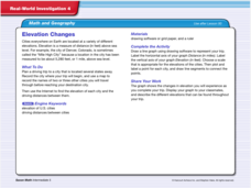
In this math and geography real world investigation, 6th graders plan a driving trip to a city that is located several states away from their home while recording the elevations of three cities that are included in the trip. They use...
Curated OER
Location, Location
Third graders draw and interpret simple scale maps, use maps to move around efficiently or plans to propose actions. They use of a compass to specify and find directions. They display and discuss a map of the local region.
Curated OER
Pacific Atolls and Island Groups
Students construct, interpret and translate maps and geographic data. Given a worksheet, students identify an island, an atoll, a scale, and a compass rose. Students grid systems, legends, and symbols. They use the map to find answers to...
Curated OER
The Cardiac 100
Middle schoolers make a full scale diagram. In this heart and blood flow lesson, students pretend they must design the cardiac 100 racecourse and they must teach the new blood cells how to get around the heart. Middle schoolers create a...
Curated OER
Volcanoes
Second graders review the characteristics and aspects of volcanoes. Using this information, they write a creative story and draw illustrations to accompany the words. They use geographical terms to describe a location and the physical...
Curated OER
Arctic Microclimates
Students identify, measure, and average micro-climatic temperatures in a particular region. They draw a small-scale map of an area to be sampled (classroom, playground, park, backyard) and identify potential locations for...
Curated OER
Mapping an Artifact
Students copy a present day artifact onto graph paper. In groups, they decide the scale of the drawing and create the picture using specific graphing points. They are also given photographs in which there are no graphing points and they...
Curated OER
Searching the Attic
Students investigate an attic or basement to "discover" family artifacts. They develop a grid map using string, create a naming system for the grid, and analyze items of interest.
Curated OER
CORNER CABINET
Ninth and tenth graders calculate the length, width, height, perimeter, area, volume, surface area, angle measures or sums of angle measures of common geometric figures. They solve problems involving scale drawings, models, maps or...
Curated OER
Living in the Desert
Conduct an investigation on the plants used by the Hohokam tribe. To survive in the harsh desert environment the Hohokam used many natural resources. Learners read, research, map, and graph multiple aspects of Hohokam plant use as a...
Curated OER
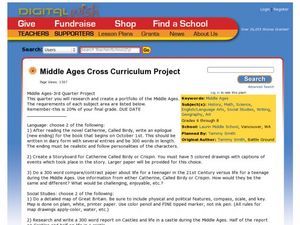
Middle Ages Cross Curriculum Project
Middle schoolers complete several projects on the Middle Ages. In this world history lesson, students complete language arts, social studies, math, and science projects. Some of these include: comparing a teenager's life now to that in...
Curated OER
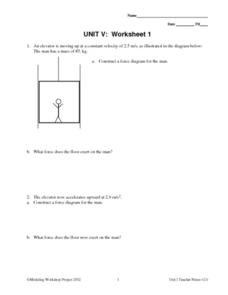
Unit V: Worksheet 1 - Constant Force
In a force diagram, a stick figure man in an elevator takes a ride. Physics analysts work out the force exerted on him by the elevator floor. As the acceleration changes, they draw new force diagrams and compute new force values. This...
University of Colorado
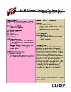
Are All Asteroids' Surfaces the Same Age?
Did you know scientists can tell the age of an asteroid by looking closely at its craters? This final lesson of a six-part series focuses on two asteroids, Gaspra and Ida, in order to demonstrate the concept of dating asteroids. Scholars...
Curated OER
Scale Basketball
Young scholars discuss scale diagrams and maps as well as the use of spreadsheets to find the best scale to use in a model before practicing scale and ratio problems on their own.
Curated OER
Navigating Your Community
Students draw a map from memory describing the route between their classroom and the gym including a legend, a compass rose, a map scale, symbols, and a landmark at every change of direction. They then retrace their steps in their maps...
Curated OER
Old World and New World - Why Contact Took So Long
Students use a globe to determine why contact between the old world and the new world took a long time. In this map skills lesson plan, students analyze routes between regions to determine why it took so long for the old world and the...
Curated OER
A Thoreau Look at Our Environment
Sixth graders write journal entries o school site at least once during each season, including sketched and written observations of present environment. They can use sample topographical maps and student's own maps. Students can use...
Curated OER
Size Small School
Middle schoolers explore the concept of scale and ratio. In this scale and ratio lesson, students work in groups to measure a given space such as a hallway, office, or gym. Middle schoolers measure their area using a meter...
Curated OER
Comparing Ratios
In this comparing ratios worksheet, students solve and complete 3 different problems using the screens shown. First, they write a ratio that compares the shaded part to unshaded part illustrated. Then, students use the same grid to...


