Curated OER
Maize to Maquiladoras: Movement from Mexico to Arizona
Fourth graders label maps of Arizona and Mexico to show the people, goods, and ideas that have moved between the two places. In this Arizona and Mexico lesson plan, 4th graders summarize the effects of the movement on Arizona life.
Curated OER
FUN WITH MAPS
Second graders receive a general overview about how maps are made and used, how specific information can be derived from them, and how a student can gain personal information about their surroundings from examining them.
Curated OER
The Mesoamerican Mystique
Students gain a better understanding of the cultural diversity in the northern region of Central America. They engage in a lesson which focuses on research, archaeology, historical videos, and travel highlights.
Curated OER
Seasonal Cloud Cover Variations
Students recognize different cloud types. They determine the seaonality of various types of clouds. They graph the data and determine if a correlation exists between season, cloud cover and type of clouds most prevalent during each season.
Curated OER
Map Projections: The Grapefruit Activity
Students partcipate in activities in which they examine different map projections. They discover the positives and negatives of each type. They use grapefruits to help them with the different types of map projections.
Curated OER
Minerals and the Products of Mining
Students explain any perceived relationship between mineral resources and political/economic power. They test knowledge through puzzles and classroom activities and research different minerals and educate one another about their...
Curated OER
Controlling the Flow of the Colorado River: A Study of Dams
Students research and map the Colorado River and its dams and predict the effects of a dam on an area. They suggest reasons a dam would be built and compare the Colorado River system with other major river systems within the US and...
Curated OER
The Changing Face Of America
Students explain historical and contemporary patterns of immigration to the United States. They observe immigrant markers in the cultural landscape and identify trends in population change in the local state and community.
Curated OER
Using the Four Main Directions in the Classroom
Students utilize a compass to determine where North is in the classroom. In this direction lesson, students label the four main directions. Students locate features in the classroom and describe the directions to get to them. Students...
Curated OER
Which Way is Up? The Tree of Life in Africa
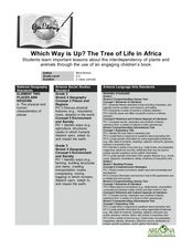
Learners read a book titled This is the Tree about a baobab tree and draw a picture and label the tree. In this tree lesson plan, students also write a paragraph explaining why they drew that tree.
Curated OER
Weather in the USA
Young scholars identify the different types of weather conditions that occur in the United States. They discover how to adapt to weather and explain forecast and warning signals.
Curated OER
Traveling Through North America
Students identify places and landmarks in North America, specifically Canada and the United States, by using and constructing maps. Six lessons on one page; includes test.
Curated OER
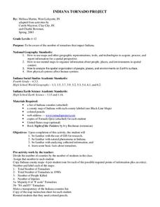
Indiana Tornado Project
Students become aware of the number of tornadoes that impact Indiana. They explore basic facts about tornadoes. Students use the GIS for research. They explore that natural phenomena in Indiana. Students become familiar with...
Curated OER
Matching the Globe with the Map
Learners examine how to use a globe. In this globe and map comparison lesson, students discuss how the globe and map are alike when looking at Africa and Antarctica. Learners investigate shapes and sizes of globes versus maps.
Curated OER
If the World Was a Village...Examining Ethnocentrism
Seventh graders examine their own perceptions of world's people, compare those perceptions to real demographic data, provide definition and understanding of term "ethnocentrism," and examine their own ethnocentrism based on comparison of...
Curated OER
Does Humidity Affect Cloud Formation?
Students use NASA's S'COOL database to identify factors that affect cloud formation.
Curated OER
How Islands Form
Students how islands form, rising water levels, growth of coral, and volcanoes. They complete Island Investigation worksheets after researching island formation on various Internet websites.
Curated OER
Power of Germs
Students view the film, Guns, Germs, and Warfare. They create projects based on the impact of germs on the development of societies and countries.
Curated OER
Population Change in Vermont, 1990-2000
Students improve their mapping skills and knowledge about population distribution and change in Vermont at the county level. They are divided into groups of two or four. Each group is given two county base maps and the population...
Curated OER
Oceanography
Fourth graders define new vocabulary associated with oceanography. They locate and label the four oceans. They also identify features of the ocean floor.
Curated OER
Our Natural Resources
Students discuss key terms used to describe ecosystems and how humans are altering natural resources. They listen to the book, Grandfather's Wisdom, and list the renewable and nonrenewable resources they have used or consumed in the past...
Curated OER
Ocean Currents
Fourth graders work in groups to research ocean currents and create posters with their findings. They locate the patterns and names of major ocean currents and identify them on a map. Students also use red pencil to show ocean currents...
Curated OER
Japan and The Ring of Fire
Middle schoolers engage in a study of the volcanic forces and earthquakes associated with The Ring of Fire in the Pacific Ocean. The people of Japan are researched in how they have dealt with living in the area. Also students write in...
Curated OER
A Trip Around the World
Students role play the role of a travel agent. In groups, they must plan a trip around the world making stops in a different biome. They use the internet to discover the characteristics of each biome and create a travel brochure for...
Other popular searches
- World Map Earth's Biomes
- Geography Earths Crust
- Geography the Earths Crust
- World Map Earths Biomes
- World Map Earth's Bio Mes


