Curated OER
Baseball Challenge - Basic Geography Skills
A fabulous presentation/activity based on geography. The author has designed a "baseball game" where batters advance to the next base if they correctly answer a multiple choice question about geography. Geographic terms are used, along...
Curated OER
Roman Holiday in Google Earth
Students plan an itinerary for an educational trip to Rome. In this research skills lesson, students use Google Earth to conduct research for their project in their travel teams. Students also set up blogs to share their progress through...
Curated OER
Geography 12
Geography is such a fascinating subject for learners of all ages. Prepare learners with good guiding questions, which they can use while reading their texts. Each of the provided 13 questions requires a full paragraph response on the...
Curated OER
Natural Disasters and the Five Themes of Geography
Have your class do research on natural disasters and create a presentation using this resource. In completing this activity, learners apply the five geography themes to their research. They write a paper describing their results. It's a...
Geophysical Institute
Latitude and Longitude with Google Earth
Travel the world from the comfort of your classroom with a lesson that features Google Earth. High schoolers follow a series of steps to locate places all over the earth with sets of coordinates. Additionally, they measure the distance...
Oregon State
World Map of Plate Boundaries
Young geologists piece together the puzzle of plate tectonics in an earth science lesson. Given a physical map of the world, they search for land formations that indicate the location of different types of plate boundaries.
Curated OER
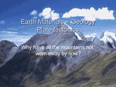
Earth Materials - Geology and Plate Tectonics
Not going into depth on any one topic, this Earth science presentation skims the crust. It touches on the materials that construct the crust and then moves into plate tectonics. This is a useful and colorful note-taking guide for your...
Space Awareness
How To Travel On Earth Without Getting Lost
Have you ever wanted to travel the world? Take a virtual trip with a geography lesson that uses longitude and latitude, the position of the sun, an astronomy app, and a classroom globe.
Space Awareness
Where on Earth Am I?
Almost every phone has GPS installed, but a large number of teens don't know how the technology works. An initial activity illustrates how GPS determines a location on Earth. Scholars then apply trilateration procedures to a...
Curated OER
Geography
Introduce your second graders to geography with this 13-slide PowerPoint. Students discover the names of the 7 different continents, as well as review the four oceans on the Earth. This presentation contains fabulous graphics on each slide.
Curated OER
Sub-Saharan Africa: Physical Geography
In this geography skills activity, students respond to 22 short answer and map skills questions about the location and geographic features of sub-Saharan Africa.
Association of American Geographers
Project GeoSTART
Investigate the fascinating, yet terrifying phenomenon of hurricanes from the safety of your classroom using this earth science unit. Focusing on developing young scientists' spacial thinking skills, these lessons engage...
Owl Teacher
Introduction to World of Geography Test
Assess your learners on the five themes of geography and the most important key terms and concepts from an introductory geography unit. Here you'll find an assessment with 15 fill-in-the-blank and 14 multiple-choice questions, sections...
Owl Teacher
Introduction to World Geography
Give your learners a thorough overview of what they will learn when studying geography, from the five themes of geography (location, place, environment, movement, and regions) to the tools of a geographer and parts of a map.
Curated OER
The Earth's BIG Features
Your students will enjoy the vivid pictures and interesting facts about world geography, in this presentation. Depicted are several major geographical features found around the world and a description of each.
California Academy of Science
Tropical Belt
Where in the world is the equator? Explore a world map with your class, coloring in oceans, continents, and rainforests while locating the three major lines of latitude: the equator, Tropic of Cancer, and Tropic of Capricorn. Discuss how...
K12 Reader
United States Geography
Encourage reading for information with a text about United States geography. Kids read a short passage about the landforms in the United States, including mountain ranges and natural resources, and answer five reading comprehension...
Geographer Online
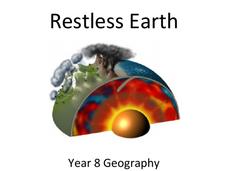
Restless Earth
In less than 25 years, the continent of Australia moved 4.9 feet thanks to plate tectonics. The presentation introduces the idea of the layers of the earth as well as plate tectonics. It goes into why the plates move and where we believe...
Curated OER
Earth Science Jeopardy
This jeopardy game has 5 categories and 5 point levels, and is designed with a section of hodge podge, geography, and earth science review questions. The questions are clear and the point selections are designed to darken once used.
World Maps Online
Introduction to the World Map
Students identify the differences between maps and globes. For this map skills instructional activity, students are shown a globe and a map and recognize the differences. Students use post-it notes to locate several locations on the...
Institute for Geophysics
Understanding Maps of Earth
Here is your go-to student resource on primary geography concepts, including facts about the surface of the earth and its hemispheres, latitude and longitude, globes, types of maps, and identifying continents and oceans.
NY Learns
Geography of the Fertile Crescent by ECSDM
Using Google Earth, a vocabulary assignment, and map handout, your class members will outline the Fertile Crescent in Mesopotamia and identify the source of the Tigris and Euphrates rivers. They will then complete graphic organizers...
California Academy of Science
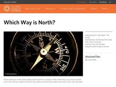
Which Way is North?
Who needs a compass to find cardinal directions? Just place a stick in the ground and record the movement of its shadow over the course of a day. Then, measure the shadow lengths in order to determine a north-south line. A simple...
Curated OER
Papier-Mâché Globe
Paper mache projects are great for using up paper from the recycle bin. Give your class the chance to create a three-dimensional globe out of paper mache. They'll work to make their globes as accurate as possible, adding proper colors...
Other popular searches
- World Map Earth's Biomes
- Geography Earths Crust
- Geography the Earths Crust
- World Map Earths Biomes
- World Map Earth's Bio Mes


