Curated OER
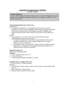
Exploring Wyoming Species Habitats
Students are introduced to the concept of species habitats and ranges. They introduced to ArcView GIS as a tool for mapping. Pupils use query data for species withina county, elevation, range, rivers and streams, land cover, and etc....
Curated OER
Volcano Contour Models Activity and Tracing the Highs and Lows in San Francisco
Learners investigate how to draw topographic contours and read topographic maps.They examine the topography of San Francisco and contrast the elevation of different points within San Francisco.
Curated OER
"Potato Mountain": Reading/Understanding Topographic Maps
Learners investigate how to read topographic maps. In this map reading lesson students complete a topographic map activity.
Curated OER
Velocity and Acceleration
In this velocity and acceleration activity, students determine the distance walked and the displacement of a person who walks 15 m west and 20 m east. Then they determine the resultant velocity of a bicyclist who rides 10 km/h west and...
Curated OER
Sun, Shadows, Surface Structure...and the Face on Mars
Learners use light and shadow information to make inferences regarding the three dimensional shapes of specific objects photographed on the surface of Mars. Limitations of the of the data provided are discussed and entries made into the...
Curated OER
Water, Water Everywhere
Students recognize that all of the water on earth cannot be used for drinking and that the percentage of ground and surface water is a small percentage. In this water lesson students identify ways to conserve water.
Curated OER
Mapping Potato Island
Students create their own topographical map using a potato. In this hands on lesson students construct a topographical map and explain what contour lines are using a potato.
Curated OER
The Heart of the Matter
Upper elementary pupils learn about the blood transportation system and anatomy of the human heart. They fill in an outline of the human heart (not included) focusing on the flow of blood to and from the heart. Using stethoscopes, they...
Curated OER
Hemlock Trees and the Pesky Pest, The Woolly Adelgid
Young scholars review Excel and how to create graphs with this program. They create two graphs in Excel, one showing the average number of woolly adelgid egg sacks on the outer 15 cm of hemlock branch at sites sorted by latitude, then...
Curated OER
Layers of the Atmosphere Foldable
Aspiring meteorologists make themselves a tool for reviewing the characteristics of each layer of the atmosphere. The procedure for this little project divides the paper into five sections, but many earth science teachers opt for the...
Curated OER
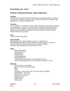
Food Safety Lab
Learners determine the optimal living conditions for yeast and apply these results to microbes in food. For this microbiology lab lesson, students observe the reaction of yeast to elevated temperatures. They relate these results to safe...
Curated OER
Topos, Compasses, and Triangles, Oh My!
Students triangulate using a compass, topographical (topo) map and a view of outside landmarks. They take a field trip to another location away from school and mark discernible landmarks (like mountains or radio towers) and changes in...
Curated OER
No Magic Borders: Haleakala Style
Students discuss borders and boundaries. They discuss pollution and the fact that boundaries cannot stop pollution and that pollution affects even protected wildlife and plants. They participate in an activity in which they must place...
Curated OER
Oregon Rainshadows
Students brainstorm list of possible highest locations in Oregon, identify and label places from list on map using color code, and discuss and identify causes of a rain shadow.
Curated OER
Meteorology Math
For this math and science worksheet, students calculate three temperatures at a given elevation when told the ground temperature. On two problems they are given the temperature at a specified elevation and students compute the ground...
Curated OER
Stargazers and Skywatchers
Students are introduced to the apparent motion of the Sun across the sky and the way it changes in summer and winter.
Curated OER
A View Of Home From The Front Door and From Space
Students discover how distance can change how our view of an object. Students build a representative model of where their home is located from different distances. They create three drawn models of their home from various elevations as...
Curated OER
Common Themes
Tenth graders test usefulness of a model Earth by comparing its predictions to observations in the real world. In this landforms lesson students construct an island from a contour map using model clay then analyze the landscape features...
Curated OER
Atmosphere
This is a very basic presentation of the layers of the atmosphere. It divides the atmosphere into four layers and pretty much only mentions the elevation and order of each. The last of seven slides shows a pie graph and data table of the...
Curated OER
The Effect of Tides & Elevation on Wetland Plant Communities
Students comprehend how tides can impact shoreline plant communities through the study of a freshwater tidal marsh. They use actual tidal data to show that tidal ranges differ among geographic locations, even those relatively close...
Curated OER
Mission Planning: Earth/Mars Comparisons
Students compare and contrast conditions on Mars to those on our own planet, specifically, their local or regional environments. The physical characteristics, the atmosphere, and other astronomical data is considered.
Michigan Sea Grant
Exploring Watersheds
Collaboratively, students partake in a hands-on activity in which they build models of a watershed. Each group member draws an elevation map—a bird's eye view—of their model and predicts how water will flow from the high to low points....
Curated OER
The Ups and Downs of Weight and Mass
Students explore the concept of mass, and how it differs from weight. They also calculate their weight change as they ride up and down on an elevator. They record the changes in their weight as the elevator moves
graph the collected data.
Other popular searches
- Angle of Depression/elevation
- Angle of Elevation
- Elevation Plans
- Boiling Point Elevation
- Elevation Maps
- Land Elevation
- Contour Maps and Elevation
- Elevation Relief Map
- Angles of Elevation
- Elevation Changes
- Map Elevation
- Plans and Elevations


