Cornell University
Constructing and Visualizing Topographic Profiles
Militaries throughout history have used topography information to plan strategies, yet many pupils today don't understand it. Scholars use Legos and a contour gauge to understand how to construct and visualize topographic profiles. This...
CK-12 Foundation
Topographic and Geologic Maps: Topographic Maps
Maps are great for helping you get where you're going, but what does that place actually look like? Geology scholars compare and contrast the features of topographical and geologic maps using an interactive lesson. The resource describes...
Carolina K-12
Preventing Voter Fraud or Encouraging Voter Suppression?
The issues of voter fraud and voter suppression are relevant in every election, local as well as national. Soon-to-be voters learn about a recent bill proposed in North Carolina, the Voter Information and Verification Act, and decide for...
Curated OER
Topos, Compasses, and Triangles, Oh My!
Students triangulate using a compass, topographical (topo) map and a view of outside landmarks. They take a field trip to another location away from school and mark discernible landmarks (like mountains or radio towers) and changes in...
Curated OER
MAPS AND TOPOGRAPHY
Students analyze the details of a topographic map and create one of their own by utilyzing a map of elevations.
Curated OER
High Temperature records by State
In this temperatures worksheet, learners view a spreadsheet of the high temperatures of the states and change the data on it using spreadsheet tools. Students complete 4 tasks.
Curated OER
Highest Mountain Countries Quiz
In this online interactive geography quiz worksheet, students examine the chart that includes the elevations of 20 world mountains. Students identify the names of the mountains in 4 minutes.
Curated OER
Powerful Pulleys
Students explore the building of a pyramid and how pulleys were used to change the direction of applied force. They demonstrate the mechanical advantage of using a pulley and apply it to modern engineering.
Curated OER
How Does My River Flow?
Young scholars create a river. In this water flow lesson plan, students predict how they think their river will flow and then construct a river box. Young scholars create a landscape for the river to flow through, let the river flow and...
Curated OER
Women and Sports
Students examine how women in sports has changed over the years. In this women in sports lesson plan students research the benefits of being active.
Curated OER
The World's Tallest Building
Students investigate the world's tallest buildings. In this architecture lesson plan, students discover how humans change the physical environment. Students read about and view pictures of famous buildings in the world. Students make...
EngageNY
Real-World Positive and Negative Numbers and Zero II
Continuing from the previous lesson in the series, scholars learn to use positive and negative integers to describe real-world situations. In groups, they come up with their own situations for given positive and negative integers.
Serendip
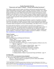
Homeostasis and Negative Feedback – Concepts and Breathing Experiments
More asthma attacks happen at higher altitudes, but why? Scholars complete worksheets, learning about homeostasis and feedback related to breathing. Then, they work in small groups to experiment with breathing in limited amounts of...
CK-12 Foundation
Latitude, Longitude, and Direction: Angle from the Equator
Which has the higher IQ, latitude or longitude? Longitude because it has 360 degrees! The interactive introduces the way latitude is measured and why it can never have more than 90 degrees. A handful of challenge questions encourage...
US Department of Energy
Go Far Cars Ramp: A Basic Ramp with Four Height Settings
Precise measurements make the job easier! One of the challenges when using an inclined plane for testing comes from pupils not using exact measurements. They often rely on books that slide or different ramp lengths when experimenting. By...
Curated OER
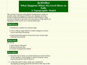
What Happens When Sea Level Rises or Falls
Students examine the impact of sea level on land formations. In this geography and map lesson plan, students construct a contour map model illustrating how much of the clay "coastline" is covered as water is added. Metric measurement...
Curated OER
A View Of Home From The Front Door and From Space
Students discover how distance can change how our view of an object. Students build a representative model of where their home is located from different distances. They create three drawn models of their home from various elevations as...
Curated OER
Generate an Accurate Landscape Profile from a Topographic Map
Students enerate an accurate landscape profile from a topographic map. They determine the correct interval needed to accurately graph the change in elevation on a single piece of graph paper.
Curated OER
The Ups and Downs of Weight and Mass
Students explore the concept of mass, and how it differs from weight. They also calculate their weight change as they ride up and down on an elevator. They record the changes in their weight as the elevator moves
graph the collected data.
Curated OER
Building a Topographic Model
Students explore the features of a topographic map. They make paper models that portray, in three-dimensions, features represented by contour lines on a topographic map. Students demonstrate different elevations shown on a...
Curated OER
Dough Lake Topology
High schoolers practice coordinates and measurements, develop 2D, 3D topological map, construct grid with string on real surface, establish "level" fixed point for measurements, take and record data points of elevation, and enter data on...
Curated OER
Emotional Speed with Balls and Ramps
Fifth graders investigate the relationship between mass and speed. In this physics lesson plan, 5th graders experiment with motion by being given a ramp, two balls, and blocks or books for elevation. Students determine how different...
Curated OER
Natural Selection: Exploring the 'Ohi'a Common Garden
Seventh graders examine natural variation by visiting the Ohi'a Common Garden in Volcano, Hawaii. In this natural selection lesson, 7th graders study background information about phenotypes, genotypes, and phenotypic plasticity before...
Curated OER
PBS - Scientific American Frontier:Affairs of the Heart:Teaching Guide:Exploring Vessel Physics
Students explore the relationship between pressure and vessel diameter. They are given an open-ended design challenge in which they engineer their own remote repair device. Students see a model that represents how elevated blood...


