Curated OER
Ancient Civilizations
Sixth graders complete map-work in order to understand the progression of hunter-gatherer societies. In this hunter-gatherer lesson, 6th graders label maps with the Equator, the Tropics, and the vegetation. They complete associated...
Curated OER
Where Is Cocoa Grown?
Students locate and identify cocoa-growing regions around the world. They discuss why it is grown there and how the climate and conditions needed are different from those in their hometowns. They play a true or false game about Ghana.
Curated OER
South America Puzzle
In this geography activity, students complete a crossword puzzle related to the countries, capitals, bodies of water, and populations of South America. They use the 23 clues given to solve the puzzle.
Curated OER
Vocabulary for Dimensions of the Earth
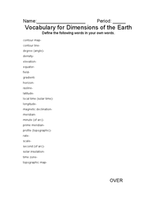
In this Earth dimensions worksheet, students define 24 terms associated with contour maps, latitude, longitude, and time zones.
Curated OER
Give Me Some Latitude
In this latitude instructional activity, students use an atlas or other reference to respond to 4 multiple choice questions about the equator and the poles.
Curated OER
Paper Mache Globes
Third graders create a paper mache model of the earth. At the conclusion of a discussion about the earth, they are given paper mache materials, they create their globe and appropriately draw and label landforms, bodies of water and the...
Curated OER
Locate and Name the bodies of water and the continents
Second graders locate the equator, bodies of water, and different continents on a globe. In this globe lesson plan, 2nd graders recall geographical information on a globe.
Curated OER
Learning About the Globe
Students examine the following terms to increase their geography skills: globe, equator, prime median, Western Hemisphere, Eastern Hemisphere, Northern Hemisphere, Southern Hemisphere, Pacific Ocean, Atlantic Ocean, and The United States.
Curated OER
Four Main Directions
Learners describe directions using a globe for north, east, south and west. In this mapping activity students identify the north and south pole. Learners understand the importance of the equator and the Prime Meridian. Students explain...
Curated OER
Hemispheres & Continents
Students learn in cooperative learning groups to determine how the equator and the Prime Meridian divide the earth into hemispheres and use Venn diagrams. Students will locate and label the hemispheres, continents, and oceans.
Curated OER
Surface Air Temperature Trends of the Caribbean
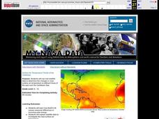
Students investigate the seasonal changes to sea surface and near-surface air temperatures near the equator. They use actual satellite data to track and graph the differences in air and sea temperatures during different seasons in the...
Curated OER
A Field of Stars
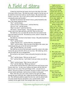
Students discover the earth can be compared to the shape of an apple, having a spherical shape, and has a north and south pole. They listen to the story, "A Field of Stars" and then observe as the apple is cut open on the equator to...
Curated OER
Lesson Design Archaeology- World Map
Learners practice locating positions on the world map. In this map skills lesson, students explore the world map and items such as the compass rose, Equator, mountains, cities, etc. The learners practice locating positions on the world...
Curated OER
Rotation Around the Sun
Third graders participate in a hands-on demonstration of the rotation of the earth around the sun. They identify the equator and the North and South Poles on a Styrofoam ball and then spin the ball on a pencil while they also revolve...
Curated OER
Community Cartography
Students use an inflatable globe which they wrap in plastic wrap. They use a permanent marker and outline the continents, and label major oceans and trace the equator. Students bring heir globes and use their projection for a discussion...
Curated OER
Day and Night
In this day night compare and contrast worksheet, students examine a picture of the earth and of the sun labeling day, night, equator, sun, North Pole, and South Pole.
Curated OER
Earth's Features
In this geography worksheet, students label a map of the world with the Arctic Circle, Tropic of Capricorn, Tropic of Cancer, Equator, North Pole, South Pole, and the Antarctic Circle.
Curated OER
Currently Warm
Seventh graders investigate how ocean currents affect climate. In this earth science lesson, 7th graders draw and label the current in their assigned ocean. They discuss how currents from the poles differ from the equator.
Curated OER
Seasons of the Year
Students examine how the link between the tilt of the Earth's axis to the ecliptic and seasons of the year--length of day, effectiveness of sunlight, polar day and night, and seasons south and north of the equator, as well as near it.
Curated OER
Learning Lesson: The Shadow Knows II
Students discover and practice how to calculate the circumference of the Earth. They measure the length of their shadows and use the distance they are away from the equator to complete the calculations. They discuss winter or summer...
Curated OER
Cool Coral Reefs
Young scholars identify, color and label the continents of the world and the equator. They identify and produce water temperature between 74 and 78 degrees. They identify and discuss the term polyps and construct a colony of polyps.
Curated OER
Circle the Earth - Explore Surface Types on a Journey around Earth
Students use CERES percent coverage surface data with a world map in locating landmasses and bodies of water at Earth's Equator.
Curated OER
Making a Globe
Students examine the mercator projection or nautical chart and observe how global maps do not have the same distance as flat maps. They design handmade globes using the meridians and equator as guides to draw in the land. They paint and...
Curated OER
Is it Really Winter in Australia? It is June!
The purpose of this activity is to determine how the location of a place on the Earth (hemisphere) determines what season that place is experiencing relative to the Sun's rays. Day one the learners will be introduced to the terms...
Other popular searches
- Equator Climate
- Hemispheres and Equator
- Prime Meridian and Equator
- The Equator
- Map Equator
- Social Studies Equator
- Equator Grade 2
- Equator, Hemispheres
- Equator Season
- Equator Activity Sheets
- Equatorial Guinea
- Equator Temperature


