Curated OER
Watershed Island
Students make a clay model and a geographic map of a watershed. They talk about the differences between the two representations and the potential human threats to watersheds.
Curated OER
Landscape Diversity in the Yukon Territory
Students review and analyze a satellite image of the Yukon territory.
Curated OER
Physical Features
Students draw physical land features using ClarisWorks or Kid Pix, write their definitions, create slideshow, and create class geography book.
Curated OER
Map Lesson Plan
Fourth graders locate and label major sites related to the Revolutionary War in the Hudson River Valley. They examine topographical features of each site and list a few of these features and list two advantages of each military site.
Curated OER
Geography of South America
Student's identify geographic features of a South American map. They use the scale of the map to calculate distances between points. They identify examples of the five geographic themes on the map of South America.
Curated OER
Your Neighborhood Geography
Tenth graders observe geographical characteristics of their own neighborhoods. They take digital pictures and write a summary of the geographical features they find which they present to the class.
Curated OER
Geographic Features of the East Coast
Fourth graders view a map of the thirteen colonies and discuss why the people who came from England built towns along the Atlantic coast. They read the directions on the worksheet and underline words in the question that ask them to do...
Curated OER
GIS and Agriculture
Students are introduced GIS systems and how they operate. Using a GIS system, they locate and map the various types of agricultural products grown in Oregon. They rank each county based on the amount of agricultural products produced and...
NOAA
A Watery World
With about 70% of the earth's surface covered in oceans, it's fair to say that we live in a very wet world. Young scientists gain a better appreciation of this fact as they use maps to identify the world's ocean basins in the first...
Geophysical Institute
Latitude and Longitude with Google Earth
Travel the world from the comfort of your classroom with a lesson that features Google Earth. High schoolers follow a series of steps to locate places all over the earth with sets of coordinates. Additionally, they measure the distance...
Curated OER
Mountains and Beach
Students discover the world of geography, assessing new geographic terms and combining them into one colorful scene. They complete their scenes and exchange them with a partner to name the geographic features illustrated in their...
Curated OER
Train Across Canada
Students are taught the historic and contemporary significance and routes of both freight and passenger railway systems in Canada. They study the Canadian terrain and identify its varied geographic features. Students depict a 3-D train...
Curated OER
Geography Color: Island
In this coloring geography instructional activity, students identify the picture of an island. Students then color the island and write a definition for the geographical feature.
Curated OER
Sub-Saharan Africa: Physical Geography
In this geography skills worksheet, learners respond to 22 short answer and map skills questions about the location and geographic features of sub-Saharan Africa.
Curated OER
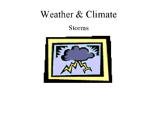
Weather and Climate: storms
The main types of storms are described in this presentation and characteristic facts are given. The main details thunderstorms, tornadoes, hurricanes and winter storms formations are listed. Geographical features that affect weather...
Curated OER
Exploring Canadian Cities - a Day To Remember
Students research information on the geographical features, climate, and cultural activities of a Canadian city. They plan a day in the city with a schedule of activities. They synthesize information and create a large poster about the...
Curated OER
Map It!
Fourth graders demonstrate map making skills by using the computer to create maps of the geographic features, regions, and economy for their state.
Curated OER
Geography And The Gulf War
Students develop maps, tables, graphs, charts, and diagrams to depict the geographic implications of current world events, and analyze major human conflicts to determine the role of physical and cultural geographic features in the...
Curated OER
China - the Geography of European Imperialism - Spheres of Influence in China
Ninth graders create a map of China. They identify the various spheres of influence carved out by the Imperialist powers of Europe as well as locating geographical features of china and major cities. They explain the global impact of...
Curated OER
Colonial America and Roots of Government
Students identify 50 States and the major geographic features, regions, and political representation of each. In connection, they investigate the causes and effects of European colonization on North America. They identify the formation...
Curated OER
The Ruins of Pompeii: A Window into History
Sixth graders research the history of Pompeii and its destruction. Locate important geographical features of Rome. Gain insight into the past through archaeological interpretation. Synthesize historical information through imaginative...
Teachers' Curriculum Instituted
The Roman Record
Using Google Earth, Google Docs, and other Google Tools, collaborative groups of seventh graders research and then create and share online newspapers reporting on the early development, geographical features, political issues, and family...
Environment Agency - Abu Dhabi
Find the Most Spectacular Volcanoes in the World!
Heat things up in your earth science class with this collaborative lesson plan on volcanoes. After first being introduced to the different types of volcanoes and how they are formed, young geologists work in small groups to research the...
National Geographic
Mapping the Americas
Celebrate the geography of the Americas and develop map skills through a series of activities focused on the Western Hemisphere. Learners study everything from earthquakes and volcanoes of the Americas and the relationship between...
Other popular searches
- Egypt Geographic Features
- Geographical Features of Utah
- Geographic Features of Congo
- World Geographical Features
- World Geographic Features
- Earth Geographic Features
- Geographic Features Map
- Egypts 3 Geographic Features
- Africa/geographical Features
- Missouri Geographical Features


