National Wildlife Federation
Massive Migrations
Turn your students into flocks of migratory birds for this fun lesson on animal migration. Prior to the activity, the teacher creates four different migration routes in the classroom or any available open space, labeling nesting...
Environment Agency - Abu Dhabi
Plate Tectonics
Young scholars observe a presentation on plate tectonics, layers of the earth, and plate boundaries. They then use the Internet to research major plates and label them on a world map.
Curated OER
Identifying Continents and Oceans
Students locate and identify the four major oceans and the seven continents on a world map. They use an unlabeled world map and compass rose to describe relative locations of the continents and oceans.
Curated OER
World Oceans
Learners locate the world's oceans. In this geography skills lesson, students chart the locations of the Indian, Arctic, Pacific, and Atlantic Oceans on world maps.
Curated OER
Rivers Run Through It
In this mapping practice worksheet, 5th graders read an informational paragraph and answer 7 questions about the parts of a map along with places shown on a given map.
Curated OER
Locating Patterns of Volcano Distribution
Students examine patterns of volcanic distribution worldwide, use tables to plot and label location of each volcano on map, lightly shade areas where volcanoes are found, and complete open-ended worksheet based on their findings.
Curated OER
Zones of Conflict
Students read maps and identify specific countries involved in conflict. They classify countries in cultural realms. They relate maps to what they know about world conflict.
Curated OER
New Perspectives
Students examine maps that are designed to give different perspectives. They create mental maps that illustrate their own perspectives and those of people from other parts of the world.
Curated OER
ADULT ESOL LESSON PLAN--Environment and the World
Students locate and trace Florida on a United States map as well as their local counties and city of residence on a state map. In addition, they label all the directions north, south, east and west on each map.
Curated OER
A Place Called Fairfax
Students use maps to locate Virginia, its surrounding states and Fairfax County. Individually, they describe the absolute and relative location of the county and why it is important to know both. As a class, they brainstorm the...
Curated OER
A Place Called Fairfax
Students are introduced to the various types of maps of Fairfax County, Virginia. Using the maps, they explain the relative and absolute locations of the county and discuss the importance of both. They also discover how the county is...
Curated OER
Knowing Where You Are
Learners work together to research the names of places in their state. They divide up their state so that each group can research a different section and complete a chart of the different names. They create a key for the map to explain...
Curated OER
What Do You Know About Oceans?
Students brainstorm and discuss what they know about oceans and seas, read poem My Ocean Speaks by Olga Cossi, discuss narrator's feelings about ocean, write reflective journal entries about their experience or inexperience with the...
Curated OER
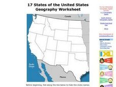
17 states
In this states worksheet, students label states in the United States that are on the west side of the country. Students label 17 states.
Curated OER
Countries of the World
Students in a ESL classroom examine a world map and study the various countries' names. The study the cultures of selected countries and create a vocabulary list. Finally they label an empty map with the countries' names and a short...
Curated OER
The Continents and Oceans of the World
Students explore world mapping skills. In this world geography lesson, students identify and label the continents and oceans on a world map using the Visual Thesaurus. Students generate mnemonic devices to help memorize these terms.
Curated OER
Where In the World Are You?
Fourth graders fill in blank copies of the United States Map and then the World Map.
Curated OER
European Climates
Ninth graders study the climate regions of Europe. In this geography skills instructional activity, 9th graders determine how weather and climate are influenced as they research the climate zones of specific locations and write about the...
Curated OER
Finding Your Spot in the World
Students practice locating places on a Thomas Brothers map. In this map skills lesson, students locate places on the map of where their ancestors are from and then practice finding various community places on a map. Students graph the...
Curated OER
The Edge of the Lake
Second graders explore the geography of Nevada. In this map-making instructional activity, 2nd graders use salt dough to create a relief map of Nevada. Students label the landforms and bodies of water that are studied and specified in...
Curated OER
Plotting the Ocean Floor
Fourth graders plot points on a graph, connect the dots to make the ocean floor profile and label the topographical features. They utilize a worksheet and a website imbedded in this plan to plot the ocean floor.
Curated OER
Africa
Students complete various activities related to the continent of Africa. They label and color a map of Africa, sing the Continent Song, view pictures and discuss animals of Africa, listen to the book "Bill and Pete Go Down the Nile,"...
Curated OER
The Birmingham River System
After a lesson on geography and the features of a river, students view a map of the Birmingham river system, which is in England. They are then asked to label 4 features on the map.
Curated OER
Geography and World Music
Students are able to demonstrate the ability to identify, contrast and compare the music of different places and regions, and the ability to recognize music as a resource for information about places and regions.


