US Environmental Protection Agency
Protecting Your Drinking Water
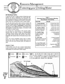
Having a clean, reliable source of drinking water is essential for any community, but in many cases this is easier said than done. Engage young environmentalists in exploring the five factors affecting vulnerability of a groundwater...
Australian Government
The Great Artesian Basin
Covering 23% of the continent and holding 64,900 cubic kilometers of water, the Great Artesian Basin is the primary source of water for much of inland Australia. Using detailed student worksheets, experiments, and case studies,...
Curated OER
The Hot Spot Hypothesis
Students use a digital atlas, geologic maps, and topography maps to explore geologic regions of Yellow Stone National Park. They locate evidence that support the theory of hot spots. Students research and explore the movements of Hot...
Curated OER
Interior of the Earth
Sixth graders identify and describe the composition and physical properties of the layers of the Earth. They also explain how scientists used the scientific process to know about the center of the Earth. Finally, 6th graders read a...
Curated OER
Discovering New Mexico
Seventh graders discuss the elements of maps and using basic linear measurement. They calculate the distance between the cities and create a simulated journey around New Mexico using a road map. They write out the directions for their...
Curated OER
Mineral Exploration Using Remote Sensing
Students use quantitative data that they gather to figure out where there is an ore body in their model. They describe how geologists could use similar information in order to figure geologic patterns and geologic history for a specific...
Curated OER
Earthquake Depth
Students research and locate earthquake epicenters on a map using latitude and longitude. They determine if the depth of an earthquake has any relationship to the distance from a plate boundary.
Curated OER
History of the West using the Digital Atlas
Students navigate the digital atlas of Idaho. They research the unique features of south central Idaho and the geological events which have shaped it over the past 17 million years. Afterward, they write an essay on an aspect of changes...
Curated OER
Geography Worksheet
In this geography skills worksheet, students respond to 14 short answer questions by using maps and atlases. The maps and atlases are not included.
Curated OER
Design an Island
Students make a map of an imaginary island using the topographic symbols provided from a worksheet. Students place lakes, dwellins, reefs, etc. in areas where they would logically be located from understanding how the topography of an...
Curated OER
Japan's Geography Worksheet
In this geography skills activity, students label a map of Japan and then respond to 8 short answer questions about the country.
Curated OER
Volcano Contour Models Activity
Students experiment with water levels and plastic topographic volcano models to determine the contour lines that would be used to create a topograpohic map of a volcano. They use the traced lines to actually develop the map.
Channel Islands Film
Island Rotation: Lesson Plan 3
How far have California's Channel islands moved? What was the rate of this movement? Class members first examine data that shows the age of the Hawaiian island chain and the average speed of the Pacific Plate. They then watch West...
Curated OER
Mapping Where Animals Live
In this animal mapping worksheet, learners read a short passage about amphibians and reptiles in New York State, then use a set of maps to answer related questions.
Curated OER
Investigating Earthquakes: GIS Mapping and Analysis
Students describes the technique of preparing "GIS-ready" data and shows how to map that data and conduct basic analyses using a geographic information system (GIS).They use latitude and longitude fields to plot the data in a GIS and...
Curated OER
Classify Rocks
Young scholars classify different types of rocks. In this earth science instructional activity, students test different rock samples and construct a chart to record observations. They create a concept map that answers essential questions.
Curated OER
Geology of Yosemite
Students are shown slides of Yosemite and explore how the valley was formed by performing an experiment. Instructions on how to set up the lab are included. They can be assessed orally or by writing a report on the outcome of the lab.
Cornell University
Constructing and Visualizing Topographic Profiles
Militaries throughout history have used topography information to plan strategies, yet many pupils today don't understand it. Scholars use Legos and a contour gauge to understand how to construct and visualize topographic profiles. This...
Curated OER
Natural Resources
Learners explore Iowa geography and topographic maps. In this geography and topographic maps lesson, student investigate maps, newspapers, Iowa flora and fauna. Students gain an understanding of how different landforms can be identified...
Curated OER
Design an Island
Students explore islands. They create a two- or three-dimensional map of an island. They explain how the topography of an area influences the location of water sources, ecosystems, and human settlements. Lesson includes adaptations for...
Science Matters
Wattsville and Mercalli Booklet
There has been an earthquake! Can you listen to the description of damage given by callers in order to determine the epicenter? The 11th of 20 lessons has pupils read a script of one emergency caller. The class records the information on...
Curated OER
Mining in a Nutshell
Your class will love this geology-inspired set of activities that demonstrate the processes through which we are able to use mineral resources. They describe the major steps that a company must follow from initial discovery of a mineral...
Curated OER
Ping!
Using "mystery bathymetry" shoeboxes, young explorers simulate sonar action to map out the topography of an un-viewable landscape. This classic activity helps physical oceanography learners understand how sonar works. It would be...
Curated OER
A Geological Puzzle
Students compare and contrast the various types of rocks on each continent. In groups, the calculate the rock ages and types to determine if the continents, in their opinion, were joined at one time. They develop two imaginary...
Other popular searches
- Geologic Mapping Loveland
- Geologic Mapping of Loveland
- Geologic Mapping Love Land
- Creating a Geologic Map
- Geologic Mapping of Love Land
