New York State Education Department
Global History and Geography Examination: June 2016
Assess scholars' knowledge of the changing borders in Germany during World War II with a test that includes both multiple choice and essay questions.
Curated OER
The Treaty of Versailles: An Outside Perspective
In this World War I worksheet, students read an article about the Treaty of Versailles and examine 2 maps. Students then respond to 8 short answer questions based on the information.
Curated OER
Sixth Grade Social Studies Quiz
In this social studies instructional activity, 6th graders complete multiple choice questions about economics, climate, maps, and more. Students complete 15 questions.
Curated OER
This Land is Your Land
Learners consider the concept of borders and their development by looking at maps and documents. They create a presentation highlighting a current border dispute and propose solutions.
Curated OER
Geography - Mapping the Holocaust
Eighth graders map the important locations of the Holocaust. In this Holocaust instructional activity, 8th graders research the location of countries involved in the Holocaust as well as the location of concentration camps. Students mark...
Curated OER
A Month of Mapping Literature
Explore the world through literature! With push pins to mark where each story came from, learners examine cultural differences, geographical location, and how those elements affect story content. This lesson could use deeper development,...
Curated OER
World War I - The War Ends
Your class is in for a treat with this outstanding PowerPoint on World War I. The presentation is loaded with facts, maps, important personalities, and discussion questions on the war. Additionally, there is a wonderful video called,...
Curated OER
World War I
Using maps, diagrams, and lists, this resource is a wonderful way to review the main concepts involving WWI. There are charts with a comparison of imperialism and nationalism, and other key ideas that explain how Europe plunged into this...
Carnegie Mellon University
International Perspectives to Climate Change 1
After a lecture about how the first industrial revolution triggered the path to climate change, your environmental studies class discusses what the impacts are. In a culminating activity, they get into groups and identify countries on a...
Curated OER
Traveling Cat Flown Home to Family
Students locate Wisconsin and Belgium on a world map, then read a news article about a cat that stowed away on ship from the U.S. to Europe. In this current events lesson, the teacher introduces the article with map and vocabulary...
Curated OER
Anne Frank: One of Hundreds of Thousands
Middle schoolers conduct research to put Anne Frank's diary into historical context. They use maps, timelines, essays and websites to examine the early victories of the German army, paying special attention to the Netherlands and...
Curated OER
How Has Colonialism Led to Multilingualism in Africa
Prepare yourself for a top-notch presentation on colonialism in Africa! Discussed are the reasons for African multilingualism. Maps and a country-by-country look at various colonists that made their mark on the African continent are...
Curated OER
Project Map: Latitude And Longitude Worksheet
In this latitude and longitude worksheet, students find the coordinates of 14 cities around the world and use this information to complete 14 short answer questions. This worksheet includes online atlas web links.
Curated OER
NATO Geography & Language
The class receives background information on NATO, an atlas, and a blank world map. They color the original 1949 countries in red, the 1952 additions in green, and the 1990 additions in blue. This exercise would be a good starting point...
Curated OER
Victory in Europe, 1944-1945
Students examine the overall strategy pursued by the Allies in the final moths of World War II in Europe by examining military documents and consulting an interactive map of the European theater.
Curated OER
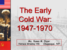
The Early Cold War: 1947-1970
With a combination of images, maps, and valuable information, this presentation is a strong resource for a history class that is coming out of a WWII unit and into a Cold War unit. Some points are outlined for students, while others are...
National Endowment for the Humanities
How "Grand" and "Allied" Was the Grand Alliance?
Learn more about the Grand Alliance with a scaffolded lesson plan that includes four activities. Class members use primary sources to complete a map exercise, understand the goals and objectives of each individual nation, and participate...
Classics for Kids
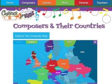
Composers and Their Countries
How many of the world's greatest composers were born in Austria? Or Germany? Or the United States? An interactive map provides young musicians with information about prominent composers in the last few centuries, as well as the periods...
Curated OER
The Cold War (1945-1991): An Ideological Struggle
Covering the main topics of the Cold War, including some excellent discussion points on the methodologies of the Soviet and Eastern Bloc nations versus the US and Western Democracies, this presentation is a good way to introduce the...
Curated OER
The Geography & Peoples of Europe
Extremely throrough and informative, this presentation details many aspects of European geography and demographics, including natural resources, climate, topography, and population distribution. This slideshow would be an excellent...
Curated OER
Europe 1914
In this Europe 1914 map worksheet, pupils note the 9 regions of the Europe labeled on the map and their relevance to World War II.
Echoes & Reflections
The Ghettos
Young historians examine primary sources, including diaries, poems, and photographs, to consider the conditions in the ghettos and how they fit into the escalation of the Third Reich's plot against the Jewish people.
Echoes & Reflections
Rescuers and Non-Jewish Resistance
What does it mean to be a rescuer during the time of the Holocaust? Learners consider the role of those who resisted the Nazi invasions, including hiding Jewish people, throughout Europe. Activities include listening to the testimony of...
Echoes & Reflections
Studying The Holocaust
While many young scholars are familiar with the Holocaust, they may not understand the specific history that led to the unprecedented atrocity. The first lesson in the unit helps teachers gauge their pupils' background knowledge. A...
Other popular searches
- Map of Germany
- Map of Germany 1933
- Outline Map of Germany
- Picture Map of Germany
- Germany Map Study
- Germany Map Activity


