Curated OER
GIS and Agriculture
Students are introduced GIS systems and how they operate. Using a GIS system, they locate and map the various types of agricultural products grown in Oregon. They rank each county based on the amount of agricultural products produced and...
Curated OER
Indiana Tornado Project
Students become familiar with the use of GIS for research, natural phenomena in Indiana, and analyzing collected information.
Curated OER
Rivers And Capitals
Students become familiar with the use of GIS for research and become aware of the importance of rivers to cities. They also analyze the placement of cities and learn the names of rivers in the United States.
Curated OER
What Is That Bubblin' In My Back Yard?
Pupils are introduced to the GIS system. They create a map plotting local sites the Environmental Protection Agency has on its EPA Regulated Sites list. They identify a list of schools that are near potentially hazard sites.
Curated OER
Can You Give Me Directions To the Game?
Students become familiar with the use and capabilities of GIS and use it for research and mapping purposes. They heighten their ability to estimate travel times by incorporating distance, mode of travel and urban congestion into the...
Curated OER
The Hajj: Muslim Pilgrimage in a Geographic Perspective
Students read information on the Hajj. They discuss pilgrimage and ways it differs from going to a church, mosque or synagogue. Students discuss logistical problems that might be posed for the host country of a pilgrimage. Students do an...
Curated OER
Got Park? Or if you build it, they will come!
Students use GIS and GPS technology to evaluate, research, locate, and recommend where a new park should be located that benefit the community.
Curated OER
The American Trail System
Learners research a trail system. They create a display board of the trail system, generate a map of the trail system, and develop a commercial advertising of the trail system. They design a display board featuring facts about the...
Curated OER
Exploring Folk Traditions and Folk Beliefs
Ninth graders work together to brainstorm an idea to focus on the similiarties and differences between various cultures. Individually, they interview family members using questions they created based on their topic. They use their...
Earth Day Network
The Neolithic Revolution
With the abundance of food products we can easily access in our society today, it is easy to forget the toll this can take on our global environment. Young learners will discover how the transition to agriculture and domesticated living...
Curated OER
Comparing Kwakiutl, Cheyenne and Navajo tribes
Third graders study the difference between the Kwakiutl, Cheyenne and Navajo tribes. They identify the people, resources, lifestyle and beliefs of the Kwakiutl, Cheyenne, and Navajo Indians. Afterward, they present their projects on each...
Curated OER
Indiana Tornado Project
Students become aware of the number of tornadoes that impact Indiana. They explore basic facts about tornadoes. Students use the GIS for research. They explore that natural phenomena in Indiana. Students become familiar with...
School Improvement in Maryland
Smart Growth
New roads, new businesses, new developments, new mass transit systems. All growth has both positive and negative effects on communities. Government classes investigate the principles of Maryland's 1997 Smart Growth program and the...
Curated OER
Mapping School Grounds
Students map and analyze the natural and cultural environment of the school grounds. In small groups, they sketch the natural and cultural features of each side of the school building, create a map, participate in a class discussion,...
Curated OER
The Mountain Community: Why Flagstaff?
Students identify geographical features that hindered or promoted settlement in the city of Flagstaff, Arizona. In this settlement lesson plan, students write a summary of what they learned and identify geographical features on a map.
Curated OER
Is Urban Sprawl Causing Us To Lose More Than Ground?
Pupils map the changes that occur in the land as a result of urban sprawl. They explore the problems that paving and building have on the watershed and the habitats on the Northshore.
Curated OER
Operation Genesis
Students, while working in groups under the Operation Genesis project involve fictional elements of role playing to grasp geographic concepts concerning human/environment interaction. They create the physical features of a fictional...
Curated OER
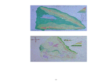
A Contouring We Go
Students examine the built environment and infrastructures of their community by constructing contour equipment, using the equipment, and comparing their results to current topographical maps of the same area
Curated OER
Early Explorers
Fifth graders study early explorers. In this World history lesson, 5th graders draw an outline of a map labeling each part, build geographical features out of dough, and paint each of the land and water features.
Curated OER
Development Issues in the Northern Suburbs
Students demonstrate the ability to obtain geographic information from a variety of print and electronic sources. They use a variety of maps and data to identify and locate geographical features of Minnesota and Anoka County. in...
Curated OER
Great Lakes at Stake
Students explore conservation of the Great Lakes. For this geography and ecology lesson, students identify the Great Lakes on a map and view a video depicting the history and importance of these lakes. Students work in groups to research...
Curated OER
World War II - War Comes to Hawaii
Ninth graders use geographic representations to organize, analyze, and present information on people, places, and environments. They use tools and methods of geographers to construct, interpret, and evaluate qualitative and quantitative...
Curated OER
Greeks Around the World: A Case Study on Greek Diaspora
Learners gain an understanding of the concept of Diaspora relating to Greeks. They use guided discovery to apply the geographic inquiry model to an examination of the reasons for Greek Diaspora.
Curated OER
Reading the Landscape in Children's Literature
Students identify geographical information about landscapes found in student literature, demonstrate an organizing tool, developed around geographical themes, for the recording of information, and share uses of this approach.


