BrainPOP
Latitude and Longitude Differentiated Lesson Plan
Scholars warm-up their map skills with a discussion using location words to describe familiar places. An engaging video informs class members about latitude and longitude. Three leveled activities extend the learning experience for...
Curated OER
Map Coordinates: Monkey Map
Here's an engaging, meaningful, and clever lesson on map skills for elementary schoolers. Pupils combine story writing with mapping skills to create an original piece of work. They utilize a worksheet embedded in the plan to guide them...
Curated OER
Playground Mapping
Students convert their physical models of a playground from a previous lesson into a map of the playground that includes a scale and key. They examine and discuss examples of maps, view an image to map photo essay, and create a map using...
CK-12 Foundation
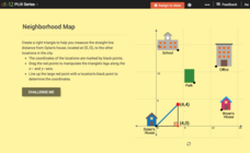
Pythagorean Theorem to Determine Distance: Neighborhood Map
Find the distance between various locations in a neighborhood. Scholars use the interactive to find distances between locations on a map. The map is overlaid onto a grid to provide coordinates for each location, and pupils apply...
Curated OER
Map Your School
Learners participate in a project to map their school. They measure and graph various areas around the school. Young scholars find the longitude and latitude of the school and research the school's history, and highlight special...
Curated OER
Introducing Maps Through Dance
Students are introduced to the key concepts of maps; direction, pathway/line, shape and symbol. They create the pathways and shapes they have "mapped" out on paper on the floor. They dance along the paths.
Curated OER
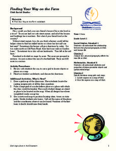
Finding Your Way on the Farm
Third graders make a grid map. In this directionality lesson, 3rd graders review how to use a grid to locate objects or places on a map. Students draw a grid map of the classroom and locate seating assignments. Students create a grid of...
Teach Engineering
What is GIS?
Is GIS the real manifestation of Harry Potter's Marauders Map? Introduce your class to the history of geographic information systems (GIS), the technology that allows for easy use of spatial information, with a resource that teaches...
Curated OER
Landscape Picture Map: Making a Map Grid
Students create a map grid system. In this map lesson, students discuss how mapmakers use a grid system to make giving directions easier. Students learn how the grid system works and create a grid system on their landscape pictures.
Curated OER
Planning a Garden Using a Grid
Third graders plan for a garden. In this garden planning lesson plan, 3rd graders investigate the use of a grid to accurately map out and plan for a vegetable garden. Students predict the space requirements for different vegetables.
Teach Engineering
What's Wrong with the Coordinates at the North Pole?
Here is an activity that merges technology with life skills as individuals use Google Earth to explore the differences between coordinate systems and map projections. The self-guided worksheet is the fourth segment in a nine-part unit....
Curated OER
Using the Landscape Picture Map to Develop Social Studies Skills
Enhance your class' geography skills using this resource. Explore a variety of concepts including production and distribution, and people and the environment. Learners make predictions and identify locations on maps. This is a creative...
CK-12 Foundation
Direction on the Earth: Using a Compass
Navigate the world of orienteering in an informative interactive. Earth science scholars learn practical direction skills, such as proper polar coordinates and pairing compasses with maps. The interactive map allows them to practice...
Curated OER
Map Skills
Do you need to practice map skills? Children with a range of abilities will complete a KWL chart about maps, practice important map vocabulary and then read a few pages from their textbook. They will use their vocabulary words and...
K-State Research and Extensions
Water
How are maps like fish? They both have scales. The chapter includes six different activities at three different levels. Scholars complete activities using natural resources, learn how to read a map, see how to make a compass rosette,...
Curated OER
Grid Frame Mapping
Students map and describe small area of the schoolyard and discuss habitats.
Curated OER
Cemetery Mapping Lesson
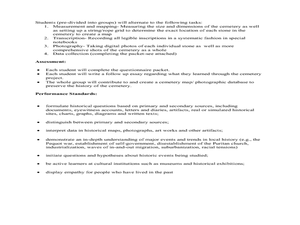
Eighth graders explore historical records. In this cemetery mapping lesson, 8th graders analyze local community data as they examine gravestones and read epitaphs.
Curated OER
Me on the Map Lesson 1
Students use maps, globes, geographic information systems and other
sources of information to analyze the nature of places at a variety of scales. They identify on a map and determine the population
of the city, county, state, country...
Curated OER
Where Am I: How to Read a Map
Third graders develop an understanding of maps. They explore what a map is, who uses maps, and how to use maps. Students investigate the compas rose. They create a compose rose which illustrates the cardinal directions. Students practice...
University of Southern California
What Is The Ocean?
Go on a tour of the ocean through the lens of a scientist. Learners read maps of the ocean floor, study tide behavior, examine wave motion, and analyze components of soil. Each lesson incorporates a hands-on component.
Curated OER
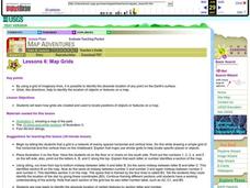
Map Grids
Students examine how grids are created and used to locate positions of objects or features on a map.
Curated OER
Plotting Earthquakes
Students plot earthquakes on a map. In this instructional activity on earthquakes, students will explore recent earthquake activity in California and Nevada. Students will plot fault lines and earthquake occurrences on a map.
Curated OER
Important Decisions Don't Just Happen! Using Data to Plan Your Services
Students interpret statistics. In this data instructional activity, students examine and organize given data. They present the data in a grid format. Using the census data, students determine the best location for a...


