Curated OER
Creating a Database: Africa, Technology, Social Studies
Students use technology to create a database demonstrating their knowlede (in the case) of the African Continent. This project could be applied to almost any other concept studied.
Annenberg Foundation
Teaching Geography: Workshop 4—North Africa/Southwest Asia
Can Jerusalem be equitably organized? Can Israel and Palestine be successfully partitioned? Part one of a two-part workshop looks at the geo-political history of Jerusalem while Part two investigates Egypt's dependence of the Nile River...
Curated OER
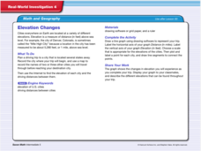
Real World Investigation- Math and Geography- Elevation Changes
For this math and geography real world investigation, 6th graders plan a driving trip to a city that is located several states away from their home while recording the elevations of three cities that are included in the trip. They use...
Curated OER
Exploration Activities
Students examine the stages in finding, removing, and processing mineral resources. They participate in the "Exploration Hunt" and "Leasing Mineral Rights" activities to better get a handle on their studying.
Curated OER
Parliamentary Structure and Process on " Deck"
Tenth graders design a "deck" of individual slides on Power Point to synthesize, in a graphic organizer, their recently acquired knowledge of different levels of government in Canada.
Curated OER
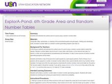
ExplorA-Pond: 6th Grade Area and Random Number Tables
Sixth graders estimate surface area of a pond using a random number table.
Curated OER
Design Your Own Building
Students explore the use of design principles in the real world. They evaluate how problems can be solved using design principles. In groups, students design the floor plan for a building of their choice.
Curated OER
Angles - Unlocking Geometry
Students investigate the concept of angles and how they are used in geometry. They construct polygons using various types of angles and then classify them according to their physical properties. Students use a computer program in order...
Alabama Learning Exchange
The Sun and the Earth
Third graders study and diagram the positions of the Earth and sun during the four seasons. They predict weather for cities in the northern and southern hemispheres.
Curated OER
My Own Private Idaho; Using Social Studies to Explore Idaho
Students engage in several activities to explore Idaho and Social Studies themes. Using an variety of media, students become familiar with Idaho's geography and geology.
Curated OER
Cherishing the Water of Life
Learners work in small groups to brainstorm a list of all creatures, plants, natural, and artificial processes that use or depend on fresh water. The class views an aquarium filled with water representing all the water in the world. The...
Curated OER
Where in the World...?
Students use longitude and latitude to locate various cities, regions, landforms, and bodies of water around the globe. They use The New York Times Learning Network's crossword puzzle 'Longitude and Latitude' to sharpen their atlas skills.
Curated OER
Atlas Scavenger Hunt
Learners discover what type of information in an atlas by participating in a scavenger hunt. With a partner, they try to find the answers to many questions as possible. They exchange their papers with another partner group and check...
Curated OER
Cities as Transportation Centers
Middle schoolers work in small groups to identify some of the major transportation centers, recommending two as possible sites for a national political convention, based on population density and the travel networks available in 1835.
Curated OER
Using Geometric Shapes To Make Patterns
Sixth graders explore the use of shapes to create geometric patterns. they start with a simple example of dividing shapes in half to create two new ones. This can be extended to creating intricate patterns.
Curated OER
The Plains Indians
Students have a better understanding of another culture other than their own. This help them to see that there were other people living in this region before us.
Curated OER
A Phylogenetic Perspective for the Cladistically Challenged
Students use M&Ms to simulate radioactive decay of elements.
Curated OER
Translating Transformations in Geometry
Students create an image using given coordinates and evaluate how the coordinates change when a slide or rotation takes place.
Curated OER
Fourths of Sets
Students create a set of cards that represent factors of four and use these cards to play a game in which they practice separating numbers into fourths. They first practice separating numbers into fourths with a projected computer...
Curated OER
The Geography of Aboriginal Languages in Canada
Middle schoolers study the relationship between geography and the Aboriginal language communities.
Curated OER
Heritage: Make a Model of a Typical Utah Settlement
Fourth graders examine the different types of settlements used in Utah. They take a community map of Utah past and present and compare the two. They create a model of the early types of settlements used by pioneers in Utah.
Curated OER
Discovering the Past Using the Future: Remote Sensing and the Lost City of Ubar
High schoolers identify and locate specific locations on the Arabian Peninsula, the Rub al Khali Desert, and present day Oman. They identify other names for the lost city of Arabia as Ubar, the Atlantis of the Sands, Iran, and the city...
US Geological Survey
U.s. Geological Survey: Teaching About and Using Coordinate Systems [Pdf]
Provides lessons and activities for teaching about the different types of coordinate systems including the Cartesian coordinate system, the Geographic Coordinate System, the Universal Transverse Mercator grid, and the State Plane...
Alabama Learning Exchange
Alex: Coordinate Geometry
Students will participate in several activities that will build their knowledge of coordinates graphing. Students will use ordered pairs to locate points on a grid. Students will also relate coordinate graphing to the real world through...







![U.s. Geological Survey: Teaching About and Using Coordinate Systems [Pdf] Lesson Plan U.s. Geological Survey: Teaching About and Using Coordinate Systems [Pdf] Lesson Plan](https://d15y2dacu3jp90.cloudfront.net/images/attachment_defaults/resource/large/FPO-knovation.png)
