Curated OER
Absolute and Relative Location
Second graders understand the difference between relative and absolute location using the grid map as an example of an absolute location. They observe a class map showing longitude and latitude lines and learn that they provide exact...
Curated OER
Lagoon Lake
Students develop skill in using co-ordinates. Up to eight cardinal points of the compass are used making this a useful activity in simple map and grid work. They utilize educational software to gain practice.
Benjamin Franklin Tercentenary
From Ben’s Pen to Our Lives
What would Ben do? Jumping off from the pseudonymous letters Ben Franklin fooled his older brother into publishing when he was still a teenager, young literary lovers dive into acting, writing, and addressing a local issue with wit and...
Curated OER
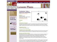
Footprints: Take a Step into Estimation
Compare sizes of student footprints with those of elephants and sauropod dinosaurs! Upper graders make estimations of the areas of irregular shapes; students use grids to make and explain estimates within low and high ranges.
Bowland
Outbreak: Infection Detection
Explore the mathematics of infection outbreaks with activities that ask learners to use coordinate grids to locate infected patients. They calculate amounts of ingredients for antidotes and determine which groups of people should be...
Curated OER
Bird and Dog Race
Your pupil's pet dog and bird are racing down the city streets. In order to know who is going to win, they better know something about calculating rates, the Pythagorean Theorem, and applying those topics to the map of the city.
Curated OER
Cartography Project
A lesson involving mapping, the use of a compass, writing and following directions, and exploring the first two themes of geography is here for you. Learners create original maps that show the routes they take through their own...
Curated OER
A Contouring We Go
Students examine the built environment and infrastructures of their community by constructing contour equipment, using the equipment, and comparing their results to current topographical maps of the same area
Curated OER
The Unseen Ocean Floor
Students build ocean floor structures, then map and model an unfamiliar ocean floor. They are introduced to bathymetry and sea floor features, and discover one of the most widely usd methods for studying the ocean.
California Academy of Science
Earthquakes and Tectonic Plates
Here is a comprehensive package in which middle schoolers learn about types of seismic waves, triangulation, and tectonic plate boundaries. Complete vocabulary, colorful maps, and a worksheet are included via links on the webpage. You...
Curated OER
Geographics in Arkansas
Third graders discuss where Arkansas is located on the United States map. They use geographic tools to participate in activities.
Curated OER
Planet Earth
Pupils explore and analyze data from different maps in order to explain geographic diversity among the continents. Student groups research continents' physical features and examine how they contribute to quality of life for inhabitants.
Curated OER
Water and Land 207
Students examine maps of different projections, mathematically calculate distortions, and note the advantages and disadvantages of each map. They study the different maps and transfer the map to graph paper.
Curated OER
Locating Places
Learners demonstrate how to use the map grid system. In this map skills lesson, students are given coordinates to locate several locations on a world map. Learners use the map grid system to identify these locations.
Curated OER
Dough Lake Topology
High schoolers practice coordinates and measurements, develop 2D, 3D topological map, construct grid with string on real surface, establish "level" fixed point for measurements, take and record data points of elevation, and enter data on...
Curated OER
Unit 2 Worksheet 4-Motion
In this motion worksheet, students analyze motion maps and construct graphs using the data. They write mathematical expressions to show the relationship of velocity versus time and position versus time. They determine displacement using...
Curated OER
Hurricane Tracking
Students access the Internet to find information on current hurricanes. They get locations, speeds, and air pressures and then plot the location of the hurricane on a hurricane-tracking map. They also access the FEMA website to solve...
Curated OER
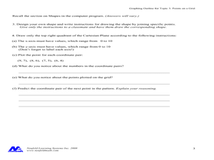
Concept: Points on a Grid
In this coordinate grid graphing worksheet, students play a game of Battleship on the computer. They answer 21 questions about the coordinate grid and graphing.
Curated OER
Geography Grid
Fourth graders search a database to find images and scan and affix them on an 8-foot long map of the state of Illinois. They then use it as a basis for discussion.
Curated OER
Gridding An Archaeological Site
Students investigate using some of the basic skills of an archaeologist while using a Cartesian coordinate system. They establish a grid system for a dig site and determine the locations for different artifacts. Students use the...
Curated OER
Gridding a 2 x 2 Meter Unit
Students use the internet to examine what happens at an archeological dig site. In groups, they practice measuring a 2x2 meter square unit and gridding it out as an archeologist would do. They review the possible solutions at the end of...
Curated OER
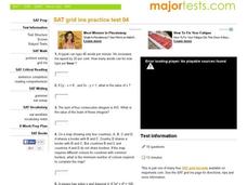
SAT Grid Ins Practice Test 04
In this SAT Practice Test, students solve a variety of problems that range from solving for a variable, rate, probability, and area.
Mathematics Assessment Project
Discovering the Pythagorean Theorem
Young mathematicians join the ancient order of the Pythagoreans by completing an assessment task that asks them to find the area of tilted squares on dot paper. They then look at patterns in the squares to develop the...
Curated OER
Timothy's Trip
In this route activity, students draw the route Timothy took on his trip based on the information given. Students draw the route on graph paper where each point equals 4 miles.
Other popular searches
- Grid Map Skills Worksheets
- Grid Map Activities
- Second Grade Grid Maps
- Grid Map Skills
- Reading a Grid Map
- Grid Map Washington d.c.
- Letter Number Grid Maps
- Mapping Grid Maps
- Interpreting a Grid Map
- Letter/number Grid Maps
- Grid Map Lessons
- Grid Map Washington Dc


